Category:SVG locator maps of regions of France
Jump to navigation
Jump to search
Administrative regions and territorial collectivity of Metropolitan France (‡ since start of 2016):
Auvergne-Rhône-Alpes‡ · Bourgogne-Franche-Comté‡ · Bretagne · Centre-Val de Loire · Corsica · Grand Est‡ · Hauts-de-France‡ · Île-de-France · Normandie‡ · Nouvelle-Aquitaine‡ · Occitanie‡ · Pays de la Loire · Provence-Alpes-Côte d'Azur
Former administrative regions of Metropolitan France (until end of 2015):
Alsace · Aquitaine · Auvergne · Bourgogne · Champagne-Ardenne · Franche-Comté · Languedoc-Roussillon · Limousin · Lorraine · Midi-Pyrénées · Nord-Pas-de-Calais · Basse-Normandie · Haute-Normandie · Picardie · Poitou-Charentes · Rhône-Alpes
Overseas departments and regions: Guadeloupe · Martinique · French Guiana · Réunion · Mayotte
Overseas collectivities: Saint-Barthélemy · Saint-Martin (France) · Saint-Pierre and Miquelon · French Polynesia · Wallis and Futuna · the French Southern and Antarctic Lands+ ≈ French Southern and Antarctic Lands+
Sui generis territories: New Caledonia · Clipperton Island+

Subcategories
This category has the following 8 subcategories, out of 8 total.
+
-
G
M
R
Media in category "SVG locator maps of regions of France"
The following 11 files are in this category, out of 11 total.
-
 2015 Critérium du Dauphiné map.svg 553 × 653; 182 KB
-
 Dauphiné.svg 838 × 843; 64 KB
-
 Elsass-Lothringen in France.svg 2,003 × 1,925; 379 KB
-
 France Large East localisation map.svg 1,220 × 1,284; 1.75 MB
-
 France Large South East.svg 1,220 × 1,284; 1.77 MB
-
 France Large South West localisation map.svg 1,220 × 1,284; 1.76 MB
-
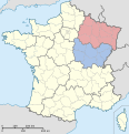
 FranceEuroCirconscriptionsEst.svg 584 × 552; 48 KB
-
 FranceEuroCirconscriptionsMassifCentralCentre.svg 584 × 552; 49 KB
-
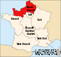 FranceEuroCirconscriptionsNordOuest.svg 584 × 552; 49 KB
-
 FranceEuroCirconscriptionsSudOuest.svg 584 × 552; 49 KB
-
 Grand Est.svg 530 × 550; 210 KB


