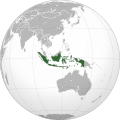
Category:SVG locator maps of Indonesia
Jump to navigation
Jump to search
Countries of Oceania: Australia · Fiji · Kiribati · New Zealand · Palau · Papua New Guinea · Samoa · Solomon Islands · Tonga · Tuvalu · Vanuatu
Other areas: Cook Islands · French Polynesia – Partly: Indonesia · French Southern and Antarctic Lands
Other areas: Cook Islands · French Polynesia – Partly: Indonesia · French Southern and Antarctic Lands
| NO WIKIDATA ID FOUND! Search for SVG locator maps of Indonesia on Wikidata | |
| Upload media |
Subcategories
This category has the following 3 subcategories, out of 3 total.
Media in category "SVG locator maps of Indonesia"
The following 16 files are in this category, out of 16 total.
-
Indonesia (orthographic projection).svg 550 × 550; 1.79 MB
-
Indonesia - Location Map (2013) - IDN - UNOCHA-id.svg 250 × 250; 1.05 MB
-
Indonesia - Location Map (2013) - IDN - UNOCHA.svg 250 × 250; 1.06 MB
-
Indonesia on the globe (Asia centered).svg 793 × 793; 316 KB
-
Indonesia on the globe (Oceania centered).svg 791 × 790; 440 KB
-
Indonesia on the globe (Southeast Asia centered).svg 897 × 897; 290 KB
-
Indonesia w1 locator.svg 1,000 × 1,000; 94 KB
-
Indonesia w2 locator.svg 1,000 × 1,000; 228 KB
-
Jampang (id).svg 789 × 502; 50 KB
-
Jampang (su).svg 789 × 502; 51 KB
-
Location Indonesia ASEAN.svg 1,100 × 900; 2.07 MB
-
LocationIndonesia.svg 1,000 × 500; 2.76 MB
-
LocationRIS.svg 1,000 × 500; 2.76 MB
-
Pulau Sibandang.svg 364 × 280; 117 KB
-
Republic of Indonesia 1948.svg 1,100 × 900; 2.13 MB
-
Territorial waters - Indonesia.svg 800 × 400; 694 KB


