Category:SVG locator maps of Hungary (location map scheme)
Jump to navigation
Jump to search
Subcategories
This category has the following 2 subcategories, out of 2 total.
Media in category "SVG locator maps of Hungary (location map scheme)"
The following 19 files are in this category, out of 19 total.
-
EU-Hungary.svg 2,045 × 1,720; 7.33 MB
-
Hungary in Europe (-rivers -mini map).svg 1,401 × 1,198; 955 KB
-
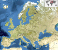
Hungary in Europe (blue marble) (-mini map).svg 1,401 × 1,198; 10.89 MB
-
Hungary in Europe (blue marble).svg 1,401 × 1,198; 11.42 MB
-
Hungary in Europe (natural) (-mini map).svg 1,401 × 1,198; 7.16 MB
-
Hungary in Europe (natural).svg 1,401 × 1,198; 8.42 MB
-
Hungary in Europe (relief) (-mini map).svg 1,401 × 1,198; 8.09 MB
-
Hungary in Europe (relief).svg 1,401 × 1,198; 8.62 MB
-
Hungary in Europe.svg 1,401 × 1,198; 2.61 MB
-
Hungary in European Union (-rivers -mini map).svg 1,401 × 1,198; 831 KB
-
Hungary in European Union.svg 1,401 × 1,198; 2.61 MB
-
Hungary in its region.svg 396 × 223; 6.84 MB
-
Hungary in the European Union and in its region.svg 396 × 223; 4.13 MB
-
Hungary in the European Union and in the world (W3).svg 3,188 × 1,949; 3.11 MB
-
Hungary in the European Union on the globe (Europe centered).svg 1,032 × 1,032; 313 KB
-
Hungary in the world (W3).svg 3,188 × 1,948; 5.42 MB
-
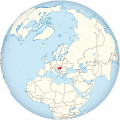
Hungary on the globe (Europe centered).svg 1,032 × 1,032; 501 KB
-
Locator map of Hungary.svg 680 × 520; 660 KB
-
Map budapest districts-and-neighbourhoods.svg 738 × 703; 171 KB


