Category:SVG location maps of provinces of Indonesia
Jump to navigation
Jump to search
Subcategories
This category has the following 2 subcategories, out of 2 total.
B
- SVG location maps of Bali (11 F)
E
Media in category "SVG location maps of provinces of Indonesia"
The following 38 files are in this category, out of 38 total.
-
Indonesia Aceh location map.svg 1,250 × 1,250; 2.9 MB
-
Indonesia Bangka Belitung Islands location map.svg 1,250 × 1,250; 2.78 MB
-
Indonesia Bali location map.svg 1,250 × 1,250; 1.83 MB
-
Indonesia Banten location map.svg 1,250 × 1,250; 2.92 MB
-
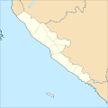
Indonesia Bengkulu location map.svg 1,250 × 1,250; 1.2 MB
-
Indonesia Central Java location map.svg 1,250 × 1,250; 4.8 MB
-
Indonesia Central Kalimantan location map.svg 1,250 × 1,250; 2.11 MB
-
Indonesia Central Papua location map.svg 2,419 × 1,636; 97 KB
-
Indonesia Central Sulawesi location map.svg 1,250 × 1,250; 6.96 MB
-
Indonesia East Java location map.svg 1,250 × 1,250; 5.44 MB
-
Indonesia Gorontalo location map.svg 1,250 × 1,250; 2.62 MB
-
Indonesia Highland Papua location map.svg 1,900 × 1,400; 54 KB
-
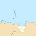
Indonesia Jakarta location map.svg 1,250 × 1,250; 1.54 MB
-
Indonesia Jambi location map.svg 1,250 × 1,250; 2.24 MB
-
Indonesia Lampung location map.svg 1,250 × 1,250; 2.69 MB
-
Indonesia Maluku location map.svg 1,250 × 1,250; 6.75 MB
-
Indonesia North Maluku location map.svg 1,250 × 1,250; 6.88 MB
-
Indonesia North Sulawesi location map.svg 1,250 × 1,250; 4.31 MB
-
Indonesia Papua 2017 location map.svg 1,250 × 1,250; 4.49 MB
-
Indonesia Papua 2022 location map.svg 2,832 × 1,808; 144 KB
-
Indonesia Riau location map.svg 1,250 × 1,250; 4.77 MB
-
Indonesia South Kalimantan location map.svg 1,250 × 1,250; 2.85 MB
-
Indonesia South Papua location map.svg 1,794 × 1,465; 30 KB
-
Indonesia South Sulawesi location map.svg 1,250 × 1,250; 7.86 MB
-
Indonesia South Sumatra location map.svg 1,250 × 1,250; 2.64 MB
-
Indonesia Southeast Sulawesi location map.svg 1,250 × 1,250; 4.43 MB
-
Indonesia Southwest Papua location map.svg 1,894 × 1,381; 135 KB
-
Indonesia West Java location map.svg 1,250 × 1,250; 4.85 MB
-
Indonesia West Kalimantan location map.svg 1,250 × 1,250; 3.34 MB
-
Indonesia West Nusa Tenggara location map.svg 1,250 × 1,250; 4.9 MB
-
Indonesia West Papua 2011 location map.svg 1,250 × 1,250; 4.82 MB
-
Indonesia West Papua 2022 location map.svg 1,932 × 2,100; 143 KB
-
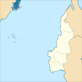
Indonesia West Sulawesi location map.svg 1,250 × 1,250; 2.86 MB
-
Indonesia Yogyakarta location map.svg 1,250 × 1,250; 1.6 MB
-
Indonesia Riau Islands location map.svg 1,250 × 1,250; 6.31 MB
-
Blank North Kalimantan Map.svg 1,577 × 1,249; 435 KB
-
Indonesia North Sumatra location map.svg 1,250 × 1,250; 4.43 MB
-
Indonesia West Sumatra location map.svg 1,250 × 1,250; 3.51 MB


