Category:SVG labeled maps of administrative divisions of Cuba (location map scheme)
Jump to navigation
Jump to search


.svg)


_(Paris_zoom).svg)
.svg)
,_administrative_divisions_-_de_-_colored_(multizoom).svg)
_-_colored.svg)
.svg)
,_administrative_divisions_-_Nmbrs_(multizoom).svg)
,_administrative_divisions_-_de_-_colored.svg)
_-_de_-_colored.svg)

.svg)

.svg)
Media in category "SVG labeled maps of administrative divisions of Cuba (location map scheme)"
The following 8 files are in this category, out of 8 total.
-
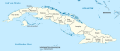
 Cuba provinces 2011.svg 1,795 × 761; 299 KB
-
 Cuba, administrative divisions - de - colored.svg 1,795 × 761; 982 KB
-
 Cuba, administrative divisions - de - monochrome.svg 1,795 × 761; 989 KB
-
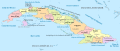 Cuba, administrative divisions - es - colored.svg 1,795 × 761; 1.35 MB
-
 Cuba, administrative divisions - et - colored.svg 1,795 × 761; 1.02 MB
-
 Cuba, administrative divisions - Nmbrs - colored.svg 1,795 × 761; 982 KB
-
 Cuba, administrative divisions - Nmbrs - monochrome.svg 1,795 × 761; 990 KB
-
 Cuba, administrative divisions - th - colored.svg 1,795 × 761; 1.55 MB


