Category:SVG administrative maps of India
Jump to navigation
Jump to search
Media in category "SVG administrative maps of India"
The following 83 files are in this category, out of 83 total.
-
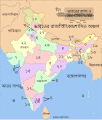
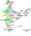
India-states-numbered-bn.svg 1,594 × 1,868; 320 KB
-
India-states-numbered-bn.png 1,594 × 1,868; 605 KB
-
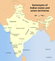
Demonyms of Indian states and union territories.svg 1,574 × 1,738; 982 KB
-
Extreme points of India en.svg 1,486 × 1,734; 438 KB
-
ExtremeIndia1.svg 1,476 × 1,680; 227 KB
-
India Administrative divisions FR.svg 1,594 × 1,868; 638 KB
-
India disputed areas map.svg 1,639 × 1,852; 978 KB
-
India map with Kashmir shown separately.svg 1,574 × 1,738; 970 KB
-
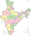
India states and union territories map.svg 1,639 × 1,852; 304 KB
-
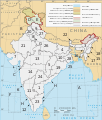
India states and union territories numbered map.svg 1,639 × 1,852; 239 KB
-
India Union Territories as.svg 1,500 × 1,615; 1.66 MB
-
India Union Territories bn.svg 1,500 × 1,615; 1.63 MB
-
India Union Territories FR-hi.svg 1,500 × 1,615; 1.66 MB
-
India Union Territories FR-mr.svg 1,500 × 1,615; 1.65 MB
-
India Union Territories FR-pa.svg 1,500 × 1,615; 1.65 MB
-
India Union Territories FR.svg 1,500 × 1,615; 1.71 MB
-
India Union Territories TE.svg 1,500 × 1,615; 1.63 MB
-
India Union Territories-bh.svg 1,500 × 1,615; 1.63 MB
-
India Union Territories-gu.svg 1,500 × 1,615; 1.73 MB
-
India Union Territories-kn.svg 1,500 × 1,615; 1.63 MB
-
India-LADAKH Full.svg 1,486 × 1,734; 437 KB
-
India-locator-map-NE.svg 1,486 × 1,734; 447 KB
-
India-map as.svg 1,519 × 1,773; 259 KB
-
India-map ml.svg 1,620 × 1,891; 285 KB
-
India-map-en.png 4,965 × 5,623; 1.56 MB
-
India-map-en.svg 1,519 × 1,773; 303 KB
-
India-map-gu.svg 1,519 × 1,773; 259 KB
-
India-map-kn.svg 1,602 × 1,794; 292 KB
-
India-map-ml.svg 1,519 × 1,773; 621 KB
-
India-map-mr.svg 1,444 × 1,581; 278 KB
-
India-map-od.svg 1,519 × 1,773; 277 KB
-
India-map-or.svg 1,519 × 1,773; 271 KB
-
India-map-pa.svg 1,519 × 1,773; 275 KB
-
India-map-ta.svg 1,490 × 1,687; 283 KB
-
India-map-te.svg 1,519 × 1,773; 278 KB
-
India-map-ur-amiri.svg 1,519 × 1,773; 277 KB
-
India-map-ur.jpg 6,232 × 7,443; 1.91 MB
-
India-map-ur.svg 1,519 × 1,773; 277 KB
-
India-states-Hindi.svg 1,594 × 1,868; 304 KB
-
India-states-numbered-new.svg 1,594 × 1,868; 309 KB
-
India-states-numbered.svg 1,594 × 1,868; 306 KB
-
India-states-russian.svg 1,594 × 1,868; 276 KB
-
INDIA.jpg 1,500 × 1,798; 670 KB
-
Indian States 1951.svg 645 × 738; 427 KB
-
Indian states and union territories-bn.svg 512 × 593; 1.87 MB
-
Map of India he.svg 1,639 × 1,852; 726 KB
-
Map of India showing high court jurisdictions.svg 1,574 × 1,738; 984 KB
-
Map of India.svg 1,622 × 1,853; 993 KB
-
NE Autonomous divisions of India as.svg 489 × 341; 584 KB
-
NE Autonomous divisions of India bn.svg 489 × 341; 562 KB
-
NE Autonomous divisions of India.svg 489 × 341; 539 KB
-
Neue Bundesstaaten.svg 1,150 × 1,230; 500 KB
-
North-Eastern India locator.svg 1,486 × 1,734; 449 KB
-
Political map of India bn.svg 1,594 × 1,868; 301 KB
-
Political map of India DE 2019.svg 1,275 × 1,494; 649 KB
-
Political map of India DE.svg 1,594 × 1,868; 369 KB
-
Political map of India EN.svg 1,594 × 1,868; 337 KB
-
Political map of India HI.svg 1,594 × 1,868; 301 KB
-
Political map of India MK.svg 1,594 × 1,868; 639 KB
-
Political map of India OR.svg 1,594 × 1,868; 309 KB
-
Political map of India SR.svg 1,594 × 1,868; 312 KB
-
Political map of India.svg 1,594 × 1,868; 342 KB
-
Southern India Wikivoyage locator.svg 1,486 × 1,734; 385 KB
-
States and UTs of India (labelled - en).svg 1,594 × 1,868; 284 KB
-
States and UTs of India (unlabelled) for WLM-IN.svg 1,594 × 1,868; 265 KB
-
States and UTs of India (unlabelled).svg 1,594 × 1,868; 262 KB
-
Tehsils of Sri Ganganagar District, Rajasthan, India.svg 3,822 × 3,820; 128 KB
-
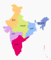
Zonal Councils as.svg 1,594 × 1,868; 224 KB
-
Zonal Councils hi.svg 1,594 × 1,868; 226 KB
-
Zonal Councils mk.svg 1,594 × 1,868; 248 KB
-
Zonal Councils ml.svg 1,700 × 1,993; 236 KB
-
Zonal Councils mr.svg 1,594 × 1,868; 225 KB
-
Zonal Councils ne.svg 1,594 × 1,868; 226 KB
-
Zonal Councils-bn.svg 437 × 512; 257 KB
-
Zonal Councils-gu.svg 1,594 × 1,868; 226 KB
-
Zonal Councils-hi.svg 1,594 × 1,868; 226 KB
-
Zonal Councils-kn.svg 1,594 × 1,868; 227 KB
-
Zonal Councils-pa.svg 1,594 × 1,868; 225 KB
-
Zonal Councils.svg 1,594 × 1,868; 226 KB
-
Zonal Councils.te.svg 1,594 × 1,868; 192 KB
-
Zonal divisions of Republic of India.jpg 1,536 × 1,920; 556 KB
-
Ŝtatoj de Barato (numerigitaj).svg 1,594 × 1,868; 306 KB
