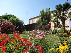
Category:Sérempuy
Jump to navigation
Jump to search
commune in Gers, France | |||||
| Upload media | |||||
| Instance of | |||||
|---|---|---|---|---|---|
| Location |
| ||||
| Population |
| ||||
| Area |
| ||||
| Elevation above sea level |
| ||||
 | |||||
Subcategories
This category has the following 2 subcategories, out of 2 total.
B
M
- Maps of Sérempuy (6 F)
Media in category "Sérempuy"
The following 17 files are in this category, out of 17 total.
-
32431-Sérempuy-Routes-Hydro.png 3,507 × 2,480; 1.04 MB
-
32431-Sérempuy-Sols.png 3,507 × 2,480; 1.01 MB
-
Population - Municipality code 32431.svg 475 × 355; 12 KB
-
Sérempuy 01.jpg 4,896 × 3,672; 3.29 MB
-
Sérempuy 02.jpg 2,923 × 2,192; 1.74 MB
-
Sérempuy 03.jpg 4,896 × 3,672; 7.24 MB
-
Sérempuy 04.jpg 2,927 × 3,903; 2.92 MB
-
Sérempuy 05.jpg 4,896 × 3,672; 6.43 MB
-
Sérempuy 06.jpg 4,896 × 3,672; 5.36 MB
-
Sérempuy 07.jpg 4,896 × 3,672; 6.86 MB
-
Sérempuy 08.jpg 4,896 × 3,672; 6.62 MB
-
Sérempuy 09.jpg 4,896 × 3,672; 6.71 MB
-
Sérempuy 10.jpg 3,672 × 4,896; 7.52 MB
-
Sérempuy 11.jpg 2,519 × 4,478; 3.67 MB
-
Sérempuy 12.jpg 4,896 × 3,672; 7.43 MB
-
Sérempuy 14.jpg 4,896 × 3,672; 6.95 MB
-
Sérempuy 15.jpg 4,896 × 3,672; 6.64 MB


