Category:Ryhall
Jump to navigation
Jump to search
village in the United Kingdom  | |||||
| Upload media | |||||
| Instance of | |||||
|---|---|---|---|---|---|
| Location | Rutland, East Midlands, England | ||||
| Population |
| ||||
| Area |
| ||||
 | |||||
English: Ryhall is a village and civil parish in the county of Rutland in the East Midlands of England. It is located close to the eastern boundary of the county, about 2 miles (3 km) north of Stamford. In 2001 it had a population of 1742, making it one of the largest villages in Rutland. It is bounded to its west by the A6121 main road from Stamford to Bourne and on the other three sides by the River Gwash, although some development has spilled over the river to the north and out along the Essendine road.
Subcategories
This category has the following 2 subcategories, out of 2 total.
B
- Belmesthorpe (16 F)
Media in category "Ryhall"
The following 200 files are in this category, out of 244 total.
(previous page) (next page)-
 A bridge over the River Gwash - geograph.org.uk - 3089775.jpg 800 × 600; 244 KB
-
 A field west of Ryhall - geograph.org.uk - 5670731.jpg 3,776 × 2,520; 2.87 MB
-
 A footpath crosses the A 6121 at Ryhall - geograph.org.uk - 350798.jpg 640 × 480; 146 KB
-
 A long straight section of the B1176 - geograph.org.uk - 5670719.jpg 3,776 × 2,520; 3.53 MB
-
 A6121 roundabout - geograph.org.uk - 5510409.jpg 640 × 444; 82 KB
-
 A6121 Ryhall Road - geograph.org.uk - 6828290.jpg 1,024 × 684; 234 KB
-
 A6121, Essendine Road - geograph.org.uk - 4211081.jpg 640 × 427; 241 KB
-

-
 All is not what it seems - geograph.org.uk - 5977569.jpg 5,938 × 7,898; 7.63 MB
-
 Approaching Rutland - geograph.org.uk - 2444970.jpg 4,000 × 3,000; 4.02 MB
-
 B1176 heading south - geograph.org.uk - 3176777.jpg 640 × 480; 105 KB
-
 Balk Road - geograph.org.uk - 4487669.jpg 4,320 × 3,240; 5.68 MB
-
 Barn range, Belmesthorpe House - geograph.org.uk - 4787719.jpg 1,280 × 871; 246 KB
-
 Beechwood, Belmesthorpe - geograph.org.uk - 4787738.jpg 1,280 × 960; 449 KB
-
 Belmesthorpe crosses the River Gwash - geograph.org.uk - 3349797.jpg 640 × 461; 51 KB
-
 Belmesthorpe postbox, ref PE9 14 - geograph.org.uk - 4787717.jpg 1,280 × 960; 434 KB
-
 Belmesthorpe village - geograph.org.uk - 2482524.jpg 640 × 480; 53 KB
-
 Belmesthorpe village sign - geograph.org.uk - 3985306.jpg 1,600 × 1,287; 891 KB
-
 Blue Bell Cottage and the Blue Bell Inn - geograph.org.uk - 4787739.jpg 1,280 × 960; 309 KB
-
 Blue Bell Inn, Belmesthorpe - geograph.org.uk - 4787742.jpg 1,280 × 960; 322 KB
-
 Bridge at Ryhall - geograph.org.uk - 4544442.jpg 4,000 × 3,000; 4.02 MB
-
 Bridge over River Gwash - geograph.org.uk - 2482533.jpg 640 × 480; 61 KB
-
 Bridge over River Gwash, Ryhall - geograph.org.uk - 6828310.jpg 1,024 × 684; 467 KB
-
 Bridge over the Gwash, Bridge Street, Ryhall - geograph.org.uk - 5667728.jpg 3,776 × 2,520; 3.54 MB
-
 Bridge over the River Gwash - geograph.org.uk - 4787706.jpg 1,280 × 960; 569 KB
-
 Bridge over the River Gwash near Ryhall - geograph.org.uk - 6365491.jpg 1,024 × 768; 262 KB
-
 Bridge over The River Gwash near Ryhall, Rutland - geograph.org.uk - 4472650.jpg 4,320 × 3,240; 5.65 MB
-
 Bridge Street - geograph.org.uk - 6076439.jpg 640 × 480; 52 KB
-
 Bridge Street - geograph.org.uk - 6608446.jpg 6,252 × 4,164; 3.48 MB
-
 Bridge Street - geograph.org.uk - 903026.jpg 640 × 427; 89 KB
-
 Bridge Street, Ryhall - geograph.org.uk - 3089822.jpg 800 × 600; 346 KB
-
 Bridge Street, Ryhall - geograph.org.uk - 4544453.jpg 4,000 × 3,000; 4.36 MB
-
 Butcher's shop, Ryhall - geograph.org.uk - 6365207.jpg 1,024 × 768; 152 KB
-
 By the River Gwash near Ryhall - geograph.org.uk - 6365493.jpg 1,024 × 768; 239 KB
-
 Cemetery, Ryhall - geograph.org.uk - 3176815.jpg 640 × 480; 91 KB
-
 Christmas Cottage, Belmesthorpe - geograph.org.uk - 4787714.jpg 1,280 × 960; 348 KB
-
 Churchyard and St. John's church, Ryhall - geograph.org.uk - 6365208.jpg 1,024 × 768; 204 KB
-
 Close-up of rime deposit on a twig - geograph.org.uk - 705646.jpg 480 × 640; 33 KB
-
 Cobbs Nook Farm - geograph.org.uk - 487422.jpg 640 × 477; 124 KB
-
 Contrejour fieldscape - geograph.org.uk - 5977570.jpg 20,002 × 4,029; 7.32 MB
-
 Corner on Newstead Road - geograph.org.uk - 6212894.jpg 3,776 × 2,520; 4.09 MB
-
 Country lane east of Belmesthorpe - geograph.org.uk - 3985361.jpg 1,600 × 1,215; 439 KB
-
 Country lane east of Belmesthorpe - geograph.org.uk - 3985415.jpg 1,600 × 1,200; 380 KB
-
 Country road - geograph.org.uk - 5510428.jpg 640 × 480; 61 KB
-
 Country road junction - geograph.org.uk - 3176904.jpg 640 × 480; 58 KB
-
 Crop field, Vale Farm - geograph.org.uk - 3176742.jpg 640 × 480; 101 KB
-
 Crossed wires - geograph.org.uk - 487418.jpg 640 × 477; 59 KB
-
 Defibrillator at the village hall - geograph.org.uk - 5934842.jpg 4,014 × 6,032; 5.09 MB
-
 Defibrillator box - geograph.org.uk - 5934845.jpg 6,032 × 4,014; 4.51 MB
-
 Detail of the Blue Bell Inn - geograph.org.uk - 4787741.jpg 960 × 1,280; 371 KB
-
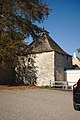
 Dovecot, Belmesthorpe - geograph.org.uk - 4787726.jpg 1,280 × 1,280; 393 KB
-
 Dovecote , Ryhall - geograph.org.uk - 6365270.jpg 1,024 × 768; 256 KB
-
 Dovecote at the hall (geograph 5936979).jpg 4,014 × 6,032; 6.56 MB
-
 Early English capital - geograph.org.uk - 903007.jpg 640 × 427; 68 KB
-
 Electricity pylon near Belmesthorpe - geograph.org.uk - 3985367.jpg 1,355 × 1,600; 428 KB
-
 Entering Belmesthorpe - geograph.org.uk - 6364965.jpg 1,024 × 768; 207 KB
-
 Entrance gates at Cobbs Nook Farm - geograph.org.uk - 4472629.jpg 4,320 × 3,240; 5.87 MB
-
 Entrance to Belmesthorpe - geograph.org.uk - 5510398.jpg 640 × 480; 60 KB
-
 Entrance to Ryhall - geograph.org.uk - 4130591.jpg 640 × 480; 75 KB
-
 Entrance to Top Farm caravan park near Ryhall - geograph.org.uk - 4473240.jpg 4,320 × 3,240; 5.78 MB
-
 Essendine Road - geograph.org.uk - 2482603.jpg 640 × 460; 79 KB
-
 Farm track off The Drift - geograph.org.uk - 6266080.jpg 1,024 × 768; 222 KB
-

-
 Farmland near Belmesthorpe - geograph.org.uk - 3176892.jpg 640 × 480; 73 KB
-
 Farmland near Ryhall - geograph.org.uk - 3176773.jpg 640 × 480; 110 KB
-
 Farmland near Ryhall and Belmesthorpe - geograph.org.uk - 3985412.jpg 1,600 × 1,335; 407 KB
-
 Farmland on the edge of Ryhall - geograph.org.uk - 3985284.jpg 1,600 × 1,343; 593 KB
-
 Farmland, Gwash Valley Farm - geograph.org.uk - 3176781.jpg 640 × 480; 101 KB
-
 Field entrance near Vale Farm - geograph.org.uk - 3176746.jpg 640 × 402; 63 KB
-
 Field of sheep east of Belmesthorpe - geograph.org.uk - 3985355.jpg 1,600 × 1,204; 682 KB
-
 Fingerpost and village sign, Belmesthorpe - geograph.org.uk - 4787712.jpg 1,280 × 960; 434 KB
-
 Fingerpost near Belmesthorpe - geograph.org.uk - 4787750.jpg 1,280 × 960; 351 KB
-
 Fingerpost near Belmesthorpe - geograph.org.uk - 4787754.jpg 901 × 1,280; 470 KB
-
 First signpost in Rutland - geograph.org.uk - 487392.jpg 640 × 477; 137 KB
-
 Footpath and Tolethorpe Oaks - geograph.org.uk - 6266089.jpg 1,024 × 768; 137 KB
-
 Footpath off The Drift - geograph.org.uk - 5670684.jpg 3,776 × 2,520; 2.81 MB
-
 Footpath to Ryhall - geograph.org.uk - 1874472.jpg 480 × 640; 87 KB
-
 Footpath to Ryhall - geograph.org.uk - 6558483.jpg 1,024 × 768; 181 KB
-
 Ford on the River Gwash at Belmesthorpe - geograph.org.uk - 2015915.jpg 3,872 × 2,592; 2.43 MB
-
 Former Belmesthorpe House and attached barn - geograph.org.uk - 4787734.jpg 1,280 × 938; 262 KB
-
 Foundry Road and the River Gwash, Ryhall - geograph.org.uk - 6364987.jpg 1,024 × 768; 378 KB
-
 Foundry Road, Ryhall - geograph.org.uk - 3089817.jpg 800 × 600; 257 KB
-
 Gate and simple fence - geograph.org.uk - 2239763.jpg 800 × 600; 376 KB
-
 Gate and track near North Lodge Farm, Ryhall - geograph.org.uk - 4462213.jpg 4,320 × 3,240; 5.23 MB
-
 Graffiti on a Village Hall windowsill, Ryhall - geograph.org.uk - 6365263.jpg 1,024 × 768; 224 KB
-
 Grange Cottage, Belmesthorpe - geograph.org.uk - 4787710.jpg 1,280 × 960; 324 KB
-
 Green at Belmesthorpe - geograph.org.uk - 4787743.jpg 1,280 × 960; 331 KB
-
 Hawthorn and rapeseed in Rutland - geograph.org.uk - 4472666.jpg 4,320 × 3,240; 6.07 MB
-
 Heading south along the B1176 Stamford Road - geograph.org.uk - 3993068.jpg 1,600 × 1,323; 503 KB
-
 House on New Road, Ryhall - geograph.org.uk - 3176791.jpg 640 × 491; 89 KB
-
 Houses in Balk Road - geograph.org.uk - 4481599.jpg 4,320 × 3,240; 5.64 MB
-
 Houses off Foundry Road, Ryhall - geograph.org.uk - 3176814.jpg 640 × 480; 63 KB
-
 Houses on A6121 at Ryhall - geograph.org.uk - 350802.jpg 640 × 480; 134 KB
-
 Lane heading towards Belmesthorpe - geograph.org.uk - 3985396.jpg 1,600 × 1,200; 310 KB
-
 Lane in the village of Belmesthorpe - geograph.org.uk - 3985347.jpg 1,600 × 1,086; 622 KB
-
 Lane on the western edge of Belmesthorpe - geograph.org.uk - 3985294.jpg 1,600 × 1,182; 656 KB
-
 Lane past Crossroads Spinney - geograph.org.uk - 3993038.jpg 1,600 × 1,074; 711 KB
-
 Lilac Cottage, Belmesthorpe - geograph.org.uk - 4787721.jpg 1,280 × 949; 344 KB
-
 Looking down Clay Hill from The Drift - geograph.org.uk - 4462465.jpg 4,320 × 3,240; 5.39 MB
-
 Looking south from The Drift on Clay Hill - geograph.org.uk - 4462476.jpg 4,320 × 3,240; 5.91 MB
-

-
 Minor road north-east of Ryhall - geograph.org.uk - 6212887.jpg 3,776 × 2,520; 3.96 MB
-
 New Road - geograph.org.uk - 6608449.jpg 6,252 × 4,164; 4.41 MB
-
 New Road, Ryhall - geograph.org.uk - 3176792.jpg 640 × 480; 59 KB
-
 Newstead Road - geograph.org.uk - 4544529.jpg 4,000 × 3,000; 4.26 MB
-
 Newstead Road heading south - geograph.org.uk - 3176894.jpg 640 × 411; 47 KB
-
 Newstead Road towards Belmesthorpe - geograph.org.uk - 1874480.jpg 640 × 534; 118 KB
-
 Newstead Road towards Newstead - geograph.org.uk - 1874479.jpg 640 × 469; 84 KB
-
 North arcade - geograph.org.uk - 902992.jpg 640 × 427; 57 KB
-
 Old Milepost - geograph.org.uk - 3652470.jpg 768 × 1,024; 271 KB
-
 Old Milepost - geograph.org.uk - 3652474.jpg 1,024 × 768; 269 KB
-
 Old Milepost - geograph.org.uk - 3652489.jpg 768 × 1,024; 270 KB
-
 Old Milepost - geograph.org.uk - 3652494.jpg 1,024 × 768; 282 KB
-
 Overgrown former railway cutting near Ryhall, Rutland - geograph.org.uk - 4462223.jpg 4,320 × 3,240; 5.96 MB
-
 Paddock entrance near Belmesthorpe in Rutland - geograph.org.uk - 4472617.jpg 4,320 × 3,240; 5.59 MB
-
 Path through the churchyard, Ryhall - geograph.org.uk - 6365489.jpg 1,024 × 768; 180 KB
-
 Plaque for the tree - geograph.org.uk - 6608444.jpg 6,252 × 4,164; 3.94 MB
-
 Pointing to Gr3atford - geograph.org.uk - 4787757.jpg 1,280 × 960; 385 KB
-
 Power lines crossing the Rutland farmland - geograph.org.uk - 3985390.jpg 1,600 × 1,127; 271 KB
-
 Prepared field, Ryhall Heath - geograph.org.uk - 6266100.jpg 1,024 × 768; 209 KB
-
 Pylons and rape on Clay Hill, Ryhall, Lincolnshire - geograph.org.uk - 4462512.jpg 4,320 × 3,240; 5.54 MB
-
 Pylons east of Belmesthorpe - geograph.org.uk - 6212880.jpg 3,776 × 2,520; 4.15 MB
-
 Rape crop near Vale Farm north of Ryhall - geograph.org.uk - 4473260.jpg 4,320 × 3,240; 5.67 MB
-
 Remains of Ryhall and Belmesthorpe Station - geograph.org.uk - 4787708.jpg 1,280 × 960; 449 KB
-
 Rime deposit on vegetation - geograph.org.uk - 705632.jpg 640 × 480; 74 KB
-
 River Gwash - geograph.org.uk - 3176886.jpg 640 × 480; 73 KB
-
 River Gwash at Belmesthorpe - geograph.org.uk - 4544480.jpg 4,000 × 3,000; 4.14 MB
-
 River Gwash at Belmesthorpe - geograph.org.uk - 4544499.jpg 4,000 × 3,000; 3.94 MB
-
 River Gwash at Belmesthorpe and a former railway - geograph.org.uk - 4544506.jpg 4,000 × 3,000; 4.28 MB
-
 River Gwash in Belmesthorpe, Rutland - geograph.org.uk - 3985302.jpg 1,600 × 1,297; 793 KB
-
 River Gwash near Belmesthorpe - geograph.org.uk - 3985271.jpg 1,600 × 1,097; 681 KB
-

-

-
 Road Junction - geograph.org.uk - 2488177.jpg 640 × 480; 108 KB
-
 Road junction and finger post - geograph.org.uk - 5510402.jpg 640 × 480; 70 KB
-
 Road junction and grass triangle - geograph.org.uk - 5131192.jpg 3,648 × 2,736; 2.55 MB
-
 Road junction and grass triangle - geograph.org.uk - 5131200.jpg 3,648 × 2,736; 2.75 MB
-
 Road junction at Belmesthorpe - geograph.org.uk - 4787707.jpg 1,280 × 960; 424 KB
-
 Road junction in the village of Belmesthorpe - geograph.org.uk - 3985338.jpg 1,600 × 1,138; 493 KB
-
 Road junction with grass triangle - geograph.org.uk - 5496259.jpg 4,032 × 2,268; 2.22 MB
-
 Road junction with grass triangle - geograph.org.uk - 5496265.jpg 4,032 × 2,268; 2.05 MB
-
 Road north-west of North Lodge Farm - geograph.org.uk - 6212884.jpg 3,776 × 2,520; 4.11 MB
-
 Road to Essendine - geograph.org.uk - 2239758.jpg 800 × 600; 403 KB
-
 Road to Uffington - geograph.org.uk - 2239773.jpg 800 × 600; 414 KB
-
 Rutland arable land - geograph.org.uk - 2246198.jpg 800 × 600; 398 KB
-
 Rutland lichen - geograph.org.uk - 2246203.jpg 800 × 600; 487 KB
-
 Rutland oak - geograph.org.uk - 2246195.jpg 800 × 600; 385 KB
-
 Ryhall Belmesthorpe station-Geograph-1636985-by-Brian-Green.jpg 640 × 480; 133 KB
-
 Ryhall Bridge - geograph.org.uk - 903021.jpg 640 × 427; 100 KB
-
 Ryhall Cemetery - geograph.org.uk - 6365490.jpg 1,024 × 768; 210 KB
-
 Ryhall Cemetery, Belmesthorpe Lane, Ryhall - geograph.org.uk - 6212828.jpg 3,776 × 2,520; 3.95 MB
-
 Ryhall farmland - geograph.org.uk - 1043990.jpg 640 × 427; 96 KB
-
 Ryhall Methodist Church, Mill Street, Ryhall - geograph.org.uk - 5667719.jpg 3,776 × 2,520; 3.61 MB
-
 Ryhall Road - geograph.org.uk - 2486346.jpg 640 × 480; 53 KB
-
 Ryhall Road and Ryhall village - geograph.org.uk - 3981146.jpg 1,656 × 1,109; 697 KB
-
 Ryhall Road in the village of Ryhall - geograph.org.uk - 3981183.jpg 1,600 × 1,080; 358 KB
-
 Ryhall village hall - geograph.org.uk - 5934841.jpg 6,032 × 4,014; 4.76 MB
-
 Ryhall Village Hall - geograph.org.uk - 6365487.jpg 1,024 × 768; 179 KB
-
 Ryhall village shop - geograph.org.uk - 6608445.jpg 6,252 × 4,164; 3.27 MB
-
 Ryhall's tree - geograph.org.uk - 6608439.jpg 4,163 × 6,251; 4.62 MB
-
 Sedilia - geograph.org.uk - 903004.jpg 427 × 640; 57 KB
-
 Signpost one mile east of Belmesthorpe - geograph.org.uk - 3985421.jpg 1,600 × 1,393; 672 KB
-
 South along Ryhall Road towards Stamford - geograph.org.uk - 3981198.jpg 1,562 × 1,265; 566 KB
-
 South arcade - geograph.org.uk - 903001.jpg 640 × 427; 62 KB
-

-

-

-
 St John the Evangelist, Ryhall - Font - geograph.org.uk - 4470317.jpg 573 × 900; 183 KB
-
 St John the Evangelist, Ryhall - geograph.org.uk - 4470299.jpg 900 × 603; 182 KB
-
 St John the Evangelist, Ryhall - geograph.org.uk - 4470301.jpg 900 × 608; 196 KB
-
 St John the Evangelist, Ryhall - geograph.org.uk - 4470303.jpg 900 × 603; 195 KB
-
 St John the Evangelist, Ryhall - geograph.org.uk - 4545887.jpg 4,000 × 3,000; 4.08 MB
-

-

-

-

-

-

-
 St.John the Evangelist's chancel - geograph.org.uk - 902979.jpg 640 × 427; 62 KB
-
 St.John the Evangelist's church - geograph.org.uk - 902970.jpg 640 × 427; 63 KB
-
 St.John the Evangelist's font - geograph.org.uk - 902987.jpg 427 × 640; 61 KB
-
 St.John the Evangelist's nave - geograph.org.uk - 902997.jpg 640 × 427; 58 KB
-
 St.John the Evangelist's tower - geograph.org.uk - 902975.jpg 427 × 640; 69 KB
-
 The A6121 from Stamford to Ryhall - geograph.org.uk - 6309233.jpg 3,776 × 2,520; 4.22 MB
-
 The A6121 past the west side of Ryhall - geograph.org.uk - 5667841.jpg 3,776 × 2,520; 2.55 MB
-
 The B1176 heading north from Ryhall - geograph.org.uk - 5670712.jpg 3,776 × 2,520; 3.58 MB
-
 The Blue Bell, Belmesthorpe - geograph.org.uk - 3089785.jpg 800 × 600; 275 KB
-
 The Blue Bell, Belmesthorpe - geograph.org.uk - 3089789.jpg 800 × 600; 277 KB
-
 The Blue Bell, Belmesthorpe - geograph.org.uk - 3089793.jpg 600 × 800; 210 KB
-
 The chancel of St John the Evangelist, Ryhall - geograph.org.uk - 4545906.jpg 4,000 × 3,000; 4.02 MB
-
 The chancel of St John the Evangelist, Ryhall - geograph.org.uk - 4545910.jpg 4,000 × 3,000; 4.02 MB
-
 The Churchyard of St John the Evangelist, Ryhall - geograph.org.uk - 4544968.jpg 4,000 × 3,000; 4.13 MB
-
 The Churchyard of St John the Evangelist, Ryhall - geograph.org.uk - 4545895.jpg 4,000 × 3,000; 4.1 MB
-
 The county boundary - geograph.org.uk - 2444958.jpg 4,000 × 3,000; 4.16 MB
-
 The County boundary - geograph.org.uk - 4545542.jpg 4,000 × 3,000; 3.95 MB
-
 The Drift approaching Ryhall Heath Farm - geograph.org.uk - 5670667.jpg 3,776 × 2,520; 2.69 MB
-
 The Drift becomes a dirt track - geograph.org.uk - 3278204.jpg 2,256 × 1,504; 1.36 MB
-
 The Drift heading west - geograph.org.uk - 3176765.jpg 480 × 640; 67 KB
-

-
 The Drift joining the B1176 - geograph.org.uk - 5670698.jpg 3,776 × 2,520; 2.73 MB


.jpg)


