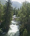
Category:Russian River, Alaska
Jump to navigation
Jump to search
| The Russian River heads at Upper Russian Lake and flows NW to Kenai River, 34 mi. SW of Hope, Chugach Mts. Its local name was reported in 1904 by Fred H. Moffit, U.S. Geological Survey (USGS). |
river in Alaska | |||||
| Upload media | |||||
| Instance of | |||||
|---|---|---|---|---|---|
| Location |
| ||||
| Length |
| ||||
| Mouth of the watercourse | |||||
 | |||||
Media in category "Russian River, Alaska"
The following 16 files are in this category, out of 16 total.
-
Black Bear in Russian River.jpg 700 × 490; 513 KB
-
Brown bear and black bear in the upper Russian river.jpg 700 × 490; 103 KB
-
Brown bear in the upper Rusian river.jpg 700 × 490; 142 KB
-
Brown bear in the upper Russian river.jpg 700 × 490; 108 KB
-
Near Russian River Falls.jpg 1,024 × 768; 188 KB
-
Passenger ferry across the Russian river.jpg 2,100 × 1,418; 167 KB
-
River ferry boat.jpg 2,048 × 1,362; 186 KB
-
Russian River - DPLA - 5b4bb809f6c91a4304f18dcf5f5c4dfd.JPG 1,504 × 2,240; 3.04 MB
-
Russian River - DPLA - 7b1d94933d8afac925b7c3a415dfde09.JPG 1,858 × 2,922; 5.86 MB
-
Russian River Alaska.jpg 1,100 × 1,304; 274 KB
-
Russian river Alaska.jpg 2,816 × 2,112; 2.54 MB
-
Russian River Falls - DPLA - c0502101a3422c3c801dbcd36b9dd75a.jpg 693 × 1,050; 143 KB
-
Russian River Falls.jpg 1,024 × 768; 453 KB
-
Russian River1.JPG 1,887 × 2,831; 3.36 MB
-
Russian River2.JPG 1,501 × 937; 539 KB


