Category:Russian-language SVG maps
Jump to navigation
Jump to search
Subcategories
This category has the following 4 subcategories, out of 4 total.
Media in category "Russian-language SVG maps"
The following 200 files are in this category, out of 343 total.
(previous page) (next page)-
2001 Macedonia insurgency-ru.svg 1,400 × 1,130; 180 KB
-
2022 Russian invasion of Ukraine.svg 2,199 × 1,478; 4.36 MB
-
2022 Russian invasion of Ukraine; 31 December 2023.svg 2,199 × 1,478; 3.68 MB
-
Aavasaksa topographic map-ru.svg 1,368 × 1,688; 256 KB
-
Abkhazia map-ru.svg 945 × 737; 809 KB
-
Acadia 1604-1607 topographic map-ru.svg 700 × 640; 412 KB
-
Acadia 1610-1613 topographic map-ru.svg 546 × 403; 547 KB
-
Administrative divisions of Madura Island - ru.svg 853 × 275; 32 KB
-
Administrative divisions of North Kalimantan - ru.svg 1,017 × 984; 34 KB
-
Aerial view of Lenné-Dreieck - RU.svg 1,280 × 989; 1.55 MB
-
African continent-ru.svg 1,525 × 1,440; 751 KB
-
African language families ru.svg 600 × 650; 53 KB
-
Agalega Islands map-ru.svg 512 × 623; 227 KB
-
Alaska administrative units - ru.svg 1,768 × 975; 179 KB
-
Albania map-ru.svg 1,880 × 3,850; 6.85 MB
-
Albania-map-ru.svg 394 × 487; 34 KB
-
Alexander Park - plan.svg 2,827 × 2,209; 1.73 MB
-
Anahim Volcanic Belt-ru.svg 2,334 × 832; 815 KB
-
Anaximander world map-ru.svg 1,063 × 1,063; 17 KB
-
Ancient Egypt old and middle kingdom-ru.svg 512 × 594; 58 KB
-
Angeln-ru.svg 514 × 546; 34 KB
-
Antarctica-ru.svg 512 × 511; 669 KB
-
Apollo 15 Traverses - ru.svg 3,003 × 5,161; 2.73 MB
-
Apollo 16 Traverses - ru.svg 2,456 × 6,292; 1.94 MB
-
Apollo 17 Traverses - ru.svg 6,001 × 3,219; 2.85 MB
-
Arctic big rus.svg 1,010 × 1,267; 1.4 MB
-
Argentina-map-ru.svg 626 × 998; 225 KB
-
ARMENIA avia.svg 637 × 629; 53 KB
-
Aruba map ru.svg 350 × 350; 336 KB
-
Attack on Mers-el-Kébir harbor.svg 692 × 470; 87 KB
-
Attack on Mers-el-Kébir map.svg 841 × 535; 116 KB
-
Australia-climate-map ru.svg 1,250 × 1,131; 248 KB
-
Australian oil and gas facilities map-ru.svg 1,146 × 808; 223 KB
-
BaffinIsland ru.svg 668 × 536; 1.09 MB
-
Bangladesh divisions ru.svg 1,531 × 2,138; 3.86 MB
-
Basque dialects-ru.svg 678 × 486; 78 KB
-
Battle of Actium-ru.svg 716 × 533; 312 KB
-
Battle of Donetsk Airport (ru).svg 767 × 473; 206 KB
-
Battle of Quiberon Bay - 1759 - Tracks map-ru.svg 672 × 913; 131 KB
-
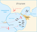
Battle of Taranto map-ru.svg 889 × 761; 100 KB
-
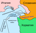
Bay-of-Piran maritime-boundary-dispute-ru.svg 789 × 735; 136 KB
-
BD Map admin ru.svg 1,531 × 2,138; 115 KB
-
BEL-RUS 2014-06-22 (ru).svg 534 × 738; 56 KB
-
Biafra independent state map-ru.svg 1,100 × 850; 455 KB
-
Black Sea Straits rus.png 1,754 × 1,314; 90 KB
-
Blank map of Mexico with states names-ru.svg 976 × 655; 269 KB
-
Blue and green eyes percentage ru.svg 2,435 × 2,011; 189 KB
-
Bolivia departments-ru.svg 2,000 × 2,208; 83 KB
-
Bosnia and Herzegovina, administrative divisions - ru (entities) - colored.svg 1,063 × 1,014; 249 KB
-
Brunei map-ru.svg 938 × 1,066; 176 KB
-
Bulgaria-geographic map-ru.svg 2,483 × 1,642; 5.23 MB
-
Calaisis 1360 map-ru.svg 1,424 × 892; 773 KB
-
Califato de Córdoba - 1000 rus.svg 694 × 603; 305 KB
-
Canada Köppen-ru.svg 1,297 × 1,359; 3.96 MB
-
Carte de la Bourgogne (Relief)-ru.svg 803 × 889; 329 KB
-
Catherine Park - plan.svg 3,099 × 1,931; 1.29 MB
-
Caucasus topographic map-ru.svg 1,155 × 898; 5.44 MB
-
Caucasus-ethnic ru.svg 512 × 577; 170 KB
-
Caucasus-political-ru.svg 512 × 485; 504 KB
-
Chehs1919(ru).svg 780 × 380; 331 KB
-
Chinese Eastern Railway-ru.svg 850 × 743; 36 KB
-
Circuit de la Sarthe track map-ru.svg 1,424 × 983; 103 KB
-
Departments of Congo ru.svg 2,284 × 2,449; 1.96 MB
-
Constantinople-ru.svg 1,023 × 832; 11 KB
-
Constituencies in parliamentary elections in Belarus 2019.svg 6,303 × 6,009; 938 KB
-
Contrade di Siena locator map with names - Russian.svg 1,924 × 2,269; 47 KB
-
Conveyor belt-ru.svg 343 × 376; 91 KB
-
Copenhagen metro ru.svg 1,052 × 579; 19 KB
-
Corona de Castilla 1400 ru.svg 738 × 542; 755 KB
-
Course Channeltunnel ru.svg 472 × 387; 63 KB
-
Crete topographic map-ru.svg 3,370 × 1,600; 2.61 MB
-
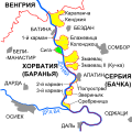
Croatia Serbia border Backa Baranja-ru.svg 520 × 520; 206 KB
-
Croatia Serbia border Syrmia Vukovar-ru.svg 406 × 610; 120 KB
-
Dagestan topographic map-ce.svg 400 × 512; 3.26 MB
-
Dagestan topographic map-ru.svg 400 × 512; 2.79 MB
-
Densité départements-France-ru.svg 620 × 750; 165 KB
-
Detail site Kourou-ru.svg 750 × 1,030; 97 KB
-
Dhangethi administrative map - ru.svg 984 × 1,500; 414 KB
-
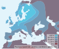
Dist of hu lang europe-ru.svg 688 × 438; 123 KB
-
Districts of damascus-ru.svg 500 × 383; 275 KB
-
E-roads-Caucasus-countries.svg 1,027 × 677; 193 KB
-
East Ukraine Conflict RBK.svg 2,048 × 2,701; 1.98 MB
-
Easter Island map-ru.svg 1,750 × 1,245; 538 KB
-
Eastern Mediterranean 1450-ru.svg 2,497 × 2,369; 267 KB
-
Enclaves in Kyrgyzstan RU.svg 1,273 × 684; 223 KB
-
Environs of Athens-ru.svg 910 × 1,000; 553 KB
-
Ethnic Groups of Minahassa Peninsula - ru.svg 1,229 × 637; 101 KB
-
Ethnolinguistic map of Burma 1972 ru.svg 1,063 × 2,037; 61 KB
-
Euro2008 venues ru.svg 730 × 320; 78 KB
-
Expeditions in Antarctica before 1897-ru.svg 503 × 621; 11.61 MB
-
Extent of Siberian traps-ru.svg 1,897 × 1,082; 3.75 MB
-
Falkland Islands topographic map-ru.svg 2,550 × 1,990; 1.94 MB
-
File Taiwan local government map rus.svg 744 × 1,052; 1.88 MB
-
Finno-ugrian-map.svg 963 × 987; 927 KB
-
First Naval Battle of Narvik-RU.svg 1,373 × 856; 379 KB
-
Franz Josef Land location-ru.svg 507 × 470; 58 KB
-
French Polynesia relief map RU.svg 1,260 × 1,260; 1.43 MB
-
GE-AB-gagra-ru.svg 550 × 450; 582 KB
-
Geo map Baltic shield.svg 1,134 × 1,096; 756 KB
-
Georgia administrative map-ru.svg 707 × 385; 1.08 MB
-
Georgia, Ossetia, Russia and Abkhazia (ru).svg 676 × 400; 98 KB
-
Golden Horde 1389-ru.svg 960 × 684; 66 KB
-
Grossgliederung Europas-ru.svg 683 × 709; 682 KB
-
Grunwald (beginning) ru.svg 850 × 992; 369 KB
-
Grunwald (end) ru.svg 850 × 992; 354 KB
-
Guadeloupe map RU.svg 744 × 710; 98 KB
-
Guyanas-ru.svg 480 × 330; 315 KB
-
Guyane map-ru.svg 1,183 × 1,427; 902 KB
-
Hanover in 1720 ru.svg 2,500 × 2,120; 35 KB
-
Hecataeus world map-ru.svg 825 × 803; 67 KB
-
Herodotus world map-ru.svg 788 × 476; 276 KB
-
Illyrian Tribes (Pусский).svg 1,600 × 1,600; 8.57 MB
-
Illyrians (Pусский).svg 1,600 × 1,600; 5.11 MB
-
India average annual temperature map ru.svg 1,639 × 1,852; 386 KB
-
India climatic zone map ru.svg 1,639 × 1,852; 375 KB
-
India-states-russian.svg 1,594 × 1,868; 276 KB
-
Indonesia Ethnic Groups Map - ru.svg 2,129 × 878; 2 MB
-
Isle of Man topographic map-ru.svg 1,200 × 1,100; 644 KB
-
IsleOfMan SheadingsAndParishes-ru.svg 1,200 × 1,100; 229 KB
-
Istanbul canal map-ru.svg 1,536 × 1,043; 1.6 MB
-
Istanbul districts map ru.svg 2,248 × 1,191; 600 KB
-
Italy 1000 AD alt1 ru.svg 564 × 810; 185 KB
-
Izium Eparchy.svg 1,120 × 1,401; 69 KB
-
Jordan governorates named regions-ru.svg 1,050 × 1,138; 32 KB
-
Kabylie topographic map-ru.svg 848 × 425; 4.97 MB
-
Kanal İstanbul-ru.svg 1,440 × 978; 852 KB
-
Kartvelian languages.ru.svg 790 × 550; 4.23 MB
-
Kazakhstan obl ru.svg 658 × 369; 86 KB
-
Kazakhstan-turkmenistan-iran railway link map 2014.svg 500 × 928; 620 KB
-
Kew Gardens Map-ru.svg 1,200 × 1,000; 233 KB
-
Kharkiv Eparchy.svg 1,376 × 1,366; 86 KB
-
Kirov oblast city.svg 599 × 749; 98 KB
-
KNDR Airbases ru.svg 837 × 835; 394 KB
-
Kosovo map-ru.svg 1,777 × 1,830; 3.74 MB
-
Lakes of Wannsee - ru.svg 1,163 × 735; 145 KB
-
LDGowerLordship-ru.svg 1,255 × 983; 692 KB
-
Libyan Uprising-ru.svg 690 × 715; 47 KB
-
Liechtenstein administrative map-ru.svg 1,301 × 1,697; 524 KB
-
Liechtenstein topographic map-ru.svg 1,301 × 1,697; 2 MB
-
Lincoln Sea map ru.svg 1,000 × 913; 246 KB
-
Location of the BOTs-ru.svg 735 × 433; 1.28 MB
-
Maas memel etsch belt (rus).svg 1,300 × 1,200; 611 KB
-
Maas Memel Etsch Belt (svg, rus).svg 1,138 × 1,135; 558 KB
-
Madura Island topographic map - ru.svg 2,401 × 806; 1.09 MB
-
Map Greco-Persian Wars-ru.svg 992 × 793; 4.04 MB
-
Map of achaean Crete-ru.svg 548 × 305; 386 KB
-
Map of Alnashi Districts ru.svg 727 × 683; 57 KB
-
Map of ancient Epirus and environs (Pусский).svg 1,303 × 1,500; 378 KB
-
Map of Bangladesh-ru.svg 1,678 × 2,074; 3.76 MB
-
Map of Efate Island RU.svg 3,900 × 2,990; 577 KB
-
Map of fertile crescent-ru.svg 1,987 × 2,442; 626 KB
-
Map of Franz Josef Land-ru.svg 1,289 × 862; 709 KB
-
Map of Grahovo Districts ru.svg 866 × 763; 48 KB
-
Map of Kiyasovo Districts hu.svg 1,003 × 1,478; 26 KB
-
Map of Kiyasovo Districts ru.svg 941 × 1,385; 26 KB
-
Map of Kizner Districts ru.svg 440 × 674; 110 KB
-
Map of Malaya Purga Districts ru.svg 669 × 507; 72 KB
-
Map of Meshchyora National Park - ru.svg 2,166 × 2,801; 949 KB
-
Map of Meshchyorsky National Park - ru.svg 2,170 × 2,798; 892 KB
-
Map of Mozhga Districts ru.svg 763 × 800; 72 KB
-
Map of mycenaean Messenia-ru.svg 800 × 800; 1.39 MB
-
Map of Northern Fleet bases RUS.svg 400 × 348; 80 KB
-
Map of railway Ovinische - Vesyegonsk.svg 2,153 × 2,855; 376 KB
-
Map of region of Abruzzo, Italy, with provinces-ru.svg 2,219 × 2,085; 60 KB
-
Map of region of Aosta Valley, Italy-ru.svg 2,709 × 1,997; 47 KB
-
Map of region of Apulia, Italy, with provinces-ru.svg 4,170 × 3,287; 85 KB
-
Map of region of Basilicata, Italy, with provinces-ru.svg 1,952 × 2,278; 84 KB
-
Map of region of Calabria, Italy, with provinces-ru.svg 1,294 × 2,082; 126 KB
-
Map of region of Campania, Italy, with provinces-ru.svg 2,045 × 1,861; 105 KB
-
Map of region of Emilia-Romagna, Italy, with provinces-ru.svg 4,800 × 2,530; 186 KB
-
Map of region of Friuli-Venezia Giulia, Italy, with provinces-ru.svg 4,316 × 3,831; 102 KB
-
Map of region of Lazio, Italy, with provinces-ru.svg 3,287 × 3,357; 107 KB
-
Map of region of Liguria, Italy, with provinces-ru.svg 4,446 × 2,134; 84 KB
-
Map of region of Lombardy, Italy, with provinces-ru.svg 5,930 × 5,262; 238 KB
-
Map of region of Marche, Italy, with provinces-ru.svg 3,504 × 3,450; 114 KB
-
Map of region of Molise, Italy, with provinces-ru.svg 7,200 × 5,600; 89 KB
-
Map of region of Piedmont, Italy, with provinces-ru.svg 3,493 × 4,314; 217 KB
-
Map of region of Sardinia, Italy, with provinces-ru.svg 2,286 × 4,403; 267 KB
-
Map of region of Sicily, Italy, with provinces-ru.svg 8,803 × 6,748; 137 KB
-
Map of region of Trentino-South Tyrol, Italy, with provinces-ru.svg 3,528 × 3,182; 106 KB
-
Map of region of Tuscany, Italy, with provinces-ru.svg 3,624 × 4,010; 228 KB
-
Map of region of Umbria, Italy, with provinces-ru.svg 3,705 × 4,496; 89 KB
-
Map of region of Veneto, Italy, with provinces-ru.svg 3,346 × 3,385; 171 KB
-
Map of Russia-ru.svg 977 × 500; 230 KB
-
Map of Sealand with territorial waters RU.svg 600 × 613; 131 KB
-
Map of sinitic languages full-ru.svg 2,219 × 1,759; 162 KB
-
Map of sinitic languages-ru.svg 366 × 738; 447 KB
-
Map of the military districts of the Pylos kingdom-ru.svg 800 × 800; 1.41 MB
-
Map of USA and Canada, NBA, zoom (ru).svg 1,100 × 780; 179 KB
-
Map of Uva Districts ru.svg 678 × 898; 63 KB
-
Map of Zanzibar Archipelago ru.svg 628 × 794; 832 KB
-
Map of Zavyalovo Districts ru.svg 1,100 × 914; 53 KB
-
Map rajasthan dist 7 div - ru.svg 788 × 691; 532 KB
-
Map San Marino-ru.svg 330 × 355; 35 KB
-
Mapa reconquista almohades-ru.svg 474 × 368; 43 KB
-
Mariana Islands ru.svg 1,036 × 1,001; 248 KB
-
Markakol map-ru.svg 1,278 × 1,949; 4.22 MB
-
Member States of the European Union (polar stereographic projection) RU.svg 442 × 409; 1.56 MB
-
Mezhdusharskiy Island ru.svg 448 × 631; 11 KB
-
Migration map of Greek tribes at the turn of II - I millennium BC-ru.svg 1,642 × 1,270; 9.22 MB


