Category:Ruins in England
Jump to navigation
Jump to search
Wikimedia category | |||||
| Upload media | |||||
| Instance of | |||||
|---|---|---|---|---|---|
| Category combines topics | |||||
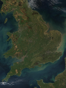
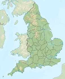
| England | |||||
country in north-west Europe, part of the United Kingdom | |||||
| Spoken text audio | |||||
| Pronunciation audio | |||||
| Instance of | |||||
| Name in native language |
| ||||
| Named after | |||||
| Patron saint | |||||
| Location |
| ||||
| Capital | |||||
| Basic form of government |
| ||||
| Official language | |||||
| Anthem |
| ||||
| Currency | |||||
| Head of state |
| ||||
| Head of government |
| ||||
| Highest point | |||||
| Population |
| ||||
| Area |
| ||||
| Replaces |
| ||||
| Different from | |||||
| official website | |||||
 | |||||
Subcategories
This category has the following 59 subcategories, out of 59 total.
A
B
- Biddulph Old Hall (148 F)
C
D
- Drayton Lodge, Norfolk (2 F)
E
G
H
I
K
L
M
N
O
R
S
T
W
- Webbs Heath Drift Mine (6 F)
Y
Media in category "Ruins in England"
The following 63 files are in this category, out of 63 total.
-
Anchorite House - geograph.org.uk - 2487297.jpg 800 × 531; 180 KB
-
Anchorite House Remains.jpg 1,944 × 2,592; 1.88 MB
-
Anchorite House.jpg 2,592 × 1,944; 1.71 MB
-
College Farmhouse - geograph.org.uk - 1211133.jpg 640 × 480; 98 KB
-
Coventry Cathedral - geograph.org.uk - 19036.jpg 640 × 480; 105 KB
-
Crews Hole Colliery Chimney. - panoramio.jpg 1,732 × 2,083; 775 KB
-
Derelict House - geograph.org.uk - 1928310.jpg 531 × 800; 113 KB
-
Derelict House - geograph.org.uk - 1934391.jpg 800 × 600; 117 KB
-
Igp (224683099).jpeg 2,048 × 1,024; 816 KB
-
In the Cathedral precincts - geograph.org.uk - 671317.jpg 607 × 467; 89 KB
-
Inside Derelict House - geograph.org.uk - 1861000.jpg 1,024 × 768; 352 KB
-
Jervaulx Abbey church and cloister, East Witton, Wensleydale.jpg 1,920 × 1,080; 796 KB
-
Jervaulx Abbey cloister, East Witton, Wensleydale.jpg 1,920 × 1,080; 856 KB
-
Jervaulx Abbey, East Witton, Wensleydale. Old entrance coats of arms.jpg 1,920 × 1,080; 892 KB
-
Knackered Nissen Hut - geograph.org.uk - 389870.jpg 640 × 426; 118 KB
-
Moongate detail, Gamlingay Cinques - geograph.org.uk - 267116.jpg 480 × 640; 276 KB
-
Moongate, Gamlingay Cinques - geograph.org.uk - 267111.jpg 640 × 480; 240 KB
-
Old Inn, Wells (3610813547).jpg 1,536 × 2,022; 2.4 MB
-
Portclew Chapel (ruin), Freshwater East - geograph.org.uk - 1573252.jpg 640 × 480; 113 KB
-
Remains of the Camp 18 POW camp in Featherstone Park, Northumberland, England.jpg 4,608 × 3,456; 5.71 MB
-
Rievaulx Abbey Ruins.jpg 8,688 × 5,792; 27.21 MB
-
Roxby Hall fragment C13th.png 338 × 474; 290 KB
-
Ruin at Shingham Farm - geograph.org.uk - 396258.jpg 640 × 480; 101 KB
-
Ruins of old mine workings, near Hartsop - geograph.org.uk - 984410.jpg 640 × 411; 117 KB
-
Shide Chalk Pit2.jpg 1,280 × 960; 622 KB
-
StAlbansRomanWall-PS01.JPG 3,264 × 2,448; 2.63 MB
-
Standing in ruins, Newcastle upon Tyne (6521096511).jpg 804 × 768; 346 KB
-
Agricultural Ruins - geograph.org.uk - 57610.jpg 640 × 480; 178 KB
-
Applecake - ruined cottage - geograph.org.uk - 244596.jpg 640 × 480; 120 KB
-
Derelict Brick Building, near Lutley - geograph.org.uk - 482995.jpg 640 × 540; 155 KB
-
Derelict Signal Box, Port Clarence - geograph.org.uk - 331390.jpg 640 × 427; 75 KB
-
Ellers - geograph.org.uk - 92645.jpg 640 × 482; 55 KB
-
Ford Place - geograph.org.uk - 577302.jpg 640 × 426; 130 KB
-
High Thwaites - geograph.org.uk - 63214.jpg 640 × 480; 67 KB
-
Interior, Raistrick Greave - geograph.org.uk - 167437.jpg 1,024 × 683; 254 KB
-
Low Thwaites - geograph.org.uk - 56273.jpg 640 × 480; 58 KB
-
Parci Gill - geograph.org.uk - 50932.jpg 640 × 480; 69 KB
-
Punchard Coal Level - geograph.org.uk - 69108.jpg 640 × 480; 79 KB
-
Remains of barn doorway and moorland - geograph.org.uk - 91344.jpg 427 × 640; 109 KB
-
Remains of Mineral Railway Bridge - geograph.org.uk - 670483.jpg 640 × 427; 70 KB
-
Remains of Tower Hill Colliery - geograph.org.uk - 53160.jpg 640 × 480; 125 KB
-
Ruined Barn, Gibside - geograph.org.uk - 630725.jpg 640 × 427; 110 KB
-
Ruined building, West Horrington - geograph.org.uk - 187343.jpg 640 × 480; 142 KB
-
Ruined farmhouse, Raistrick Greave - geograph.org.uk - 167436.jpg 1,024 × 683; 187 KB
-
Ruined house (2) - geograph.org.uk - 582953.jpg 480 × 640; 131 KB
-
Ruined house - geograph.org.uk - 582951.jpg 640 × 480; 123 KB
-
Ruined house by the Old Bedford River - geograph.org.uk - 590080.jpg 2,000 × 3,008; 3.83 MB
-
Ruined Hut, Wardle - geograph.org.uk - 40039.jpg 640 × 480; 132 KB
-
Ruins of Wether House - geograph.org.uk - 54062.jpg 640 × 480; 87 KB
-
Stony Broke - geograph.org.uk - 174601.jpg 640 × 480; 66 KB
-
Stork House - geograph.org.uk - 215024.jpg 640 × 384; 72 KB
-
The party's over - geograph.org.uk - 109018.jpg 640 × 426; 94 KB
-
The Road to Rack and Ruin - geograph.org.uk - 109074.jpg 640 × 480; 136 KB
-
Top Withens. - geograph.org.uk - 63070.jpg 640 × 480; 94 KB
-
Wether House - geograph.org.uk - 56275.jpg 640 × 480; 83 KB


