Category:Ruchazie
Jump to navigation
Jump to search
district in Glasgow City, Scotland, UK | |||||
| Upload media | |||||
| Instance of | |||||
|---|---|---|---|---|---|
| Location | Glasgow City, Scotland | ||||
 | |||||
Media in category "Ruchazie"
The following 14 files are in this category, out of 14 total.
-
Across Ruchazie from Gartloch Road - geograph.org.uk - 1262090.jpg 640 × 480; 114 KB
-
Boghall Street, Ruchazie (geograph 2468176).jpg 640 × 480; 285 KB
-
Boghall Street, Ruchazie (geograph 2468186).jpg 640 × 480; 283 KB
-
Five a side football (geograph 2468639).jpg 640 × 480; 279 KB
-
Flats on Galdenoch Street - geograph.org.uk - 1262074.jpg 640 × 480; 128 KB
-
Gartloch Road (geograph 5816572).jpg 1,024 × 640; 233 KB
-
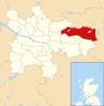
Glasgow wards 2017 no21 North East.png 2,000 × 2,040; 503 KB
-
Hogganfield Manor - geograph.org.uk - 1262068.jpg 640 × 480; 115 KB
-
M8 Motorway at Junction 11 (geograph 2933625).jpg 640 × 480; 375 KB
-
Map of Glasgow and its Environs OS Map name 007-05, Ordnance Survey, 1857-1893.png 11,450 × 7,581; 15.37 MB
-
Ruchazie Community Centre - geograph.org.uk - 1262085.jpg 640 × 480; 133 KB
-
Ruchazie Community Church - geograph.org.uk - 1234050.jpg 640 × 480; 61 KB
-
Site of a school, Ruchazie (geograph 2464015).jpg 640 × 480; 262 KB
-
U Save at Ruchazie (geograph 5816557).jpg 1,024 × 663; 242 KB


