Category:Royal Ordnance Factory, United Kingdom
Jump to navigation
Jump to search
English: Royal Ordnance Factories (ROFs) was the collective name of the UK government's munitions factories in and after World War II. Until privatisation in 1987 they were the responsibility of the Ministry of Supply and later the Ministry of Defence.
British weapons manufacturing company | |||||
| Upload media | |||||
| Instance of | |||||
|---|---|---|---|---|---|
| Industry | |||||
| Location |
| ||||
| Headquarters location | |||||
| Legal form | |||||
| Inception |
| ||||
| Dissolved, abolished or demolished date |
| ||||
| Follows | |||||
| |||||
Subcategories
This category has the following 8 subcategories, out of 8 total.
B
P
R
T
Media in category "Royal Ordnance Factory, United Kingdom"
The following 50 files are in this category, out of 50 total.
-
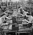
At work in a British Shell Factory, England, C 1940 D324.jpg 800 × 612; 78 KB
-
BAE Systems, Radway Green - geograph.org.uk - 200279.jpg 640 × 482; 55 KB
-
Barclay 1571 (6325589564).jpg 2,592 × 1,944; 1.11 MB
-
Caerphilly Rd, Cardiff - geograph.org.uk - 1736505.jpg 3,296 × 2,472; 1.85 MB
-
Dunham Hill No2 (2845521391).jpg 1,600 × 1,200; 568 KB
-
Dunham Hill No2 (2845521975).jpg 1,600 × 1,200; 400 KB
-
Dunham Hill No2 (2845522575).jpg 1,600 × 1,200; 588 KB
-
Dunham Hill No2 (2845523117).jpg 1,600 × 1,200; 448 KB
-
Dunham Hill No2 (2846350098).jpg 1,600 × 1,200; 497 KB
-
Fire hydrant - geograph.org.uk - 483819.jpg 480 × 640; 172 KB
-
Georgetown - geograph-5347628-by-Thomas-Nugent.jpg 640 × 480; 206 KB
-
Gunpowder Park Waltham Abbey - geograph.org.uk - 167207.jpg 640 × 480; 74 KB
-
Newton Aycliffe Nature Park - geograph.org.uk - 1355790.jpg 640 × 480; 77 KB
-
NG2 business park - geograph.org.uk - 1218744.jpg 640 × 479; 57 KB
-
Pillbox, S0007012, Brookside, Yeading - geograph.org.uk - 1186920.jpg 640 × 480; 125 KB
-
Pillbox, S0007012, Brookside, Yeading - geograph.org.uk - 1186921.jpg 640 × 480; 128 KB
-
Pillbox, S0007012, Brookside, Yeading - geograph.org.uk - 1186923.jpg 640 × 480; 150 KB
-
Reed Beds in Rushcliffe Country Park - geograph.org.uk - 55390.jpg 640 × 480; 64 KB
-
ROF (Royal Ordnance Factory) Featherstone - geograph.org.uk - 987791.jpg 640 × 478; 103 KB
-
ROFBridgwater.jpg 640 × 426; 115 KB
-
Rotherwas Distribution Building .jpg 1,536 × 1,024; 293 KB
-
Salford Armoured Vechicles (6268658787).jpg 4,320 × 3,240; 5.83 MB
-
Salford Armoured Vechicles (6269183946).jpg 4,320 × 3,240; 4.53 MB
-
Salford Armoured Vechicles (6269184470).jpg 4,320 × 3,240; 4.78 MB
-
Salford Armoured Vechicles (6269184946).jpg 4,320 × 3,240; 4.85 MB
-
Salford Armoured Vechicles (6269185974).jpg 4,320 × 3,240; 5.26 MB
-
Salford Armoured Vechicles (6269186328).jpg 4,320 × 3,240; 5.45 MB
-
Sheep farm near Glascoed - geograph.org.uk - 745353.jpg 640 × 426; 100 KB
-
Sign for ng2 - geograph.org.uk - 1242714.jpg 479 × 640; 97 KB
-
Sten Gun Production in Britain, 1943 D12333.jpg 766 × 800; 63 KB
-
Sten Gun Production in Britain, 1943 D12370.jpg 764 × 800; 114 KB
-
Disused entrance to armaments works - geograph.org.uk - 99235.jpg 640 × 480; 80 KB
-
Footpath near Birchwood Station - geograph.org.uk - 109252.jpg 640 × 480; 163 KB
-
Homebase - Nottingham - geograph.org.uk - 626451.jpg 640 × 346; 57 KB
-
Kirkby Town Centre - geograph.org.uk - 122465.jpg 640 × 480; 60 KB
-
Pirate ship - geograph.org.uk - 490240.jpg 640 × 478; 107 KB
-
Walled Garden, Birchwood - geograph.org.uk - 107477.jpg 640 × 480; 162 KB


