Category:Route 445 (Japan)
Jump to navigation
Jump to search
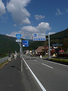
English: National Route 445 (Kumamoto Prefecture, Japan)
日本語: 日本国の一般国道445号は熊本市を起点とし、美里町、八代市泉町(五家荘)、五木村などを経由して人吉市に至る。
road in Kumamoto prefecture, Japan | |||||
| Upload media | |||||
| Instance of | |||||
|---|---|---|---|---|---|
| Location | Kumamoto Prefecture, Japan | ||||
| Transport network | |||||
| Connects with | |||||
| Maintained by | |||||
| Start time |
| ||||
| Length |
| ||||
| Terminus | |||||
| Partially coincident with | |||||
 | |||||
Subcategories
This category has only the following subcategory.
V
Media in category "Route 445 (Japan)"
The following 18 files are in this category, out of 18 total.
-
Hamasen bypass Ezu 2024.jpg 3,435 × 1,932; 1.65 MB
-
Japan National Route 445 in front of grand torii of Aoi Aso Shrine.jpg 4,008 × 3,006; 3.56 MB
-
Japan National Route 445 near Aoi Aso Shrine.jpg 4,032 × 3,024; 1.87 MB
-
Japanese National Route Sign 0445.svg 455 × 435; 10 KB
-
Michinoeki Itsuki Kumamoto 01.JPG 2,304 × 3,072; 3.11 MB
-
Michinoeki Itsuki Kumamoto 2021 01.jpg 4,032 × 3,024; 3.38 MB
-
Nihonsugi Pass Kumamoto 01.JPG 1,497 × 1,996; 1.57 MB
-
Nihonsugi Pass Kumamoto 02.JPG 1,996 × 1,497; 883 KB
-
Pond of Aoi Aso Shrine from Misogibashi Bridge (east).jpg 3,979 × 2,985; 4.15 MB
-
Pond of Aoi Aso Shrine from Misogibashi Bridge (west).jpg 3,944 × 2,958; 3.84 MB
-
Pond of Aoi Aso Shrine.jpg 3,986 × 2,990; 3.64 MB
-
Route 445 ja Kashima Clair 2018.JPG 2,121 × 1,591; 1,001 KB
-
Route 445 Kaneuchi Bridge 20230822.JPG 1,532 × 2,152; 614 KB
-
Route445 Gokanosho Shiibaru 01.JPG 1,497 × 1,996; 1.4 MB
-
Route445 Hitoyoshi Aoi-Aso.JPG 2,121 × 1,591; 1.04 MB
-
Route445 Itsuki 01.JPG 1,497 × 1,996; 1.42 MB
-
Route445 Itsuki 02.JPG 1,497 × 1,996; 819 KB


