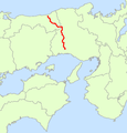
Category:Route 29 (Japan)
Jump to navigation
Jump to search
English: Category for the National Route 29 of Japan
日本語: 国道29号に関するカテゴリ
road in Japan | |||||
| Upload media | |||||
| Instance of | |||||
|---|---|---|---|---|---|
| Location | |||||
| Transport network | |||||
| Connects with |
| ||||
| Maintained by | |||||
| Start time |
| ||||
| Length |
| ||||
| Terminus |
| ||||
| Partially coincident with | |||||
 | |||||
Subcategories
This category has the following 7 subcategories, out of 7 total.
H
- Himeji-kita bypass (4 F)
- Himeji-nishi bypss (4 F)
M
- Michinoeki Haga (5 F)
- Michinoeki Hatto (4 F)
- Michinoeki Minami-Haga (10 F)
T
- Tokura Pass (4 F)
Media in category "Route 29 (Japan)"
The following 41 files are in this category, out of 41 total.
-
Aino Himejicity Hyogopref Route 29 Himejinishi bypass.JPG 2,304 × 1,320; 775 KB
-
Gohanda Tottoricity Tottoripref Route 29 Tottoriminamibypass.JPG 1,586 × 938; 588 KB
-
Hagatown Hara Shisocity Hyogopref Route 29.JPG 4,608 × 3,456; 5.52 MB
-
Hagatown Ueno Shisocity Hyogopref Route 29.JPG 3,059 × 1,741; 1.97 MB
-
Hagatown Yasuga Shisoucity Hyogopref Route 29.JPG 1,920 × 1,080; 996 KB
-
Hayashidatown Shimoise Himejicity Hyogopref Route 29 No,2.JPG 2,080 × 1,104; 540 KB
-
Hayashidatown Shimoise Himejicity Hyogopref Route 29.JPG 1,672 × 1,076; 422 KB
-
Ichinomiyatown Aguro Shisocity Hyogopref Route29.JPG 3,147 × 1,879; 2.15 MB
-
Ichinomiyatown Azumi Shisocity Hyogopref Route 29 No,2.JPG 3,229 × 1,904; 2.17 MB
-
Ichinomiyatown Azumi Shisocity Hyogopref Route 29.JPG 3,245 × 2,072; 2.17 MB
-
Ichinomiyatown Higashiichiba Shisocity Hyogopref Route29.JPG 3,264 × 1,791; 1.91 MB
-
Ishikura Himejicity Hyogopref Route 29 No,2.JPG 2,304 × 1,728; 1.7 MB
-
Ishikura Himejicity Hyogopref Route 29.JPG 2,304 × 1,728; 1.88 MB
-
Japan National Route 2 -12.jpg 2,592 × 1,944; 1.05 MB
-
Japan National Route 29 in Wakasa town.JPG 4,000 × 3,000; 3.26 MB
-
Japan National Route 29 Map.png 573 × 600; 60 KB
-
Japanese National Route Sign 0029.svg 455 × 435; 11 KB
-
Kamiokatown Oiwake Tatsunocity Hyogopref Route 29 No,1.JPG 2,152 × 1,240; 555 KB
-
Kamiokatown Oiwake Tatsunocity Hyogopref Route 29 No,2.JPG 2,304 × 1,728; 1.8 MB
-
Michinoeki Yamasaki, Hyogo01.JPG 1,600 × 1,200; 578 KB
-
R002-2019-049.jpg 1,600 × 900; 296 KB
-
R029-039.jpg 1,500 × 844; 260 KB
-
R029-066.jpg 1,500 × 844; 286 KB
-
R029-106.jpg 1,500 × 844; 208 KB
-
R029-134.jpg 1,500 × 843; 338 KB
-
R029-184.jpg 2,816 × 1,584; 1.64 MB
-
R029-218.jpg 1,500 × 844; 395 KB
-
R029-222.jpg 1,500 × 844; 270 KB
-
R029-241.jpg 1,414 × 795; 247 KB
-
R029-296.jpg 1,500 × 844; 218 KB
-
R029-312.JPG 1,323 × 744; 208 KB
-
R029-313.JPG 1,500 × 844; 255 KB
-
R29-kmpost.jpg 2,880 × 2,160; 2.03 MB
-
R29-r537-standingsign.jpg 2,880 × 2,160; 2.33 MB
-
Shobu Tottoricity Tottoripref Route 29 Tottoriminamibypass.JPG 1,568 × 865; 522 KB
-
Yamasakitown Funamoto Shisocity Hyogopref Route 29.JPG 2,304 × 1,728; 1.75 MB
-
Yamasakitown Isonami Shisocity Hyogopref Route 29.JPG 3,191 × 2,017; 2.18 MB
-
Yamasakitown Mitsu Shisocity Hyogopref Route 29.JPG 4,608 × 3,456; 5.3 MB
-
Yamasakitown Yamada Shisocity Hyogopref Route 29 No,2.JPG 3,264 × 1,853; 2.13 MB
-
Yamasakitown Yamada Shisocity Hyogopref Route 29.JPG 3,208 × 2,231; 2.21 MB
-
国道29号線 - Panoramio 47315691.jpg 1,600 × 1,068; 212 KB


