Category:Roundhay
Jump to navigation
Jump to search
suburb and former civil parish in Leeds, West Yorkshire, UK | |||||
| Upload media | |||||
| Instance of |
| ||||
|---|---|---|---|---|---|
| Location | Leeds, West Yorkshire, Yorkshire and the Humber, England | ||||
| Different from | |||||
 | |||||
Subcategories
This category has the following 11 subcategories, out of 11 total.
Media in category "Roundhay"
The following 91 files are in this category, out of 91 total.
-
A path leading to West Park Road - geograph.org.uk - 3075820.jpg 800 × 600; 235 KB
-
Allotments, Roundhay, Leeds - geograph.org.uk - 202534.jpg 640 × 340; 80 KB
-
Almshouses - Wetherby Road, Roundhay - geograph.org.uk - 552584.jpg 640 × 403; 40 KB
-
Ascending (2354326543).jpg 3,373 × 1,611; 2.26 MB
-
Ascent (2354254325).jpg 3,370 × 1,230; 1.97 MB
-
Betfred, Street Lane, Roundhay, Leeds.jpg 3,872 × 2,592; 3.28 MB
-
Bins (2354182367).jpg 2,651 × 2,534; 1.94 MB
-
Boundary Wall To St Johns School And Almshouses.jpg 3,456 × 4,608; 4.82 MB
-
Bus on Prince's Avenue, Roundhay, Leeds - DSC07585.JPG 3,648 × 2,736; 3.54 MB
-
Caution dangerous jazz (534839705).jpg 640 × 480; 75 KB
-
Co-operative travel agents on Street Lane, Roundhay.jpg 3,872 × 2,592; 3.01 MB
-
Cold (2109887733).jpg 2,342 × 3,816; 3.43 MB
-
Curry Lounge and '@ home', Roundhay.jpg 2,592 × 3,872; 2.7 MB
-
DeerParkLeeds.jpg 2,973 × 1,664; 1.01 MB
-
Descent (2354265793).jpg 2,088 × 1,202; 1.1 MB
-
Dog (2354310799).jpg 1,288 × 1,644; 963 KB
-
Edward VII Postbox, The Avenue - geograph.org.uk - 5256380.jpg 683 × 1,024; 239 KB
-
El Ligero's washing (10135325994).jpg 3,264 × 2,176; 1.25 MB
-
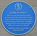
Elmete Hall Plaque 2021.jpg 1,904 × 1,882; 812 KB
-
Elmete Hill - Asket Hill - geograph.org.uk - 1128282.jpg 640 × 465; 256 KB
-
Elmete Mount - Asket Hill - geograph.org.uk - 1128280.jpg 640 × 480; 298 KB
-
Elmete Way - Asket Hill - geograph.org.uk - 1128284.jpg 640 × 430; 227 KB
-
Fastest way down (2355123258).jpg 2,384 × 1,310; 1.44 MB
-
Fire Hydrant plate - geograph.org.uk - 3357095.jpg 1,476 × 2,008; 716 KB
-
Flying Pizza restaurant, Street Lane.jpg 3,872 × 2,592; 3.27 MB
-
Gate Piers And Walls At South Lodge, Roundhay Hall Hospital.jpg 4,608 × 3,456; 5.14 MB
-
Hopeful daffs (2355161874).jpg 3,317 × 2,366; 2.92 MB
-
Jackson Avenue - Gledhow Avenue - geograph.org.uk - 1439930.jpg 640 × 480; 225 KB
-
James Avenue - The Drive - geograph.org.uk - 1439968.jpg 640 × 480; 230 KB
-
Ladywell Mead - Asket Hill - geograph.org.uk - 1128283.jpg 640 × 439; 214 KB
-
Ladywood Grange - Asket Hill - geograph.org.uk - 1128281.jpg 640 × 455; 221 KB
-
Lake (2355131028).jpg 3,519 × 1,746; 2.63 MB
-
Lambert Avenue - Gledhow Lane - geograph.org.uk - 1439722.jpg 640 × 480; 242 KB
-
Lamp post in Roundhay churchyard (3543499810).jpg 1,561 × 2,071; 3.67 MB
-
Lidgett Avenue - Jackson Lane - geograph.org.uk - 1439777.jpg 640 × 480; 253 KB
-
Lidgett Court - The Drive - geograph.org.uk - 1439961.jpg 640 × 480; 244 KB
-
Lidgett Crescent - The Drive - geograph.org.uk - 1439966.jpg 640 × 480; 281 KB
-
Lidgett Grove - Jackson Avenue - geograph.org.uk - 1439766.jpg 640 × 480; 258 KB
-
Lidgett Grove - Lidgett Lane - geograph.org.uk - 1439748.jpg 640 × 480; 222 KB
-
Lidgett Hill - Lidgett Lane - geograph.org.uk - 1439741.jpg 640 × 480; 237 KB
-
Lidgett Lane - viewed from Gledhow La - geograph.org.uk - 1439735.jpg 640 × 480; 280 KB
-
Lidgett Park Mews - Lidgett Park Road - geograph.org.uk - 1440399.jpg 640 × 490; 263 KB
-
Lupton's Field, Asket Hill - geograph.org.uk - 1162280.jpg 640 × 480; 96 KB
-
Lupton's Field, Asket Hill - geograph.org.uk - 1162300.jpg 640 × 480; 99 KB
-
Morfitt Shaw estate agents, Roundhay.jpg 3,872 × 2,592; 3.09 MB
-
Napa bar and restaurant, Roundhay.jpg 3,872 × 2,592; 3 MB
-
New arms (2354295613).jpg 3,106 × 1,441; 1.36 MB
-
Oakwood Lane - Easterly Road - geograph.org.uk - 1127723.jpg 640 × 469; 244 KB
-
Oakwood Lane - Easterly Road - geograph.org.uk - 1127727.jpg 640 × 455; 174 KB
-
Piste (2355145344).jpg 3,528 × 1,513; 2.31 MB
-
Pizza Express, Roundhay.jpg 3,872 × 2,592; 2.97 MB
-
Road (2355067678).jpg 2,492 × 3,006; 3.39 MB
-
Roper Grove - Gledhow Avenue - geograph.org.uk - 1439928.jpg 640 × 480; 232 KB
-
Round (2355044630).jpg 2,409 × 3,110; 3.67 MB
-
Roundhay Fox.jpg 3,648 × 2,736; 3.42 MB
-
Roundhay Park Lane - geograph.org.uk - 791295.jpg 640 × 456; 86 KB
-
Roundhay tram pylons.jpg 2,448 × 3,264; 1,002 KB
-
Roundhayhousing.jpg 1,600 × 1,200; 677 KB
-
Santander, Street Lane, Roundhay.jpg 3,872 × 2,592; 2.86 MB
-
Sheds (25240992980).jpg 3,786 × 2,526; 10.21 MB
-
Showboat to Roundhay - geograph.org.uk - 1325054.jpg 640 × 467; 57 KB
-
Snow (2354187099).jpg 3,135 × 2,458; 2.54 MB
-
Snow (2354207571).jpg 2,592 × 3,888; 5.41 MB
-
Snowscape (2354279979).jpg 3,886 × 1,953; 3.36 MB
-
Steps (2354286795).jpg 2,181 × 3,381; 3.58 MB
-
Storm in Roundhay (851944243).jpg 640 × 480; 79 KB
-
Storm in Roundhay (852806748).jpg 640 × 480; 99 KB
-
Straight (2354224561).jpg 3,886 × 2,478; 5.08 MB
-
The only red thing in town (2354250479).jpg 2,579 × 3,779; 4.02 MB
-
The Roundhay Alp (2355152152).jpg 3,237 × 1,990; 3.68 MB
-
The White House - Wetherby Road - geograph.org.uk - 1128294.jpg 640 × 477; 310 KB
-
Thorn Lane - Gledhow Lane - geograph.org.uk - 1439713.jpg 640 × 416; 214 KB
-
Thorn Lane - Gledhow Lane - geograph.org.uk - 1439717.jpg 640 × 480; 307 KB
-
Tram pylon in Roundhay 11 September 2018 1.jpg 3,072 × 2,304; 1.2 MB
-
Tram pylon in Roundhay 11 September 2018 2.jpg 3,072 × 2,304; 1.21 MB
-
Tram pylons in Roundhay 11 September 2018 1.jpg 2,304 × 3,072; 3.28 MB
-
Tree Tops Court - Elmete Avenue - geograph.org.uk - 1128293.jpg 640 × 442; 214 KB
-
Tudor Lawns - Wetherby Road - geograph.org.uk - 1128296.jpg 640 × 431; 244 KB
-
Walkies (2355094024).jpg 3,465 × 2,519; 5.34 MB
-
Wetherby Road - viewed from Asket Hill - geograph.org.uk - 1128286.jpg 640 × 453; 172 KB
-
Wetherby Road - viewed from Asket Hill - geograph.org.uk - 1128287.jpg 640 × 480; 323 KB
-
White (2354196349).jpg 3,888 × 2,592; 4.59 MB
-
Park Edge Close - Roundhay - geograph.org.uk - 552605.jpg 640 × 374; 49 KB


