Category:Round Hill, Brighton
Jump to navigation
Jump to search
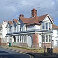
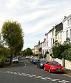
Round Hill is a mostly residential area of Brighton, England. It is bounded by Preston Circus to the south, Ditchling Road to the west, Hollingdean to the north and Lewes Road to the east.
Subcategories
This category has the following 8 subcategories, out of 8 total.
2
B
- Bugle Inn, Brighton (8 F)
J
R
- Richmond House, Brighton (5 F)
- Roundhill Crescent, Brighton (16 F)
U
Media in category "Round Hill, Brighton"
The following 62 files are in this category, out of 62 total.
-
109–119 Ditchling Road, Round Hill, Brighton (January 2011).JPG 2,400 × 1,800; 1.01 MB
-
Belton Close, Round Hill, Brighton - geograph.org.uk - 4696237.jpg 640 × 541; 80 KB
-
Belton Road, Round Hill, Brighton - geograph.org.uk - 4696244.jpg 640 × 440; 67 KB
-
Crescent Road, BN2 (2) - geograph.org.uk - 4153438.jpg 640 × 480; 82 KB
-
Crescent Road, BN2 (3) - geograph.org.uk - 4153440.jpg 640 × 480; 83 KB
-
Crescent Road, BN2 (4) - geograph.org.uk - 4153446.jpg 640 × 480; 79 KB
-
Crescent Road, BN2 - geograph.org.uk - 4153432.jpg 640 × 480; 85 KB
-
Crescent Road, Round Hill, Brighton - geograph.org.uk - 4696256.jpg 640 × 428; 66 KB
-
D'Aubigny Road, Brighton (September 2010).JPG 2,400 × 1,600; 820 KB
-
Ditchling Rise - geograph.org.uk - 5945191.jpg 1,024 × 681; 201 KB
-
Ditchling Rise, BN1 - geograph.org.uk - 4153469.jpg 640 × 481; 81 KB
-
Ditchling Rise, Brighton - geograph.org.uk - 3001133.jpg 4,320 × 3,240; 4.45 MB
-
Downs Junior School ditchling road.jpg 4,032 × 3,024; 3.23 MB
-
Former Victoria pub, 31a Richmond Road, Round Hill, Brighton (February 2014).JPG 2,400 × 2,400; 1.26 MB
-
Housing at Richmond Road, Round Hill, Brighton (February 2014).JPG 3,200 × 2,200; 1,015 KB
-
Housing at Wakefield Road, Round Hill, Brighton (November 2015).JPG 4,000 × 3,200; 2.84 MB
-
Housing on Belton Road, Round Hill, Brighton (January 2011).JPG 2,302 × 1,800; 751 KB
-
Housing on Vere Road, Round Hill, Brighton (January 2011).JPG 2,400 × 1,800; 985 KB
-
Looking down Wakefield Road to the sea - geograph.org.uk - 2609054.jpg 1,600 × 1,200; 520 KB
-
Mayo Court, Mayo Road, Round Hill, Brighton (February 2014).JPG 3,400 × 2,200; 1.55 MB
-
Oakleigh Lodge, 123 Ditchling Road, Round Hill, Brighton (January 2011).JPG 2,400 × 1,800; 945 KB
-
Preston, Brighton and Hove geograph-3749926-by-Ben-Brooksbank.jpg 2,374 × 1,274; 3.63 MB
-
Prince's Crescent - geograph.org.uk - 5947367.jpg 1,024 × 681; 152 KB
-
Prince's Crescent, BN2 (2) - geograph.org.uk - 4152324.jpg 640 × 480; 85 KB
-
Prince's Crescent, BN2 - geograph.org.uk - 4152321.jpg 640 × 480; 82 KB
-
Prince's Rd - geograph.org.uk - 5945190.jpg 1,024 × 681; 172 KB
-
Prince's Road, BN2 (2) - geograph.org.uk - 4153457.jpg 640 × 480; 79 KB
-
Prince's Road, BN2 (3) - geograph.org.uk - 4153461.jpg 640 × 480; 90 KB
-
Prince's Road, BN2 - geograph.org.uk - 4153454.jpg 640 × 480; 100 KB
-
Princes Road, Round Hill, Brighton - geograph.org.uk - 4696264.jpg 640 × 467; 75 KB
-
Richmond Road, BN2 - geograph.org.uk - 4152315.jpg 640 × 480; 75 KB
-
Richmond Road, Round Hill, Brighton - geograph.org.uk - 4696283.jpg 640 × 506; 92 KB
-
Round Hill Crescent - geograph.org.uk - 1971340.jpg 1,600 × 1,200; 384 KB
-
Round Hill Rd - geograph.org.uk - 5945195.jpg 1,024 × 681; 170 KB
-
Round Hill, Brighton - geograph.org.uk - 4697671.jpg 3,264 × 834; 1.37 MB
-
Shaftesbury Place, BN1 (2) - geograph.org.uk - 4159651.jpg 640 × 480; 99 KB
-
Shaftesbury Place, BN1 - geograph.org.uk - 4159646.jpg 640 × 480; 95 KB
-
Shaftesbury Road, Brighton - geograph.org.uk - 4696155.jpg 640 × 456; 86 KB
-
Shop at Park Crescent Road, Round Hill, Brighton (November 2015).JPG 3,400 × 2,600; 1.54 MB
-
Top of Cat's-Creep, Richmond Road, Round Hill, Brighton (January 2011).JPG 1,800 × 2,400; 1 MB
-
Vere Road, Brighton - geograph.org.uk - 4696168.jpg 640 × 522; 80 KB
-
View from Race Hill towards Round Hill, Brighton (December 2012) (1).JPG 2,400 × 1,400; 993 KB
-
View from Race Hill towards Round Hill, Brighton (December 2012) (2).JPG 2,400 × 800; 500 KB
-
View Northeastwards from Prince's Road, Round Hill, Brighton (January 2011).JPG 2,500 × 1,800; 1.01 MB
-
View Northeastwards from Richmond Road, Round Hill, Brighton (January 2011).JPG 2,500 × 1,800; 970 KB
-
View Southeastwards along Edinburgh Road, Round Hill, Brighton (February 2014).JPG 3,600 × 2,000; 1.61 MB
-
View Southwards from Crescent Road, Round Hill, Brighton (January 2011).JPG 2,500 × 1,600; 858 KB
-
Views of Brighton - Round Hill from Tenantry Down Road (December 2013) (1).JPG 2,400 × 1,800; 998 KB
-
Views of Brighton - Round Hill from Tenantry Down Road (December 2013) (2).JPG 2,400 × 1,200; 682 KB
-
Wakefield Road, BN2 - geograph.org.uk - 4152310.jpg 640 × 480; 90 KB
-
Wakefield Road, Round Hill, Brighton - geograph.org.uk - 4717031.jpg 467 × 640; 62 KB
-
Warleigh Road, Brighton - geograph.org.uk - 3332849.jpg 1,600 × 1,079; 394 KB
-
Warleigh Road, Brighton - geograph.org.uk - 4696160.jpg 640 × 499; 71 KB


