Category:Rothwell, West Yorkshire
Jump to navigation
Jump to search
market town in the City of Leeds metropolitan borough in West Yorkshire, England  | |||||
| Upload media | |||||
| Instance of | |||||
|---|---|---|---|---|---|
| Location | Leeds, West Yorkshire, Yorkshire and the Humber, England | ||||
 | |||||
English: Rothwell is a market town on the River Dolphin in the south east of the City of Leeds metropolitan borough in West Yorkshire, situated between Oulton to the east, Belle Isle to the west, Woodlesford to the north east and Robin Hood to the south west. Swillington, Methley and Kippax are located near Rothwell. Rothwell has a population of 21,010 and has benefited from recent improvements in the transport infrastructure, most notably the nearby A1/M1 link road. Rothwell is part of the West Yorkshire Urban Area.
Italiano: Rothwell è una cittadina di 25.000 abitanti della contea del West Yorkshire, in Inghilterra.
Nederlands: Rothwell is een plaats in het bestuurlijke gebied City of Leeds, in het Engelse graafschap West Yorkshire. De plaats telt ca. 21.000 inwoners.
Svenska: Rothwell är en stadsdel i sydvästa Leeds, Storbritannien, med omkring 21 000 invånare. Tidigare har gruvnäringen haft stor betydelse.
Subcategories
This category has the following 27 subcategories, out of 27 total.
A
B
C
L
M
- Mickletown (9 F)
N
O
- Oulton Beck (11 F)
R
- Rothwell Country Park (18 F)
- Rothwell Greenway (8 F)
- Rothwell Interchange (5 F)
- Rothwell War Memorial (3 F)
S
- Springhead Park, Rothwell (54 F)
T
W
Media in category "Rothwell, West Yorkshire"
The following 196 files are in this category, out of 196 total.
-
 15, Oulton Lane - geograph.org.uk - 1384660.jpg 640 × 480; 303 KB
-
 A639 crosses the M1 - geograph.org.uk - 3783615.jpg 640 × 480; 52 KB
-
 A639 Leeds Road, Rothwell - geograph.org.uk - 1481193.jpg 640 × 480; 51 KB
-

-
 Alder Leaf Beetles in West Yorkshire.jpg 4,000 × 2,248; 3.31 MB
-
 Allotments - High Ridge Park - geograph.org.uk - 1264436.jpg 640 × 404; 174 KB
-
 Allotments - Wood Lane - geograph.org.uk - 507280.jpg 640 × 460; 52 KB
-
 Apple Tree Day Nursery - Wood Lane - geograph.org.uk - 1262645.jpg 640 × 480; 256 KB
-
 Approaching Dungeon Lane Farm - geograph.org.uk - 3458208.jpg 2,048 × 1,536; 688 KB
-
 Bridge over the Beck - geograph.org.uk - 1233127.jpg 640 × 479; 132 KB
-
 Bridleway - Stone Brig Lane - geograph.org.uk - 4051074.jpg 640 × 480; 90 KB
-
 Bridleway beside the motorway north of Rothwell - geograph.org.uk - 4280728.jpg 1,600 × 1,200; 684 KB
-
 Bushy Cliffe Wood - geograph.org.uk - 6222075.jpg 1,024 × 768; 150 KB
-
 Carlton Fields, in Wakefield's rhubarb triangle - geograph.org.uk - 4298210.jpg 1,024 × 768; 147 KB
-
 Castle Lodge Avenue - Wood Lane - geograph.org.uk - 1262482.jpg 640 × 424; 164 KB
-
 Cemetery - Styebank Lane - geograph.org.uk - 1264535.jpg 640 × 480; 313 KB
-
 Churchfield Lane - Haigh Road - geograph.org.uk - 1264446.jpg 640 × 430; 171 KB
-
 Common lime Tree (Tilia vulgaris) - geograph.org.uk - 1385325.jpg 480 × 640; 346 KB
-
 Date stone - geograph.org.uk - 1269471.jpg 640 × 466; 260 KB
-
 Dental Surgery - Gillett Lane - geograph.org.uk - 1564339.jpg 640 × 425; 64 KB
-
 Derelict building near Waterloo Corner - geograph.org.uk - 3458201.jpg 2,048 × 1,536; 750 KB
-
 Derelict Chapel - Ingram Parade - geograph.org.uk - 507621.jpg 640 × 407; 36 KB
-
 Eastfield Crescent - Holmsley Lane - geograph.org.uk - 1264588.jpg 640 × 438; 194 KB
-
 Eastfield Drive - Eastfield Crescent - geograph.org.uk - 1264595.jpg 640 × 433; 189 KB
-
 Eighth Avenue, Woodlesford - geograph.org.uk - 1481120.jpg 640 × 480; 53 KB
-
 Electricity pylon - geograph.org.uk - 1592283.jpg 640 × 480; 39 KB
-

-

-

-
 Ever changing landscape - geograph.org.uk - 895952.jpg 512 × 288; 51 KB
-
 Ever changing landscape, 1month on - geograph.org.uk - 899980.jpg 640 × 480; 111 KB
-
 Farm track at Rothwell Haigh - geograph.org.uk - 3858339.jpg 1,200 × 798; 401 KB
-
 Farmland off Royds Lane - geograph.org.uk - 2740808.jpg 640 × 480; 59 KB
-
 Farmland off Wakefield Road - geograph.org.uk - 2740782.jpg 640 × 480; 69 KB
-
 Farmland off Wood Lane - geograph.org.uk - 2740787.jpg 640 × 480; 53 KB
-
 Farmland south of Dungeon Lane Farm - geograph.org.uk - 3289937.jpg 1,024 × 768; 181 KB
-
 Farmland west of Swithen's Lane - geograph.org.uk - 3289953.jpg 1,024 × 768; 171 KB
-
 Fernlea - Thorne Grove - geograph.org.uk - 1264554.jpg 640 × 480; 249 KB
-
 Field bounded by Dungeon Lane and Sanderson Lane - geograph.org.uk - 2221199.jpg 1,024 × 768; 146 KB
-
 Field of Cabbages - geograph.org.uk - 2048604.jpg 1,024 × 681; 232 KB
-
 Field of Rhubarb - geograph.org.uk - 2036041.jpg 1,024 × 681; 221 KB
-
 Fields west of Royds Lane - geograph.org.uk - 3731209.jpg 640 × 480; 59 KB
-
 Floral tubs - geograph.org.uk - 1383112.jpg 480 × 640; 342 KB
-
 Floral tubs - geograph.org.uk - 1383119.jpg 640 × 480; 323 KB
-
 Footpath - Eastfield Crescent - geograph.org.uk - 1264607.jpg 480 × 640; 260 KB
-
 Footpath along the edge of a wheat field - geograph.org.uk - 6221937.jpg 1,024 × 768; 236 KB
-
 Footpath by Lee Moor Beck - geograph.org.uk - 5654602.jpg 1,024 × 683; 260 KB
-
 Former Palace Cinema - Ingram Parade - geograph.org.uk - 507617.jpg 640 × 412; 31 KB
-
 Fox and Sons, Funeral Directors - geograph.org.uk - 1383128.jpg 640 × 480; 213 KB
-
 Gantry over the westbound M62 - geograph.org.uk - 3531050.jpg 4,544 × 2,336; 2.04 MB
-
 Garden at end of Haigh Side Close - geograph.org.uk - 1351702.jpg 640 × 429; 108 KB
-
 Gillett Lane - geograph.org.uk - 507613.jpg 640 × 368; 36 KB
-
 Gillett Lane - Oulton Lane - geograph.org.uk - 1564332.jpg 640 × 422; 58 KB
-
 Gipsy Hill - Eastfield Crescent - geograph.org.uk - 1264611.jpg 640 × 437; 177 KB
-
 Gipsy Lane - Gipsy Hill - geograph.org.uk - 1264613.jpg 640 × 439; 222 KB
-
 Gipsy Lane - Holmsley Lane - geograph.org.uk - 1264630.jpg 640 × 480; 268 KB
-
 Gipsy Mead - Gipsy Lane - geograph.org.uk - 1264621.jpg 640 × 426; 198 KB
-
 Haigh Cottage Farm - geograph.org.uk - 1481136.jpg 640 × 480; 69 KB
-
 Haigh Terrace - Wood Lane - geograph.org.uk - 1262499.jpg 640 × 429; 198 KB
-
 Haigh View - Wood Lane - geograph.org.uk - 1262502.jpg 640 × 480; 245 KB
-
 Haighside - Haighside Drive - geograph.org.uk - 1262509.jpg 640 × 480; 238 KB
-
 Haighside Close - Haighside Drive - geograph.org.uk - 1262609.jpg 640 × 436; 192 KB
-
 Haighside Drive - Wood Lane - geograph.org.uk - 1262637.jpg 640 × 437; 157 KB
-
 Haighside Way - Haighside Drive - geograph.org.uk - 1262514.jpg 640 × 480; 230 KB
-

-
 Hargreaves Street - Clayton Street - geograph.org.uk - 1564317.jpg 640 × 480; 59 KB
-
 Heating by Design - Carlton Lane - geograph.org.uk - 1561867.jpg 480 × 640; 51 KB
-
 High Ridge Court - High Ridge Park - geograph.org.uk - 1264434.jpg 640 × 434; 203 KB
-
 High Ridge Park - Haigh Road - geograph.org.uk - 1262676.jpg 640 × 480; 234 KB
-
 Holmsley Crest - Holmsley Lane - geograph.org.uk - 1264584.jpg 640 × 437; 193 KB
-
 Holmsley Garth - Holmsley Lane - geograph.org.uk - 1264695.jpg 640 × 424; 210 KB
-
 Holmsley Lane - geograph.org.uk - 841937.jpg 640 × 454; 58 KB
-
 Home Lea - Wood Lane - geograph.org.uk - 1262628.jpg 640 × 428; 163 KB
-
 Jail Yard Parade - geograph.org.uk - 1269327.jpg 640 × 360; 218 KB
-
 John O'Gaunts Walk - Haigh Road - geograph.org.uk - 1264458.jpg 640 × 428; 201 KB
-

-
 Joseph Priestley College, Main entrance. - geograph.org.uk - 1294319.jpg 640 × 480; 288 KB
-
 Joseph Priestley College, Marsh Street - geograph.org.uk - 1294314.jpg 640 × 480; 292 KB
-
 K6 phone box B - geograph.org.uk - 3958230.jpg 2,000 × 1,461; 2.42 MB
-
 K6 phone box C - geograph.org.uk - 3958231.jpg 1,631 × 2,000; 2.09 MB
-
 K6 phone box, A - geograph.org.uk - 3958229.jpg 1,832 × 2,000; 1.89 MB
-
 Kings Chase - Haigh Road - geograph.org.uk - 1264570.jpg 640 × 433; 188 KB
-
 Kings Mead - Haigh Road - geograph.org.uk - 1264573.jpg 640 × 423; 172 KB
-
 Knightscroft Avenue - Haigh Road - geograph.org.uk - 1264440.jpg 640 × 480; 215 KB
-
 Lancaster Place - Royds Lane - geograph.org.uk - 1562798.jpg 480 × 640; 65 KB
-
 Langdale Road - Gipsy Lane - geograph.org.uk - 1264624.jpg 640 × 457; 183 KB
-
 Leeds road Rothwell - geograph.org.uk - 1548424.jpg 640 × 480; 50 KB
-
 Lofthouse Cemetery - geograph.org.uk - 47547.jpg 640 × 476; 107 KB
-
 Low Shops Lane - Wood Lane - geograph.org.uk - 1262495.jpg 640 × 480; 217 KB
-
 M1 Motorway, Leeds - geograph.org.uk - 333082.jpg 640 × 480; 77 KB
-
 Manor Crescent recreation ground - geograph.org.uk - 6221979.jpg 1,024 × 768; 163 KB
-
 Megabites - Gillett Lane - geograph.org.uk - 1564337.jpg 480 × 640; 65 KB
-
 Meynell Avenue - geograph.org.uk - 507614.jpg 640 × 511; 51 KB
-
 Meynell Mount - geograph.org.uk - 507615.jpg 640 × 445; 47 KB
-
 Mini roundabout - geograph.org.uk - 1269296.jpg 640 × 480; 284 KB
-
 Morrisons supermarket - geograph.org.uk - 1269303.jpg 640 × 480; 272 KB
-

-
 New Windsor Drive - Styebank Lane - geograph.org.uk - 1264538.jpg 640 × 415; 176 KB
-
 New Windsor Drive - Thorne Grove - geograph.org.uk - 1264564.jpg 640 × 428; 173 KB
-
 No entry from Royds Lane - geograph.org.uk - 2221193.jpg 1,024 × 768; 154 KB
-
 North Lane - Holmsley Lane - geograph.org.uk - 841933.jpg 640 × 424; 51 KB
-
 Oakdale Drive - Wood Lane - geograph.org.uk - 1262650.jpg 640 × 482; 206 KB
-
 Oakfield Avenue - High Ridge Park - geograph.org.uk - 1264431.jpg 640 × 480; 244 KB
-
 Oakroyd - Royds Lane - geograph.org.uk - 1562736.jpg 640 × 480; 40 KB
-
 Orchard Way - Haigh Road - geograph.org.uk - 1264456.jpg 640 × 480; 225 KB
-
 Oulton Lane - geograph.org.uk - 1233148.jpg 480 × 640; 105 KB
-
 Park Lane - viewed from Gillett Lane - geograph.org.uk - 1564345.jpg 640 × 480; 70 KB
-
 Park shelter - geograph.org.uk - 1385281.jpg 640 × 480; 343 KB
-
 Park West - viewed from Gillett Lane - geograph.org.uk - 1564351.jpg 640 × 480; 62 KB
-

-
 Plaque - geograph.org.uk - 1386768.jpg 480 × 640; 400 KB
-
 Plaque in the pavement - geograph.org.uk - 1383101.jpg 640 × 480; 364 KB
-
 Police Station - Haigh Road - geograph.org.uk - 507609.jpg 640 × 483; 37 KB
-
 Post Office, Rothwell - geograph.org.uk - 2740791.jpg 640 × 480; 64 KB
-
 Pymont Grove - Pymont Drive - geograph.org.uk - 1264678.jpg 640 × 480; 244 KB
-
 Queensway - Churchfield Lane - geograph.org.uk - 1264451.jpg 640 × 443; 215 KB
-
-
 Rhubarb Field - Wood Lane - geograph.org.uk - 1262480.jpg 640 × 480; 270 KB
-
 Rhubarb field near Rothwell - geograph.org.uk - 3858364.jpg 1,200 × 798; 499 KB
-
 Rhubarb field near Rothwell - geograph.org.uk - 3858369.jpg 1,200 × 798; 557 KB
-

-
 Rhubarb field, Hopefield Farm - geograph.org.uk - 4298474.jpg 1,024 × 768; 137 KB
-
 Rhubarb field, north of Leadwell Lane (A654) - geograph.org.uk - 4298213.jpg 1,024 × 768; 153 KB
-
 Richmond Close - Haigh Road - geograph.org.uk - 1264465.jpg 640 × 480; 233 KB
-
 Richmond Court - Haigh Road - geograph.org.uk - 1264470.jpg 640 × 413; 191 KB
-
 Robins Grove - Gillett Lane - geograph.org.uk - 1564342.jpg 480 × 640; 53 KB
-
 Rosedale - Thorne Grove - geograph.org.uk - 1264562.jpg 640 × 480; 233 KB
-
 Rothwell - Dickinson's Building.jpg 640 × 480; 273 KB
-
 Rothwell Dental Care - Royds Lane - geograph.org.uk - 1562804.jpg 640 × 480; 86 KB
-
 Rothwell Dental Surgery - Butcher Lane - geograph.org.uk - 1561885.jpg 640 × 628; 102 KB
-
 Rothwell District Council Offices - geograph.org.uk - 1233139.jpg 480 × 640; 70 KB
-
 Rothwell Fire Station - geograph.org.uk - 1480954.jpg 640 × 480; 56 KB
-
 Rothwell Fire Station - geograph.org.uk - 219797.jpg 640 × 480; 113 KB
-

-
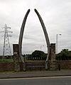 Rothwell Jawbone 2016 01.jpg 1,615 × 1,939; 1.48 MB
-
 Rothwell Jawbone 2016 02.jpg 2,620 × 1,968; 1.21 MB
-
 Rothwell Market Cross^ - geograph.org.uk - 1366755.jpg 480 × 640; 383 KB
-
 Rothwell Maypole - geograph.org.uk - 1366750.jpg 480 × 640; 262 KB
-
 Rothwell Sports Centre, Oulton - geograph.org.uk - 1480933.jpg 640 × 480; 65 KB
-
 Rothwell Sports Centre. - geograph.org.uk - 96095.jpg 640 × 480; 66 KB
-
 Rothwell vista, West Yorkshire.jpg 3,000 × 4,000; 3.87 MB
-
 Rothwell WMC - Marsh Street - geograph.org.uk - 507637.jpg 640 × 363; 31 KB
-
 Rothwellaerial.JPG 840 × 408; 73 KB
-
 Royds Court - Royds Lane - geograph.org.uk - 507636.jpg 640 × 410; 52 KB
-
 Sandy Acres - Haigh Road - geograph.org.uk - 1264462.jpg 640 × 441; 149 KB
-
 Sandy Grove - Styebank Lane - geograph.org.uk - 1264543.jpg 640 × 406; 184 KB
-
 Sandyacres Crescent - Haigh Road - geograph.org.uk - 1264467.jpg 640 × 406; 175 KB
-
 Sandyacres Drive - Haigh Road - geograph.org.uk - 1264472.jpg 640 × 401; 151 KB
-
 Scout H.Q. - Haigh Road - geograph.org.uk - 507608.jpg 640 × 374; 31 KB
-

-
 Sixth Avenue - Holmsley Lane - geograph.org.uk - 1264579.jpg 640 × 423; 245 KB
-
 Smithson Street - Marsh Street - geograph.org.uk - 1562713.jpg 480 × 640; 52 KB
-
 Spibey Lane - Wood Lane - geograph.org.uk - 1262667.jpg 640 × 427; 177 KB
-
 Sports Ground - Leeds Road - geograph.org.uk - 841812.jpg 640 × 408; 37 KB
-

-
 Stream - Rothwell Lane - geograph.org.uk - 1265726.jpg 480 × 640; 345 KB
-
 Stubble field off Royds Lane - geograph.org.uk - 2221189.jpg 1,024 × 768; 136 KB
-
 Styebank Lane - viewed Haigh Road - geograph.org.uk - 1264483.jpg 640 × 427; 155 KB
-
 Succulents - geograph.org.uk - 1383028.jpg 480 × 640; 310 KB
-
 Telephone Exchange - Butcher Lane - geograph.org.uk - 1561889.jpg 640 × 480; 66 KB
-

-
 The A654 Nr Rothwell - geograph.org.uk - 219788.jpg 640 × 480; 120 KB
-
 The Cooperative Funeral Care building - geograph.org.uk - 1269391.jpg 640 × 458; 187 KB
-
 The Oval - Oulton Lane - geograph.org.uk - 1564364.jpg 640 × 480; 55 KB
-
 Thorne Grove - Styebank Lane - geograph.org.uk - 1264548.jpg 640 × 432; 183 KB
-
 Thorntons - Marsh Street - geograph.org.uk - 1562706.jpg 399 × 640; 65 KB
-
 Traffic on the M62 - geograph.org.uk - 1592279.jpg 640 × 480; 46 KB
-

-
 Two bridges in Rothwell, West Yorkshire.jpg 4,000 × 2,248; 2.41 MB
-
 Victoria Road - Haighside Drive - geograph.org.uk - 1262617.jpg 640 × 419; 155 KB
-
 View from Rothwell towards Leeds - geograph.org.uk - 6221940.jpg 1,024 × 768; 204 KB
-
 Walking the dog, Sanderson Lane, Royds Green - geograph.org.uk - 2221206.jpg 1,024 × 768; 193 KB
-
 West Parade - Commercial Street - geograph.org.uk - 1564311.jpg 640 × 480; 81 KB
-
 Whitehall Croft - The Oval - geograph.org.uk - 1564368.jpg 640 × 480; 53 KB
-
 Willans Avenue - Haigh Road - geograph.org.uk - 1264443.jpg 640 × 419; 174 KB
-
 Windsor Crescent - Churchfield Lane - geograph.org.uk - 1264448.jpg 640 × 480; 275 KB
-
 Wood Close - Haighside Drive - geograph.org.uk - 1262591.jpg 640 × 415; 130 KB
-
 Wood Crescent - Haighside Drive - geograph.org.uk - 1262596.jpg 640 × 432; 186 KB
-
 Wood Drive - Haighside Drive - geograph.org.uk - 1262518.jpg 640 × 418; 159 KB
-
 Wood Hill - Haighside Drive - geograph.org.uk - 1262583.jpg 640 × 416; 154 KB
-
 Wood Mount - Haighside Drive - geograph.org.uk - 1262522.jpg 640 × 420; 147 KB
-
 Woodland Crescent - Wood Lane - geograph.org.uk - 1262658.jpg 640 × 480; 241 KB
-
 Woodland off Royds Lane - geograph.org.uk - 2221190.jpg 1,024 × 768; 153 KB
-
 Yew Tree Drive - geograph.org.uk - 979637.jpg 640 × 480; 68 KB
-
 Basement car park - geograph.org.uk - 1269310.jpg 640 × 480; 290 KB
-
 Beck - Carlton Lane - geograph.org.uk - 841965.jpg 640 × 480; 101 KB
-
 Beck - Carlton Lane - geograph.org.uk - 841968.jpg 556 × 640; 124 KB
-
 Bluebells - geograph.org.uk - 1294571.jpg 480 × 640; 384 KB
-

-
 Fleet Bridge - geograph.org.uk - 461411.jpg 640 × 480; 54 KB
-
 Haighside Drive. - geograph.org.uk - 149772.jpg 640 × 480; 48 KB
-
 Island on Man Made Lake. - geograph.org.uk - 217471.jpg 640 × 480; 84 KB
-
 Mill Pit Lane - geograph.org.uk - 507278.jpg 595 × 640; 64 KB
-
 Rose Cottage Farm. - geograph.org.uk - 149766.jpg 640 × 480; 87 KB
-
 Rosewood Court. - geograph.org.uk - 149764.jpg 640 × 480; 78 KB
-
 Royds Green. - geograph.org.uk - 149739.jpg 640 × 480; 136 KB


_-_geograph.org.uk_-_1385325.jpg)


_-_geograph.org.uk_-_4298213.jpg)


