Category:Rothesay, Isle of Bute
Jump to navigation
Jump to search
Български: Ро̀дсей (на английски Rothesay, на гаелски Baile Bhòid, произнася се ) е град в Южна Шотландия.
Deutsch: Rothesay ( schottisch-gälisch: Baile Bhòid) ist die Hauptstadt der Isle of Bute im schottischen unitary authority Argyll and Bute. Das Zentrum der Stadt bildet Rothesay Castle, eine Schlossruine, die aus dem 13. Jahrhundert stammt und einen für Schottland einzigartigen kreisförmigen Grundriss besitzt.
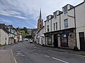
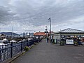
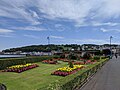
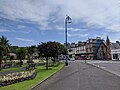
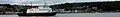
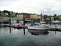
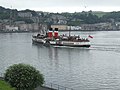
English: The town of Rothesay ) is the principal town on the Isle of Bute, in the council area of Argyll and Bute, Scotland. It can be reached by ferry from Wemyss Bay which offers an onward rail link to Glasgow. At the centre of the town is Rothesay Castle, a ruined castle which dates back to the 13th century, and which is unique in Scotland for its circular plan. Rothesay lies along the coast of the Firth of Clyde.
Français : La ville de Rothesay est la principale ville de l' île de Bute, dans la council area d'Argyll and Bute, en Écosse. La ville est le site d'un château médiéval entouré de douves. Rothesay est accessible par traversier à partir de Wemyss Bay, qui est relié par train à Glasgow.
Gàidhlig: 'S e Baile Bhòid am prìomh-bhaile air Eilean Bhòid. 'S e port-mara airson aiseagan a tha ann. An sin tha aiseagan a' dol eadar Baile Bhòid agus Wemyss Bay le Caledonian Mac a' Bhruthainn. Ann an 2001 's e 6,000 an àireamh-shluaigh a tha aige.
Nederlands: Rothesay (Baile Bhòid) is de hoofdstad van het Isle of Bute in de Schotse unitary authority Argyll and Bute. In het centrum van de stad ligt Rothesay Castle, een ruïne uit de 13e eeuw.
Русский: Ротсей — город в Шотландии.
Українська: Ротсей — місто в Шотландії.
principal town on the Isle of Bute, Argyll and Bute, Scotland, UK  | |||||
| Upload media | |||||
| Instance of |
| ||||
|---|---|---|---|---|---|
| Location |
| ||||
| Population |
| ||||
 | |||||
Subcategories
This category has the following 16 subcategories, out of 16 total.
B
- Bute Estate Office (3 F)
- Bute Museum (5 F)
C
- Rothesay Castle (1 P, 47 F)
D
F
- Rothesay ferry terminal (13 F)
G
- Glenburn Hotel, Rothesay (6 F)
P
- Rothesay Pavilion (9 F)
R
- Rothesay Harbour (32 F)
- Rothesay Joint Campus (3 F)
- Rothesay War Memorial (7 F)
V
- Rothesay Victorian Toilets (18 F)
W
- Winter Gardens, Rothesay (8 F)
Media in category "Rothesay, Isle of Bute"
The following 200 files are in this category, out of 331 total.
(previous page) (next page)-
 PATERSON(1883) p065 ROTHESAY BAY.jpg 1,374 × 1,014; 1.39 MB
-
 7-9 Argyle Street, Rothesay, Bute.jpg 3,000 × 4,000; 2.92 MB
-
 73 Victoria Street, Rothesay, Bute.jpg 3,000 × 4,000; 3.27 MB
-
 Admiralty Chart No 3527 Rothesay Bay and Approaches, Published 1905.jpg 12,083 × 8,270; 32.69 MB
-
 Albert Place - geograph.org.uk - 3534082.jpg 640 × 403; 126 KB
-
 An afternoon in Rothesay (50173290113).jpg 4,032 × 3,024; 3.94 MB
-
 An afternoon in Rothesay (50173290133).jpg 4,032 × 3,024; 3.98 MB
-
 An afternoon in Rothesay (50173290828).jpg 4,032 × 3,024; 5.15 MB
-
 An afternoon in Rothesay (50173291548).jpg 4,032 × 3,024; 4.01 MB
-
 An afternoon in Rothesay (50173292138).jpg 4,032 × 3,024; 4.17 MB
-
 An Afternoon in Rothesay (50173576683).jpg 4,608 × 3,072; 4.9 MB
-
 An Afternoon in Rothesay (50173578848).jpg 4,608 × 3,072; 4.84 MB
-
 An Afternoon in Rothesay (50173580848).jpg 4,608 × 3,072; 4.55 MB
-
 An Afternoon in Rothesay (50173583573).jpg 4,608 × 3,072; 4.98 MB
-
 An afternoon in Rothesay (50173833936).jpg 4,032 × 3,024; 3.51 MB
-
 An afternoon in Rothesay (50173833941).jpg 4,032 × 3,024; 4.08 MB
-
 An afternoon in Rothesay (50173834556).jpg 4,032 × 3,024; 3.87 MB
-
 An afternoon in Rothesay (50173834661).jpg 4,032 × 3,024; 5.01 MB
-
 An afternoon in Rothesay (50173834691).jpg 4,032 × 3,024; 3.61 MB
-
 An afternoon in Rothesay (50173836181).jpg 4,032 × 3,024; 4.15 MB
-
 An afternoon in Rothesay (50173836791).jpg 4,032 × 3,024; 4.08 MB
-
 An afternoon in Rothesay (50173837151).jpg 4,032 × 3,024; 3.84 MB
-
 An afternoon in Rothesay (50173837186).jpg 4,032 × 3,024; 3.69 MB
-
 An afternoon in Rothesay (50174091677).jpg 4,032 × 3,024; 3.94 MB
-
 An afternoon in Rothesay (50174092617).jpg 4,032 × 3,024; 4.39 MB
-
 An afternoon in Rothesay (50174093112).jpg 4,032 × 3,024; 4.05 MB
-
 An afternoon in Rothesay (50174093457).jpg 4,032 × 3,024; 4.84 MB
-
 An afternoon in Rothesay (50174093767).jpg 4,032 × 3,024; 4.13 MB
-
 An afternoon in Rothesay (50174094087).jpg 4,032 × 3,024; 4.49 MB
-
 An Afternoon in Rothesay (50174121331).jpg 4,608 × 3,072; 4.68 MB
-
 An Afternoon in Rothesay (50174124651).jpg 4,608 × 3,072; 4.76 MB
-
 An Afternoon in Rothesay (50174127981).jpg 4,608 × 3,072; 4.77 MB
-
 An Afternoon in Rothesay (50174129271).jpg 4,608 × 3,072; 4.65 MB
-
 An Afternoon in Rothesay (50174379917).jpg 4,608 × 3,072; 3.94 MB
-
 An Afternoon in Rothesay (50174380187).jpg 4,608 × 3,072; 4.34 MB
-
 An Afternoon in Rothesay (50174382337).jpg 4,608 × 3,072; 5.08 MB
-
 Approaching Loch Fad - geograph.org.uk - 1288599.jpg 640 × 480; 69 KB
-
 Approaching Rothesay - geograph.org.uk - 3174551.jpg 4,592 × 3,448; 2.11 MB
-
 Ardbeg - geograph.org.uk - 3174559.jpg 4,592 × 3,448; 2.67 MB
-
 Ardbeg and the Kyles of Bute - geograph.org.uk - 4165438.jpg 3,072 × 1,728; 1.33 MB
-
 Ardbeg from the ferry - geograph.org.uk - 3534071.jpg 640 × 305; 65 KB
-
 Ardbeg Point - geograph.org.uk - 3534177.jpg 640 × 374; 90 KB
-
 Ardyne Point - geograph.org.uk - 3534151.jpg 640 × 380; 104 KB
-
 Ardyne Point - geograph.org.uk - 3686798.jpg 640 × 480; 230 KB
-
 Ardyne Point from Rothesay Bay - geograph.org.uk - 2556535.jpg 640 × 429; 132 KB
-
 Ardyne Point from Rothesay Bay - geograph.org.uk - 2556561.jpg 640 × 362; 69 KB
-
 Argyle Place ^ Skeoch Wood, Rothesay - geograph.org.uk - 3572011.jpg 5,184 × 3,456; 7.79 MB
-
 Argyle Street from Rothesay Bay - geograph.org.uk - 2557814.jpg 640 × 480; 137 KB
-
 Arran mountains over Rothesay on Isle of Bute (3537926695).jpg 1,600 × 892; 198 KB
-
 Auld Overflow from Kirk Dam - geograph.org.uk - 1527826.jpg 640 × 480; 139 KB
-

-
 Battery Place - geograph.org.uk - 3534027.jpg 640 × 480; 154 KB
-
 Battery Place, Rothesay - geograph.org.uk - 3686783.jpg 640 × 480; 322 KB
-
 Battery Place, Rothesay, Bute - geograph.org.uk - 4598155.jpg 2,000 × 1,333; 1.34 MB
-
 Beach at Craigmore, Bute - geograph.org.uk - 4598148.jpg 2,000 × 1,333; 1.43 MB
-
 Beattie Court - geograph.org.uk - 471272.jpg 640 × 389; 77 KB
-
 Blue Boats at Rothesay (6175438268).jpg 1,280 × 853; 1.12 MB
-
 Bogany Point - geograph.org.uk - 3562559.jpg 640 × 480; 123 KB
-
 Bogany Point - geograph.org.uk - 5923983.jpg 1,600 × 1,067; 257 KB
-
 Bogany Point, Isle of Bute - geograph.org.uk - 4052783.jpg 1,920 × 1,280; 1.2 MB
-
 Bute Kingfisher (6184433843).jpg 1,280 × 817; 977 KB
-
 Bute Museum Jet Necklace.jpg 4,608 × 2,592; 1.56 MB
-
 Bute, Lovers Walk Aqueduct. - geograph.org.uk - 857298.jpg 640 × 480; 126 KB
-
 Bute, Rothesay, Albert Place Gentlemen's Urinal Building.jpg 3,000 × 4,000; 2.9 MB
-
 Bute, Rothesay, Argyle Street, Public Conveniences.jpg 3,000 × 4,000; 3.77 MB
-
 Bute, Rothesay, Rothesay Promenade.jpg 3,000 × 4,000; 3.17 MB
-
 Bylczynski-grob.jpg 600 × 800; 112 KB
-
 Cairn at Port Bannatyne - geograph.org.uk - 3534361.jpg 480 × 640; 191 KB
-
 Caledonia - geograph.org.uk - 1800546.jpg 1,190 × 800; 238 KB
-
 Calmac ferry departing from Rothesay - geograph.org.uk - 3685794.jpg 640 × 473; 259 KB
-
 Co-op Building in Rothesay - geograph.org.uk - 908933.jpg 640 × 480; 63 KB
-

-
 Craigmore Old Pier, Craigmore - geograph.org.uk - 3623186.jpg 1,024 × 768; 159 KB
-
 Craigmore Seafront - geograph.org.uk - 2624043.jpg 640 × 300; 276 KB
-
 Day trip to Rothesay (50172326063).jpg 4,032 × 3,024; 4.13 MB
-
 Day trip to Rothesay (50172871926).jpg 4,032 × 3,024; 3.49 MB
-
 Day trip to Rothesay (50173127107).jpg 4,032 × 3,024; 3.29 MB
-
 Day trip to Rothesay (50173127152).jpg 4,032 × 3,024; 3.62 MB
-
 Deer (2658970331).jpg 3,888 × 2,592; 761 KB
-
 Discovery Theatre, Rothesay, Isle of Bute (8256737030).jpg 1,120 × 1,000; 1.39 MB
-

-

-
 East Bay, Rothsay (i.e. Rothesay), Scotland-LCCN2002695048.jpg 3,646 × 2,747; 2.94 MB
-
 East Princes Street - geograph.org.uk - 3534093.jpg 640 × 316; 108 KB
-
 Eastern promenade of Rothesay - geograph.org.uk - 456715.jpg 640 × 427; 84 KB
-
 Eden Drive Rothesay - geograph.org.uk - 1491353.jpg 640 × 480; 89 KB
-
 Edward VII pillar box - geograph.org.uk - 1491290.jpg 640 × 480; 88 KB
-
 Elaborate Tombstone - geograph.org.uk - 1527832.jpg 369 × 640; 79 KB
-
 Ferry approaching Rothesay - geograph.org.uk - 530052.jpg 640 × 380; 54 KB
-
 Ferry Approaching Rothesay Terminal - geograph.org.uk - 398105.jpg 640 × 480; 59 KB
-
 Ferry arriving at Rothesay - geograph.org.uk - 5504202.jpg 1,600 × 1,038; 270 KB
-
 Ferry Docking at Rothesay Pier - geograph.org.uk - 4052812.jpg 1,920 × 1,280; 1.5 MB
-
 Ferry leaving Rothesay - geograph.org.uk - 3534107.jpg 640 × 480; 105 KB
-
 Ferry leaving Rothesay - geograph.org.uk - 3534110.jpg 640 × 480; 129 KB
-
 Ferry leaving Rothesay - geograph.org.uk - 3534113.jpg 640 × 292; 64 KB
-
 Ferry pier at Rothesay - geograph.org.uk - 3525303.jpg 640 × 442; 66 KB
-
 Ferry terminal at Rothesay, Bute - geograph.org.uk - 4643936.jpg 640 × 481; 54 KB
-

-

-
 Firth Of Clyde , Keeping Wicket - geograph.org.uk - 4418075.jpg 1,600 × 1,200; 326 KB
-
 Firth Of Clyde , MV Argyle Arrives At Rothesay Pier - geograph.org.uk - 4418081.jpg 1,600 × 1,200; 325 KB
-
 Firth Of Clyde , Rothesay Marina - geograph.org.uk - 4417718.jpg 1,600 × 1,200; 341 KB
-
 Firth Of Clyde , Rothesay Marina - geograph.org.uk - 4418051.jpg 1,600 × 1,200; 384 KB
-
 Firth Of Clyde, Fog Stops Play - geograph.org.uk - 4417717.jpg 1,600 × 1,200; 274 KB
-
 Fishing boats at Rothesay - geograph.org.uk - 2560661.jpg 640 × 611; 224 KB
-
 Flotilla of Swans in Rothesay Bay - geograph.org.uk - 5425226.jpg 2,939 × 2,213; 2.23 MB
-
 Foreshore at Dunoon - geograph.org.uk - 5425229.jpg 3,264 × 2,448; 2.75 MB
-
 Foreshore, Rothesay Bay - geograph.org.uk - 4004437.jpg 1,024 × 678; 243 KB
-
 Fountain At Rothesay, Isle of Bute (8255665657).jpg 1,280 × 698; 1.18 MB
-
 Glenburn Hotel - geograph.org.uk - 1491307.jpg 640 × 480; 71 KB
-
 Glenburn Hotel - geograph.org.uk - 2624070.jpg 640 × 416; 436 KB
-
 Glenburn Hotel in the east end of Rothesay - geograph.org.uk - 3696618.jpg 1,024 × 681; 102 KB
-
 Glenburn Hotel Rothsay - geograph.org.uk - 3774996.jpg 3,072 × 2,304; 5.73 MB
-
 Harbour at Rothesay - geograph.org.uk - 1520209.jpg 640 × 480; 68 KB
-
 Harbourside Properties, Rothesay - geograph.org.uk - 3149894.jpg 3,448 × 4,592; 3.57 MB
-
 Highland Boundary Fault, on Bute - geograph.org.uk - 1527822.jpg 640 × 480; 96 KB
-
 Houses in Rothesay - geograph.org.uk - 589253.jpg 640 × 480; 48 KB
-
 Humaita in Rothesay Bay - geograph.org.uk - 4371301.jpg 640 × 427; 143 KB
-
 Impressive Grave Monument - geograph.org.uk - 1527830.jpg 545 × 640; 84 KB
-
 Inner Harbour Rothesay - geograph.org.uk - 2417721.jpg 640 × 480; 94 KB
-
 Inner Harbour, Rothesay - geograph.org.uk - 3571841.jpg 5,184 × 3,456; 7.39 MB
-
 Inner Harbour, Rothesay - geograph.org.uk - 3571846.jpg 1,600 × 1,067; 491 KB
-
 Isle of Bute banner Ferry leaving Rothesay.JPG 2,100 × 300; 159 KB
-

-
 Isle Of Rothsay - panoramio.jpg 4,320 × 2,432; 9.32 MB
-
 King George V gate piers - geograph.org.uk - 1491285.jpg 640 × 480; 74 KB
-
 Landing Stage at Rothesay - geograph.org.uk - 4053479.jpg 1,920 × 1,280; 953 KB
-
 Looking along the A844 at Rothesay - geograph.org.uk - 704727.jpg 640 × 480; 83 KB
-

-
 Macnab's Brae Rothesay - geograph.org.uk - 1491321.jpg 640 × 480; 66 KB
-
 Maid of Glencoul-Rothesay.jpg 800 × 600; 141 KB
-
 Maid of Glencoul.jpg 800 × 600; 144 KB
-
 Mausoleum, High Kirk of Rothesay, Isle of Bute (geograph 5894980).jpg 1,024 × 768; 245 KB
-
 Memorial Stone & Esplanade Gardens, Rothesay (geograph 3571776).jpg 1,600 × 1,067; 520 KB
-
 Mile stone 1 mile from Rothesay - geograph.org.uk - 5031140.jpg 698 × 1,000; 222 KB
-

-
 Mountstewart Road - geograph.org.uk - 3014224.jpg 640 × 480; 81 KB
-
 Mountstuart Road, Rothesay - geograph.org.uk - 3525311.jpg 640 × 480; 59 KB
-
 MV 'Argyle' approaching Rothesay - geograph.org.uk - 4004452.jpg 1,024 × 624; 104 KB
-
 MV Argyle arriving in Rothesay (36170775152).jpg 5,184 × 3,888; 8.37 MB
-
 MV Argyle at Rothesay (36202968451).jpg 3,888 × 5,184; 8.27 MB
-
 MV Argyle leaving Rothesay (36170819652).jpg 5,184 × 3,888; 7.91 MB
-
 MV Bute arriving in Rothesay (50172886163).jpg 4,032 × 3,024; 4.28 MB
-
 MV Bute arriving in Rothesay (50172886468).jpg 4,032 × 3,024; 3.14 MB
-
 MV Bute arriving in Rothesay (50173430771).jpg 4,032 × 3,024; 4.16 MB
-
 MV Bute arriving in Rothesay (50173687532).jpg 4,032 × 3,024; 3.76 MB
-
 MV Bute heading to Rothesay (50172886958).jpg 4,032 × 3,024; 4.2 MB
-
 MV Bute in Rothesay Bay - geograph.org.uk - 471297.jpg 640 × 451; 84 KB
-
 MV Bute leaving Rothesay (50173561163).jpg 4,608 × 3,072; 3.68 MB
-
 MV Bute leaving Rothesay (50174365522).jpg 4,608 × 3,072; 3.44 MB
-
 MV Loch Alainn.jpg 600 × 450; 43 KB
-
 MV Marnock.jpg 600 × 450; 54 KB
-
 Ordnance Survey One-Inch Sheet 59 Firth of Clyde, Published 1956.jpg 8,619 × 10,676; 9.7 MB
-
 Ordnance Survey One-Inch Sheet 59 Firth of Clyde, Published 1965.jpg 8,314 × 9,866; 11.22 MB
-
 Ordnance Survey One-Inch Sheet 71 Island of Bute, Published 1925.jpg 12,190 × 11,123; 13.44 MB
-
 Ordnance Survey One-Inch Tourist Map of Rothesay and Firth of Clyde, Published 1920.jpg 8,604 × 11,534; 24.19 MB
-
 Outer Harbour - geograph.org.uk - 3534096.jpg 640 × 480; 120 KB
-
 Outer Harbour, Rothesay - geograph.org.uk - 3573418.jpg 5,184 × 3,456; 6.5 MB
-
 Outer Harbour, Rothesay - geograph.org.uk - 3686758.jpg 640 × 480; 285 KB
-
 Outer Harbour, Rothesay - geograph.org.uk - 4053610.jpg 1,920 × 1,280; 1.3 MB
-

-

-
 Pavilion, Argyle Street, Rothesay - geograph.org.uk - 3571987.jpg 5,184 × 3,456; 7.6 MB
-
-
 Port Bannatyne from Rothesay Bay - geograph.org.uk - 2556488.jpg 640 × 375; 82 KB
-
 Port Bannatyne Quay.jpg 4,608 × 3,456; 8.77 MB
-
 Promenade shelter - geograph.org.uk - 3534136.jpg 640 × 384; 116 KB
-
-
 Putting Green, Rothesay - geograph.org.uk - 1491282.jpg 640 × 480; 61 KB
-
 Red sandstone tenement - geograph.org.uk - 471238.jpg 640 × 480; 102 KB
-
 Red sandstone tenements - geograph.org.uk - 471267.jpg 640 × 480; 95 KB
-
 Relaxing on Bute - geograph.org.uk - 1289783.jpg 640 × 480; 134 KB
-
 Rev-robert-elder-1808-1892-minister-of-the-free-we.jpg 1,920 × 2,441; 971 KB
-
 River Clyde at Rothesay, cirka 1830.jpg 2,696 × 2,067; 632 KB
-
 Rothesay (269956217).jpg 1,024 × 768; 305 KB
-
 Rothesay (269956772).jpg 1,024 × 768; 278 KB
-
 Rothesay (269957274).jpg 768 × 1,024; 282 KB
-
 Rothesay (269957742).jpg 1,024 × 768; 413 KB
-
 Rothesay (269958188).jpg 1,024 × 768; 286 KB
-
 Rothesay (269958691).jpg 1,024 × 768; 208 KB
-
 Rothesay (269959243).jpg 1,024 × 768; 317 KB
-
 Rothesay (269966214).jpg 1,024 × 768; 369 KB
-
 Rothesay (NBY 438986).jpg 3,600 × 2,367; 2.23 MB
-
 Rothesay , Isle of Bute (5643599286).jpg 3,322 × 2,553; 4.85 MB
-
 Rothesay - geograph.org.uk - 5845053.jpg 1,024 × 471; 168 KB
-
 Rothesay - geograph.org.uk - 804089.jpg 640 × 480; 57 KB
-
 Rothesay and Arran from Rothesay Bay - geograph.org.uk - 2556573.jpg 640 × 380; 120 KB
-
 Rothesay and Ettrick Bay Light Railway.jpg 600 × 600; 43 KB
-
 Rothesay and Rothesay Bay - geograph.org.uk - 4166033.jpg 3,072 × 1,728; 1.4 MB
-
 Rothesay and Rothesay Bay - geograph.org.uk - 907838.jpg 640 × 456; 149 KB
-
 Rothesay at daybreak - geograph.org.uk - 4360447.jpg 1,024 × 669; 126 KB
-
 Rothesay Bay - geograph.org.uk - 1536661.jpg 640 × 480; 77 KB
-
 Rothesay Bay - geograph.org.uk - 3534075.jpg 640 × 480; 118 KB
-
 Rothesay Bay - geograph.org.uk - 3686774.jpg 640 × 480; 231 KB
-
 Rothesay Bay - geograph.org.uk - 4052933.jpg 1,920 × 1,280; 1.03 MB
-
 Rothesay Bay - geograph.org.uk - 4053211.jpg 1,920 × 1,280; 1.44 MB
-
 Rothesay Bay - geograph.org.uk - 4053470.jpg 1,920 × 1,280; 983 KB
-
 Rothesay Bay - geograph.org.uk - 4053473.jpg 1,920 × 1,280; 1.11 MB
-
 Rothesay Bay - geograph.org.uk - 4053587.jpg 1,920 × 1,280; 1.71 MB
-
 Rothesay Bay - geograph.org.uk - 4242384.jpg 1,024 × 682; 164 KB
_p065_ROTHESAY_BAY.jpg)


.jpg)
.jpg)
.jpg)
.jpg)
.jpg)
.jpg)
.jpg)
.jpg)
.jpg)
.jpg)
.jpg)
.jpg)
.jpg)
.jpg)
.jpg)
.jpg)
.jpg)
.jpg)
.jpg)
.jpg)
.jpg)
.jpg)
.jpg)
.jpg)
.jpg)
.jpg)
.jpg)
.jpg)
.jpg)
.jpg)
.jpg)


.jpg)


.jpg)


.jpg)


.jpg)
.jpg)
.jpg)
.jpg)
.jpg)
.jpg)


,_Scotland-LCCN2002695048.jpg)


.jpg)


.jpg)
.jpg)


.jpg)
.jpg)
.jpg)
.jpg)
.jpg)
.jpg)
.jpg)
.jpg)

.jpg)
.jpg)


.jpg)
.jpg)
.jpg)
.jpg)
.jpg)
.jpg)
.jpg)
.jpg)
.jpg)
.jpg)


