Category:Rombalds Moor
Jump to navigation
Jump to search
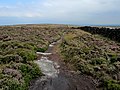
English: Rombalds Moor is large area of moorland in the north of England which stretches from Skipton, North Yorkshire in the north west to Bingley and Baildon, West Yorkshire in the south east. It encompasses smaller named areas of moorland, most notably Ilkley Moor and Skipton Moor.
moorland in West Yorkshire, England, UK  | |||||
| Upload media | |||||
| Instance of | |||||
|---|---|---|---|---|---|
| Location | Bradford, West Yorkshire, Yorkshire and the Humber, England | ||||
| Elevation above sea level |
| ||||
 | |||||
Subcategories
This category has the following 15 subcategories, out of 15 total.
A
- Addingham Low Moor (4 F)
B
- Baildon Moor (48 F)
- Bingley Moor (13 F)
D
- Draughton Moor (11 F)
F
H
- High Bradley Moor (4 F)
I
K
- Kildwick Moor (1 F)
L
- Low Bradley Moor (3 F)
M
- Morton Moor (20 F)
S
- Silsden Moor (5 F)
- Skipton Moor (34 F)
Media in category "Rombalds Moor"
The following 9 files are in this category, out of 9 total.
-
 Ashlar Chair, Rombalds Moor - geograph.org.uk - 44714.jpg 640 × 480; 141 KB
-
 Boundary Wall on Rombalds Moor - Highest Point - geograph.org.uk - 3584677.jpg 4,320 × 3,240; 4.57 MB
-
 Dusk over Rombalds Moor - geograph.org.uk - 6559880.jpg 1,024 × 768; 80 KB
-
 Plantation, Rombalds Moor - geograph.org.uk - 48504.jpg 640 × 480; 142 KB
-
 Rombalds Moor trig point - geograph.org.uk - 3035084.jpg 2,048 × 1,536; 608 KB
-
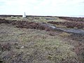 Rombalds Moor trig point - geograph.org.uk - 3436266.jpg 1,024 × 768; 161 KB
-
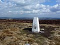 Rombalds moor trig.jpg 4,320 × 3,240; 4.67 MB
-
 Rombalds Moor Trigpoint - geograph.org.uk - 2417842.jpg 1,200 × 800; 201 KB
-
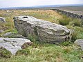 The Ashlar Chair - geograph.org.uk - 904089.jpg 640 × 480; 129 KB


