Category:Rollesby
Jump to navigation
Jump to search
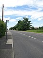
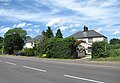
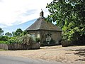
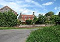
English: Rollesby is a village and civil parish in the English county of Norfolk. It is situated on the A149 road, adjacent to Rollesby Broad and Ormesby Broad, about east of the city of Norwich.
village and civil parish in Norfolk, United Kingdom  | |||||
| Upload media | |||||
| Instance of | |||||
|---|---|---|---|---|---|
| Location | Great Yarmouth, Norfolk, East of England, England | ||||
| Population |
| ||||
| Area |
| ||||
 | |||||
Subcategories
This category has the following 3 subcategories, out of 3 total.
Media in category "Rollesby"
The following 137 files are in this category, out of 137 total.
-

-
 A crop of sugar beet - geograph.org.uk - 3969033.jpg 640 × 450; 192 KB
-
 A frozen Rollesby Broad - geograph.org.uk - 2204878.jpg 640 × 480; 145 KB
-
 A well-maintained path - geograph.org.uk - 855263.jpg 480 × 640; 181 KB
-
 A149 towards Great Yarmouth - geograph.org.uk - 5876160.jpg 1,024 × 684; 189 KB
-
 Access to Church Farm - geograph.org.uk - 855284.jpg 480 × 640; 147 KB
-
 Allotments beside Court Road - geograph.org.uk - 854801.jpg 640 × 455; 201 KB
-
 Back Lane - geograph.org.uk - 854893.jpg 480 × 640; 169 KB
-
 Barley crop beside Heath Road - geograph.org.uk - 3969025.jpg 640 × 480; 160 KB
-
 Beck's Garage - geograph.org.uk - 854885.jpg 640 × 465; 147 KB
-
 Broad View - geograph.org.uk - 854794.jpg 640 × 454; 176 KB
-
 Bus shelter - geograph.org.uk - 854776.jpg 640 × 438; 109 KB
-

-
 Bus stop on Main Road (A149) - geograph.org.uk - 854784.jpg 480 × 640; 104 KB
-
 Church Farm - geograph.org.uk - 4939356.jpg 640 × 480; 66 KB
-
 Close up, Elizabeth II postbox on Main Road, Rollesby - geograph.org.uk - 4939519.jpg 1,238 × 2,151; 531 KB
-
 Cottage in Martham Road - geograph.org.uk - 4681698.jpg 640 × 360; 326 KB
-
 Cottages beside the A149 (Main Road) - geograph.org.uk - 854766.jpg 640 × 442; 112 KB
-
 Cottages on Court Road - geograph.org.uk - 854850.jpg 640 × 466; 171 KB
-
 Court Road past the Old Court House - geograph.org.uk - 854835.jpg 640 × 448; 145 KB
-
 Court Road, Rollesby - geograph.org.uk - 4938924.jpg 640 × 480; 63 KB
-
 Cowtrott Lane - geograph.org.uk - 929491.jpg 640 × 480; 200 KB
-

-
 Crop field, Rollesby - geograph.org.uk - 4938921.jpg 640 × 480; 55 KB
-
 Cultivated field beside Heath Road - geograph.org.uk - 3969027.jpg 640 × 480; 185 KB
-
 Cultivated field north of Heath Road - geograph.org.uk - 3969030.jpg 640 × 480; 191 KB
-

-
 Elizabeth II postbox on Main Road, Rollesby - geograph.org.uk - 4939518.jpg 3,061 × 2,429; 1.83 MB
-

-
 Field near Church Farm, Rollesby - geograph.org.uk - 4939358.jpg 640 × 480; 67 KB
-
 Field off Main Road, Rollesby - geograph.org.uk - 4938929.jpg 640 × 480; 53 KB
-
 Fields beside Heath Road - geograph.org.uk - 3969036.jpg 640 × 480; 173 KB
-
 Fields by Rollesby - geograph.org.uk - 3969045.jpg 640 × 480; 165 KB
-
 Footpath leading east - geograph.org.uk - 855230.jpg 480 × 640; 188 KB
-
 Footpath to Back Lane - geograph.org.uk - 854771.jpg 431 × 640; 131 KB
-
 Fresh fruit and vegetables - geograph.org.uk - 854803.jpg 640 × 480; 191 KB
-
 Gatehouse by entrance to the Hall - geograph.org.uk - 854898.jpg 640 × 480; 158 KB
-
 Gezicht op een vissershut An eel fisher's hut (titel op object), RP-F-2001-7-1162-84.jpg 2,000 × 3,000; 990 KB
-
 Greenhouses viewed across barleyfield - geograph.org.uk - 855257.jpg 480 × 640; 150 KB
-
 Hall Farm - geograph.org.uk - 854865.jpg 640 × 464; 127 KB
-
 Harvested field beside Back Lane - geograph.org.uk - 929483.jpg 480 × 640; 168 KB
-
 Harvested field beside Martham Road - geograph.org.uk - 4681692.jpg 640 × 360; 270 KB
-
 Heath Road, Rollesby - geograph.org.uk - 4939355.jpg 640 × 480; 98 KB
-
 Here Rectory Close ends - geograph.org.uk - 855208.jpg 480 × 640; 157 KB
-
 Hogweed (Heracleum sphondylium) - geograph.org.uk - 854825.jpg 480 × 640; 181 KB
-
 Hogweed flower (Heracleum sphondylium) - geograph.org.uk - 854830.jpg 640 × 480; 187 KB
-
 Holly Farm - geograph.org.uk - 854857.jpg 640 × 452; 137 KB
-
 Houses at Narrowgate Corner - geograph.org.uk - 855295.jpg 640 × 446; 156 KB
-
 Ivy-clad trees beside Heath Road - geograph.org.uk - 3969038.jpg 640 × 480; 184 KB
-

-
 Lane heading west from Rollesby - geograph.org.uk - 4939357.jpg 640 × 480; 94 KB
-
 Lily Broad - geograph.org.uk - 2439603.jpg 4,224 × 2,376; 2.75 MB
-
 Lily Broad Neck - geograph.org.uk - 2439546.jpg 4,224 × 2,376; 2.87 MB
-
 Lodge Farm - the farmhouse - geograph.org.uk - 3969053.jpg 640 × 440; 143 KB
-
 Main Road (A149), Rollesby - geograph.org.uk - 4939105.jpg 640 × 480; 67 KB
-
 Main Road (A149), Rollesby - geograph.org.uk - 4939521.jpg 640 × 440; 59 KB
-
 Main Road (A149), Rollesby - geograph.org.uk - 4939524.jpg 3,648 × 2,736; 1.91 MB
-
 Mallards walking on Rollesby Broad - geograph.org.uk - 2204880.jpg 640 × 480; 131 KB
-
 Martham Road - geograph.org.uk - 4681693.jpg 640 × 360; 274 KB
-
 Martham Road, Rollesby - geograph.org.uk - 6007792.jpg 3,456 × 2,592; 3.94 MB
-
 Martham Road, Rollesby - geograph.org.uk - 6007794.jpg 3,456 × 2,592; 3.97 MB
-
 Meadow with caravan off Lady Broad Lane - geograph.org.uk - 6007762.jpg 3,456 × 2,592; 3.68 MB
-
 Muddy lane by Lily or Lady Broad - geograph.org.uk - 6007758.jpg 3,456 × 2,592; 2.85 MB
-
 New house - old style - geograph.org.uk - 854890.jpg 640 × 480; 156 KB
-
 Old Church Farm - geograph.org.uk - 855288.jpg 640 × 480; 169 KB
-
 Old Milepost - geograph.org.uk - 1732683.jpg 1,200 × 1,600; 834 KB
-
 Old Milepost - geograph.org.uk - 1732748.jpg 1,200 × 1,600; 895 KB
-
 Old red-brick barns - geograph.org.uk - 854876.jpg 480 × 640; 157 KB
-
 Old World Cottages - geograph.org.uk - 855218.jpg 640 × 480; 170 KB
-
 Old World Cottages - plaque - geograph.org.uk - 855225.jpg 640 × 480; 164 KB
-
 Ormesby Broad - geograph.org.uk - 6007773.jpg 3,456 × 2,592; 3.89 MB
-
 Outbuilding of The Old Court House, Rollesby - geograph.org.uk - 6007800.jpg 3,456 × 2,592; 3.58 MB
-
 Path to Hill Farm - geograph.org.uk - 929487.jpg 480 × 640; 193 KB
-
 Post Office Cottage, Rollesby - geograph.org.uk - 4939122.jpg 640 × 480; 52 KB
-
 Potatoes and barley - geograph.org.uk - 855250.jpg 480 × 640; 181 KB
-
 Rollesby Broad - geograph.org.uk - 2439579.jpg 3,986 × 2,242; 2.25 MB
-
 Rollesby Broad - geograph.org.uk - 3640826.jpg 640 × 458; 59 KB
-

-
 Rollesby Broad in winter - geograph.org.uk - 2204883.jpg 640 × 545; 173 KB
-
 Rollesby Broad Sailing Club - Norfolk aerial (21010215808).jpg 3,688 × 2,596; 2.53 MB
-
 Rollesby Broad, Norfolk (21198925175).jpg 4,749 × 3,025; 4.53 MB
-
 Rollesby Post Office - geograph.org.uk - 854866.jpg 640 × 463; 97 KB
-
 Rollesby Primary School - geograph.org.uk - 2645282.jpg 4,000 × 3,000; 3.67 MB
-
 Rollesby recreation ground - geograph.org.uk - 522095.jpg 640 × 480; 70 KB
-
 Rollesby Sports Pavilion - geograph.org.uk - 2645291.jpg 4,000 × 3,000; 3.6 MB
-
 Rollesby Village Sign - geograph.org.uk - 2645288.jpg 3,000 × 4,000; 4 MB
-
 Rollesby village sign - geograph.org.uk - 6668267.jpg 4,608 × 3,072; 5.75 MB
-
 Rollesby village sign - geograph.org.uk - 6668269.jpg 4,608 × 3,072; 5.53 MB
-
 Sheds by Lodge Farm - geograph.org.uk - 3969054.jpg 640 × 480; 181 KB
-

-
 Straw bales by Hill Farm - geograph.org.uk - 4681696.jpg 640 × 360; 249 KB
-
 Stubble field beside Martham Road - geograph.org.uk - 4681689.jpg 640 × 360; 270 KB
-
 Temporary lay-by on the A149 at Rollesby - geograph.org.uk - 4270488.jpg 640 × 484; 113 KB
-
 Thatched Cottage Rollesby - geograph.org.uk - 298719.jpg 640 × 480; 95 KB
-
 Thatched Cottage, Rollesby - geograph.org.uk - 2645296.jpg 4,000 × 3,000; 3.86 MB
-

-
 The A149 (Main Road) through Rollesby - geograph.org.uk - 854787.jpg 640 × 434; 108 KB
-
 The end of Lady Broad Lane - geograph.org.uk - 6007763.jpg 2,688 × 2,016; 2.38 MB
-
 The Grange - geograph.org.uk - 855207.jpg 640 × 480; 159 KB
-
 The Horse and Groom - geograph.org.uk - 854870.jpg 631 × 455; 95 KB
-
 The Horse and Groom Hotel and Restaurant - geograph.org.uk - 854874.jpg 640 × 442; 101 KB
-
 The Horse and Groom, Rollesby - geograph.org.uk - 5876043.jpg 1,024 × 768; 247 KB
-
 The Horse ^ Groom Hotel, Rollesby - geograph.org.uk - 4939117.jpg 640 × 480; 68 KB
-
 The Old Court House - geograph.org.uk - 854846.jpg 640 × 458; 166 KB
-
 The Old Court House or House of Industry at Rollesby - geograph.org.uk - 6007815.jpg 2,459 × 1,844; 1.41 MB
-
 The Old Court House or House of Industry at Rollesby - geograph.org.uk - 6086064.jpg 3,264 × 2,448; 1.57 MB
-
 The Old Flegg Union, Aims and Purpose plaque - geograph.org.uk - 6085213.jpg 3,264 × 2,448; 1.76 MB
-
 The Old Forge stands next to the A149 - geograph.org.uk - 522102.jpg 640 × 480; 121 KB
-
 This way to Martham - geograph.org.uk - 4681697.jpg 640 × 360; 296 KB
-
 To North Walsham 16 - geograph.org.uk - 1732702.jpg 1,600 × 1,200; 779 KB
-
 To North Walsham 17 - geograph.org.uk - 1732760.jpg 1,600 × 1,200; 690 KB
-
 To Rollesby on Martham Road - geograph.org.uk - 4681694.jpg 640 × 360; 266 KB
-
 Track to the Hall - geograph.org.uk - 854896.jpg 480 × 640; 177 KB
-
 Tudor Lodge - geograph.org.uk - 854880.jpg 640 × 480; 165 KB
-
 Tudor Lodge on Martham Road - geograph.org.uk - 854884.jpg 640 × 480; 148 KB
-
 Union Farm - geograph.org.uk - 854809.jpg 640 × 480; 200 KB
-
 View along Repps Road - geograph.org.uk - 3969050.jpg 640 × 480; 130 KB
-
 View east along Back Lane - geograph.org.uk - 929477.jpg 480 × 640; 128 KB
-
 View SE along the A149 (Main Road) - geograph.org.uk - 854780.jpg 640 × 440; 133 KB
-
 View south along Wick Lane - geograph.org.uk - 854855.jpg 480 × 640; 184 KB
-

-
 Village Hall - geograph.org.uk - 855201.jpg 640 × 439; 137 KB
-
 Waterfowl on a frozen Rollesby Broad - geograph.org.uk - 2204881.jpg 640 × 560; 138 KB
-
 Wheat crop waiting to be harvested - geograph.org.uk - 929481.jpg 640 × 480; 131 KB
-
 Windswept barley - geograph.org.uk - 855399.jpg 480 × 640; 154 KB
-
 A colourful verge - geograph.org.uk - 929493.jpg 640 × 480; 202 KB
-

-
 Common Road - geograph.org.uk - 489999.jpg 640 × 480; 95 KB
-
 Derelict shed on Mill Lane - geograph.org.uk - 582934.jpg 640 × 480; 60 KB
-
 Field and woodland - geograph.org.uk - 599338.jpg 640 × 480; 57 KB
-

-
 Looking west across stubble - geograph.org.uk - 599346.jpg 640 × 480; 56 KB
-

-
 Moonlight on Rollesby Broad, Norfolk - geograph.org.uk - 275384.jpg 640 × 480; 48 KB
-
 Private woodland - geograph.org.uk - 522082.jpg 640 × 480; 85 KB
-
 Private woodland beside Back Lane - geograph.org.uk - 599332.jpg 640 × 480; 66 KB
-
 Rectory House - geograph.org.uk - 490013.jpg 640 × 480; 66 KB


,_Rollesby_-_geograph.org.uk_-_4939119.jpg)
_-_geograph.org.uk_-_854784.jpg)


_-_geograph.org.uk_-_854766.jpg)


,_RP-F-2001-7-1162-84.jpg)


_-_geograph.org.uk_-_854825.jpg)
_-_geograph.org.uk_-_854830.jpg)


_with_the_A149_(High_Road)_-_geograph.org.uk_-_582932.jpg)


,_Rollesby_-_geograph.org.uk_-_4939105.jpg)
,_Rollesby_-_geograph.org.uk_-_4939521.jpg)
,_Rollesby_-_geograph.org.uk_-_4939524.jpg)


.jpg)
.jpg)


_through_Rollesby_-_geograph.org.uk_-_854787.jpg)


_-_geograph.org.uk_-_854780.jpg)


_and_Repps_Road_-_geograph.org.uk_-_582937.jpg)


