Category:Rock formations in Ghana
Jump to navigation
Jump to search
Countries of Africa: Algeria · Angola · Benin · Botswana · Burkina Faso · Cameroon · Cape Verde · Central African Republic · Chad · Democratic Republic of the Congo · Republic of the Congo · Egypt‡ · Equatorial Guinea · Eritrea · Eswatini · Ethiopia · Gabon · Ghana · Guinea · Guinea-Bissau · Ivory Coast · Kenya · Lesotho · Libya · Madagascar · Malawi · Mali · Mauritania · Mauritius · Morocco · Mozambique · Namibia · Niger · Nigeria · Senegal · Seychelles · Somalia · South Africa · Sudan · Tanzania · Tunisia · Uganda · Zambia · Zimbabwe
Limited recognition: Somaliland – Other areas: Madeira · Mayotte · Réunion
‡: partly located in Africa
Limited recognition: Somaliland – Other areas: Madeira · Mayotte · Réunion
‡: partly located in Africa
Subcategories
This category has the following 4 subcategories, out of 4 total.
Media in category "Rock formations in Ghana"
The following 37 files are in this category, out of 37 total.
-
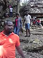
 A kapok tree surrendered by a mountain of rocks. It serves as a shrine.jpg 2,944 × 2,944; 4.16 MB
-
 Atwea Cliff.jpg 1,200 × 800; 86 KB
-
 Bongo, Upper East Region, Ghana.JPG 3,648 × 2,736; 4.02 MB
-
 Boti falls, Ghana.jpg 2,736 × 3,648; 2.39 MB
-
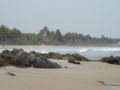
 Busua Beach Western Region.jpg 1,024 × 768; 320 KB
-
 Closer look at rock formation on the Odweanoma mountain.jpg 5,312 × 2,992; 3.52 MB
-
 Donkey skulls at Tengzug Shrine in.JPG 2,560 × 1,920; 1.57 MB
-
 Friends expedition.jpg 1,200 × 1,600; 926 KB
-
 Ghana Anamaboo006.JPG 1,600 × 1,200; 402 KB
-
 Inside the Tano Rock Shrine, in Tanoboase, Ghana.jpg 960 × 720; 100 KB
-
 Komenda Beach.jpg 799 × 600; 78 KB
-
 Kwahu cliff.JPG 3,968 × 2,976; 3.22 MB
-
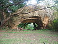 Monastery Land Bridge, Brong Ahafo (2).JPG 4,032 × 3,024; 2.6 MB
-
 Monastery Land Bridge, Brong Ahafo.JPG 4,032 × 3,024; 2.63 MB
-
 Monastery Rock Formation, Brong Ahafo.JPG 4,032 × 3,024; 2.7 MB
-
 Monastery, Brong Ahafo.JPG 4,032 × 3,024; 2.65 MB
-
 Nakpanduri cliffs1.jpg 2,592 × 1,944; 685 KB
-
 Nankanni-Gebiet B003.jpg 2,584 × 1,219; 576 KB
-
 Rocks in the Tongo Hills, Gorogo, Upper East Region, Ghana.JPG 2,560 × 1,920; 2.47 MB
-
 Rocks in the Tongo Hills, Upper East Region, Ghana, 2011.JPG 2,560 × 1,920; 2.33 MB
-
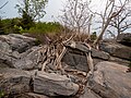
 Rocks on the Eastern corridor road on Gushagu road.jpg 6,016 × 4,016; 1.06 MB
-
 Shai Hills, Shai-Osudoku (P1100078).jpg 4,608 × 3,456; 11.6 MB
-
 Tano Rock Shrine in Tanoboase, Ghana.jpg 960 × 720; 154 KB
-
 Tano Sacred Rock - rock climbing.jpg 960 × 720; 132 KB
-
 The Kwahu Mountains.jpg 2,048 × 1,536; 849 KB
-
 The National Archives UK - CO 1069-30-44 2 001.jpg 955 × 539; 93 KB
-
 The National Archives UK - CO 1069-34-6-2-001.jpg 851 × 713; 195 KB
-

-

-

-

-

-

-
-
 Tongo-Hills-First-Community-School.jpg 4,000 × 1,800; 2.2 MB
-
 Umbrella Rock at Boti Falls 2.jpg 6,000 × 4,000; 5.97 MB
-
 Waterfall Ghana 2013.jpg 5,184 × 3,456; 9.68 MB


.JPG)


.jpg)


