Category:Rock Ferry
Jump to navigation
Jump to search
area of Birkenhead on the Wirral Peninsula, England  | |||||
| Upload media | |||||
| Instance of | |||||
|---|---|---|---|---|---|
| Location | Birkenhead, Wirral, Merseyside, North West England, England | ||||
 | |||||
Subcategories
This category has the following 30 subcategories, out of 30 total.
!
- Quality images of Rock Ferry (3 F)
- Valued images of Rock Ferry (8 F)
1
B
D
- Dacre Hill Post Office (2 F)
E
- Egerton Park, Rock Ferry (9 F)
- Eureka Villas, Rock Ferry (3 F)
H
K
- Kirklands Stadium (3 F)
- Knowsley Court, Rock Ferry (5 F)
L
- Laird's Sports Club (3 F)
R
- Rock Ferry bus depot (10 F)
- Rock Ferry by-pass (4 F)
- Rock Ferry High School (16 F)
- Rock Ferry Post Office (3 F)
- Rock Lane West bridge (6 F)
- Rock Park Estate (29 F)
S
T
V
- Viking Centre, Rock Ferry (5 F)
W
Media in category "Rock Ferry"
The following 101 files are in this category, out of 101 total.
-
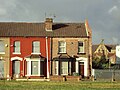
 29 Albany Road, Rock Ferry.jpg 4,812 × 3,383; 19.12 MB
-
 30087 Rock Ferry - Flickr - megabus13601.jpg 2,048 × 1,536; 771 KB
-
 4 Courtney Road, Rock Ferry - geograph.org.uk - 93809.jpg 640 × 480; 91 KB
-
 A41 passes over The Dell, Rock Ferry.jpg 4,608 × 3,456; 4.58 MB
-

-
 Billy Bunter's snack bar, Rock Ferry Industrial Estate.JPG 4,608 × 3,456; 3.49 MB
-
 Boat wreck and barge by Rock Ferry Pier - geograph.org.uk - 463834.jpg 632 × 422; 148 KB
-
 Boats, Rock Park Foreshore - geograph.org.uk - 1406863.jpg 640 × 480; 68 KB
-
 Bungalows on Rock Lane West, Rock Ferry.JPG 4,320 × 3,240; 3.09 MB
-
 Carfax, Rock Ferry.JPG 4,608 × 3,456; 3.43 MB
-
 Chatham Road, Rock Ferry.JPG 3,648 × 2,736; 3.49 MB
-
 Crane, Rock Ferry Pier - geograph.org.uk - 1406876.jpg 480 × 640; 59 KB
-
 Demolished streets, Rock Ferry (1).JPG 4,608 × 3,456; 3.41 MB
-
 Demolished streets, Rock Ferry (2).JPG 4,608 × 3,456; 3.44 MB
-
 Demolished streets, Rock Ferry (3).JPG 4,608 × 3,456; 3.61 MB
-
-
 Family Circle Luncheon Club building, Highfield Road, Rock Ferry.JPG 4,320 × 3,240; 2.93 MB
-
 Gold-sprayed sculpture, Rock Ferry 1.JPG 3,648 × 2,736; 3.64 MB
-
 Gold-sprayed sculpture, Rock Ferry 2.JPG 3,648 × 2,736; 3.58 MB
-
 Gold-sprayed sculpture, Rock Ferry 3.JPG 3,648 × 2,736; 3.58 MB
-
 Gothic Street, Rock Ferry (1).JPG 4,320 × 3,240; 3.18 MB
-
 Gothic Street, Rock Ferry (2).JPG 4,320 × 3,240; 2.67 MB
-
 Great Eastern SLV AllanGreen.jpg 935 × 613; 98 KB
-
 Greenbank House, Rock Ferry.JPG 4,320 × 3,240; 4.05 MB
-
 House under construction, St Peter's Road, Rock Ferry.JPG 4,608 × 3,456; 3.59 MB
-
 Involve Community Hall, Rock Ferry.jpg 5,123 × 3,348; 21.72 MB
-
 Ionic Street, Rock Ferry (1).JPG 4,608 × 3,456; 3.39 MB
-
 Ionic Street, Rock Ferry.JPG 4,320 × 3,240; 2.97 MB
-
 James Callaghan stone, Rock Ferry Industrial Estate (2).JPG 4,608 × 3,456; 3.5 MB
-
 James Callaghan stone, Rock Ferry Industrial Estate (3).JPG 4,608 × 3,456; 3.62 MB
-
 Lairdside Community Trust and Sign & Poster services, Rock Ferry (1).JPG 4,320 × 3,240; 3.65 MB
-
 Lairdside Community Trust, Rock Ferry (2).JPG 4,320 × 3,240; 3.56 MB
-
 Lees Avenue, Rock Ferry (1).JPG 4,320 × 3,240; 3.42 MB
-
 Lees Avenue, Rock Ferry (2).JPG 4,320 × 3,240; 3.24 MB
-
 LIDL Supermarket, St Paul's Road, Rock Ferry.JPG 4,320 × 3,240; 2.82 MB
-
 Local Amenities, Old Chester Road, Rock Ferry.JPG 4,320 × 3,240; 3.56 MB
-
 Morrisons Daily, Rock Ferry.jpg 4,474 × 2,869; 12.72 MB
-
 New apartments near Rock Ferry station.JPG 4,320 × 3,240; 3.52 MB
-
 Outlook House, Rock Ferry.jpg 3,940 × 2,923; 6.68 MB
-
 Public footpath near Rock Ferry High School, Birkenhead (1).JPG 4,608 × 3,456; 3.45 MB
-
 Public footpath near Rock Ferry High School, Birkenhead (2).JPG 4,608 × 3,456; 3.42 MB
-
 Riverside Surgery, Rock Ferry.JPG 4,608 × 3,456; 3.64 MB
-
 Rock Ferry - DSC02979.JPG 3,648 × 2,736; 3.63 MB
-
 Rock Ferry - DSC02980.JPG 3,648 × 2,736; 3.55 MB
-
 Rock Ferry - DSC02983.JPG 3,648 × 2,736; 3.67 MB
-
 Rock Ferry - DSC02984.JPG 3,648 × 2,736; 3.54 MB
-
 Rock Ferry - DSC02985.JPG 3,648 × 2,736; 3.6 MB
-
 Rock Ferry - DSC03117.JPG 3,648 × 2,736; 3.52 MB
-
 Rock Ferry - DSC03118.JPG 3,648 × 2,736; 3.53 MB
-
 Rock Ferry - DSC03125.JPG 3,648 × 2,736; 3.64 MB
-
 Rock Ferry - DSC03126.JPG 3,648 × 2,736; 3.62 MB
-
 Rock Ferry - DSC03127.JPG 3,648 × 2,736; 3.53 MB
-
 Rock Ferry - DSC03129.JPG 3,648 × 2,736; 3.49 MB
-
 Rock Ferry - DSC03130.JPG 3,648 × 2,736; 3.6 MB
-
 Rock Ferry - DSC03131.JPG 3,648 × 2,736; 3.53 MB
-
 Rock Ferry - DSC03133.JPG 3,648 × 2,736; 3.58 MB
-
 Rock Ferry - DSC03134.JPG 3,648 × 2,736; 3.57 MB
-
 Rock Ferry - DSC03135.JPG 3,648 × 2,736; 3.59 MB
-
 Rock Ferry - DSC03136.JPG 3,648 × 2,736; 3.54 MB
-
 Rock Ferry - DSC03137.JPG 3,648 × 2,736; 3.56 MB
-
 Rock Ferry - DSC03139.JPG 3,648 × 2,736; 3.55 MB
-
 Rock Ferry Esplanade.jpg 3,456 × 4,608; 4.53 MB
-
 Rock Ferry Library & Community Hall.JPG 3,648 × 2,736; 3.56 MB
-

-
 Rock Ferry Primary School (1).JPG 4,320 × 3,240; 3.09 MB
-
 Rock Ferry slipway (side view).jpg 5,152 × 3,864; 7.85 MB
-
 Rock Ferry slipway (top view).jpg 3,864 × 5,152; 7.95 MB
-
 Rock Lane West, Rock Ferry (1).JPG 4,320 × 3,240; 3.67 MB
-
 Royal Mersey Yacht Club, Rock Ferry.jpg 5,152 × 3,864; 7.87 MB
-
 Rusty Boat, Rock Park Foreshore - geograph.org.uk - 1406868.jpg 640 × 480; 75 KB
-
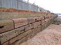
 Sea wall to Esplanade, Rock Ferry (1).jpg 5,152 × 3,864; 7.94 MB
-
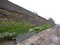 Sea wall to Esplanade, Rock Ferry (2).jpg 5,152 × 3,864; 7.93 MB
-
 Sewer vent on Bedford Drive, Rock Ferry.jpg 3,120 × 5,190; 19.53 MB
-
 Sewer vent on Cavendish Drive, Rock Ferry.jpg 3,412 × 5,171; 23.9 MB
-
 Shakespeare Avenue, Rock Ferry (1).JPG 4,320 × 3,240; 2.76 MB
-
 Shakespeare Avenue, Rock Ferry (2).JPG 4,320 × 3,240; 2.83 MB
-
 Shops at Rock Ferry (1).JPG 4,320 × 3,240; 3.96 MB
-
 Shops on Old Chester Road, Rock Ferry.JPG 4,320 × 3,240; 3.86 MB
-
 Shops, Bedford Road, Rock Ferry 1.JPG 3,648 × 2,736; 3.59 MB
-
 Shops, Bedford Road, Rock Ferry 2.JPG 3,648 × 2,736; 3.54 MB
-
 Shops, Bedford Road, Rock Ferry 3.JPG 3,648 × 2,736; 3.56 MB
-
 Shops, Bedford Road, Rock Ferry 4.JPG 3,648 × 2,736; 3.54 MB
-
 Shops, Grove Road, Rock Ferry.JPG 3,648 × 2,736; 3.58 MB
-
 Sign & Poster services, Rock Ferry (3).JPG 4,320 × 3,240; 3.16 MB
-
 Sign, The Rock Ferry Centre.JPG 3,648 × 2,736; 3.51 MB
-
 Small beach near Bedford Road East, Rock Ferry (1).JPG 4,608 × 3,456; 3.45 MB
-
 Small beach near Bedford Road East, Rock Ferry (2).JPG 4,608 × 3,456; 3.45 MB
-
 Summer Fields Care Home, Rock Ferry.JPG 4,320 × 3,240; 3.4 MB
-

-
 Thorsway, Rock Ferry (1).JPG 3,240 × 4,320; 5.12 MB
-
 Thorsway, Rock Ferry (2).JPG 3,240 × 4,320; 4.25 MB
-
 Tranmere Sailing Club (1).JPG 4,608 × 3,456; 3.54 MB
-
 Tranmere Sailing Club (2).JPG 4,608 × 3,456; 3.57 MB
-
 Tranmere Sailing Club (3).JPG 4,608 × 3,456; 3.39 MB
-
 Upturned boat, Rock Ferry foreshore.jpg 5,152 × 3,864; 7.8 MB
-
 Victoria Park Health Centre sign.JPG 3,648 × 2,736; 3.62 MB
-
 Victoria Park Health Centre.JPG 3,648 × 2,736; 3.61 MB
-
 Whites Pet Shop - geograph.org.uk - 359858.jpg 640 × 480; 79 KB
-
 Wirral Tool Hire, Rock Ferry branch.JPG 4,608 × 3,456; 3.48 MB
-
 Wong Wong, Rock Ferry.JPG 3,240 × 4,320; 3.63 MB
-
 Wycliffe Street, Rock Ferry.JPG 4,320 × 3,240; 3.41 MB


.JPG)
.JPG)
.JPG)


.JPG)
.JPG)


.JPG)

.JPG)
.JPG)
.JPG)
.JPG)
.JPG)
.JPG)


.JPG)
.JPG)


.JPG)
.jpg)
.jpg)
.JPG)


.jpg)
.jpg)


.JPG)
.JPG)
.JPG)


.JPG)

.JPG)
.JPG)


.JPG)
.JPG)
.JPG)
.JPG)
.JPG)


