Category:Rocester
Jump to navigation
Jump to search
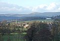
English: Rocester ( is a village and civil parish in the East Staffordshire district of Staffordshire, England. Its name is spelt Rowcestre in the Domesday Book.
village in Staffordshire, England, UK   | |||||
| Upload media | |||||
| Instance of | |||||
|---|---|---|---|---|---|
| Location | East Staffordshire, Staffordshire, West Midlands, England | ||||
| Population |
| ||||
 | |||||
Subcategories
This category has the following 4 subcategories, out of 4 total.
Media in category "Rocester"
The following 137 files are in this category, out of 137 total.
-
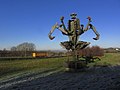
 'Bird Group by Peter Haigue - geograph.org.uk - 6649749.jpg 640 × 360; 43 KB
-
 'Bird Group' by Peter Haigue, JCB World HQ, Rocester - geograph.org.uk - 5171117.jpg 4,193 × 2,808; 1.45 MB
-
 'Digger-man' statue and JCB Works, Rocester 1988 - geograph.org.uk - 4282444.jpg 2,346 × 1,398; 3.36 MB
-
-
 A good seat for helicopter spotting - geograph.org.uk - 6649741.jpg 640 × 480; 84 KB
-
 Abbey Fields and St Michael's Church in Rocester - geograph.org.uk - 3642959.jpg 4,000 × 3,000; 2.1 MB
-
 Ashbourne Road, Rocester - geograph.org.uk - 3753509.jpg 1,496 × 1,122; 605 KB
-

-
 Bird Group , JCB Headquarters - geograph.org.uk - 5479340.jpg 3,498 × 2,626; 1.98 MB
-
 Black Headed Gull, Rocester - geograph.org.uk - 5171120.jpg 2,973 × 2,973; 695 KB
-
 Black Swan on the River Churnet - geograph.org.uk - 397030.jpg 577 × 640; 141 KB
-
 Black Swan, Rocester - geograph.org.uk - 1928507.jpg 1,965 × 1,677; 901 KB
-
 Car park at JCB Visitor Centre - geograph.org.uk - 4421010.jpg 2,000 × 1,500; 1.25 MB
-
 Central pillar in the shelter, Rocester - geograph.org.uk - 1928532.jpg 1,500 × 2,000; 695 KB
-
 Church Lane, Rocester - geograph.org.uk - 5556024.jpg 1,600 × 1,200; 611 KB
-

-
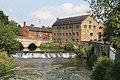 Churnet Bridge and Mill, Rocester.jpg 640 × 427; 98 KB
-
 Churnet Row, High Street, Rocester - geograph.org.uk - 6690709.jpg 2,000 × 1,349; 911 KB
-
 Combridge - geograph.org.uk - 354478.jpg 640 × 427; 113 KB
-
 Combridge Farm at Combridge - geograph.org.uk - 2914145.jpg 640 × 425; 79 KB
-
 Cross in Rocester churchyard (geograph 5558333).jpg 1,200 × 1,600; 712 KB
-
 Digger-man - geograph.org.uk - 397018.jpg 463 × 640; 109 KB
-
 Dining Hall, JCB Visitor Centre - geograph.org.uk - 4421034.jpg 2,000 × 1,500; 1.19 MB
-
 Drive on the left in 10 languages - geograph.org.uk - 6646764.jpg 640 × 480; 78 KB
-
 Farmland north of Hollington Road - geograph.org.uk - 4071360.jpg 640 × 480; 83 KB
-
 Field edge path - geograph.org.uk - 3923074.jpg 3,872 × 2,592; 6.79 MB
-
 Ford at JCB Rocester - geograph.org.uk - 4992117.jpg 3,000 × 2,000; 5.62 MB
-

-
 Ford over lake near JCB factory - geograph.org.uk - 4071380.jpg 640 × 480; 93 KB
-
 Former bridge piers in the River Dove - geograph.org.uk - 5263219.jpg 1,280 × 960; 521 KB
-
 Former Queens Arms Hotel, Rocester.jpg 2,000 × 1,466; 514 KB
-
 Helicopter take-off at JCB World Headquarters - geograph.org.uk - 5171110.jpg 3,000 × 2,445; 417 KB
-
 High Street, Rocester - geograph.org.uk - 5557091.jpg 1,600 × 1,200; 484 KB
-
 Hollington Road - geograph.org.uk - 4071356.jpg 640 × 480; 93 KB
-
 Hollington Road - geograph.org.uk - 4071361.jpg 640 × 480; 65 KB
-
 House of Hollington Road - geograph.org.uk - 4071350.jpg 640 × 480; 87 KB
-
 JCB Academy - geograph.org.uk - 4604548.jpg 640 × 427; 76 KB
-
 JCB Academy - geograph.org.uk - 6648399.jpg 2,736 × 3,648; 2.65 MB
-
 JCB Academy, Technical College - geograph.org.uk - 6648405.jpg 3,501 × 1,673; 1.09 MB
-
 JCB birds - geograph.org.uk - 6648447.jpg 3,165 × 1,674; 1.75 MB
-
 JCB Dieselmax speed record car - geograph.org.uk - 4421063.jpg 2,000 × 1,500; 1.07 MB
-
 JCB factory from a distance, 1970 - geograph.org.uk - 2580869.jpg 1,705 × 1,248; 919 KB
-
 JCB Lake at Rocester - geograph.org.uk - 458833.jpg 640 × 480; 56 KB
-
 JCB machinery loading yard - geograph.org.uk - 6646758.jpg 640 × 255; 36 KB
-
 JCB machinery loading yard - geograph.org.uk - 6646760.jpg 640 × 360; 56 KB
-
 JCB Visitor Centre - geograph.org.uk - 4421051.jpg 2,000 × 1,463; 1.34 MB
-
 JCB World Headquarters - geograph.org.uk - 4159816.jpg 1,600 × 1,200; 462 KB
-
 JCB World Headquarters - geograph.org.uk - 5479336.jpg 3,671 × 2,755; 3.23 MB
-
 JCB World Headquarters, Springfield House - geograph.org.uk - 4340249.jpg 2,592 × 1,944; 788 KB
-
 JCBs at work - geograph.org.uk - 6648350.jpg 3,220 × 1,732; 1.44 MB
-
 JCBs waiting to depart - geograph.org.uk - 6648440.jpg 4,643 × 2,287; 1.43 MB
-
 Lake by JCB World Headquarters - geograph.org.uk - 3927486.jpg 3,872 × 2,592; 4.63 MB
-
 Lake near JCB factory - geograph.org.uk - 4071364.jpg 478 × 640; 95 KB
-
 Lake near JCB factory - geograph.org.uk - 4071374.jpg 640 × 480; 97 KB
-
 Lodge next to JCB Lake at Rocester - geograph.org.uk - 458836.jpg 640 × 480; 59 KB
-
 Mallard Duck on JCB lakes - geograph.org.uk - 397021.jpg 557 × 640; 143 KB
-
 Microhydropower plant - JCB Academy - geograph.org.uk - 4604497.jpg 427 × 640; 89 KB
-
 Milepost at SK 10743992.jpg 868 × 1,318; 168 KB
-
 Mill Street - geograph.org.uk - 4072258.jpg 640 × 480; 82 KB
-

-
 New allotments - geograph.org.uk - 3335512.jpg 1,200 × 900; 174 KB
-
 New crop near Rocester - geograph.org.uk - 3927471.jpg 3,741 × 2,494; 3.85 MB
-
 Off for lunch^ Rocester - geograph.org.uk - 1928456.jpg 2,000 × 1,411; 507 KB
-

-
 One of the lakes at the JCB factory - geograph.org.uk - 2439984.jpg 800 × 600; 253 KB
-
 Opus Statue, JCB Headquarters - geograph.org.uk - 5479353.jpg 4,032 × 3,024; 4.73 MB
-
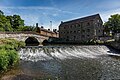 Podmore's flour Mill ^ weir, Rocester - geograph.org.uk - 6487122.jpg 2,000 × 1,333; 2.72 MB
-
 Police Station, Rocester - geograph.org.uk - 4071391.jpg 640 × 480; 61 KB
-
 Primitive Methodist Chapel, Rocester - geograph.org.uk - 1928515.jpg 2,000 × 1,455; 659 KB
-
 Red Lion, Rocester - geograph.org.uk - 6648428.jpg 3,648 × 1,744; 1.42 MB
-
 River Churnett by JCB - geograph.org.uk - 397010.jpg 480 × 640; 127 KB
-
 River Dove below Rocester - geograph.org.uk - 6648422.jpg 3,648 × 1,744; 2.23 MB
-
 River Dove Near Rocester Bridge - geograph.org.uk - 3764760.jpg 1,496 × 1,122; 838 KB
-
 River Dove, Rocester - geograph.org.uk - 4072259.jpg 640 × 480; 70 KB
-
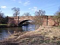 Rocester Bridge (geograph 3335534).jpg 1,200 × 900; 266 KB
-
-
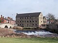 Rocester Corn Mill - geograph.org.uk - 1737357.jpg 1,200 × 900; 180 KB
-
 Rocester Football Club - geograph.org.uk - 4071403.jpg 640 × 480; 45 KB
-
 Rocester High Street and the Red Lion - geograph.org.uk - 5557068.jpg 1,600 × 1,200; 528 KB
-
 Rocester Village Hall - geograph.org.uk - 1492690.jpg 640 × 480; 62 KB
-
 Rocester, The Red Lion - geograph.org.uk - 3172052.jpg 1,024 × 765; 114 KB
-
 Sheep on Abbey Fields, Rocester - geograph.org.uk - 3927541.jpg 3,872 × 2,592; 1.25 MB
-
 Shelter in Rocester village centre - geograph.org.uk - 6646750.jpg 640 × 480; 68 KB
-
 So many paths - geograph.org.uk - 6648341.jpg 3,648 × 1,744; 2.12 MB
-
 St Michael's Church, Rocester - geograph.org.uk - 6486901.jpg 2,000 × 1,333; 3.05 MB
-
 Startled Horse, JCB World Headquarters - geograph.org.uk - 5479334.jpg 3,024 × 4,032; 4.64 MB
-
 Stile on the Limestone Way - geograph.org.uk - 5263215.jpg 1,280 × 960; 545 KB
-
 Subway beneath the B5030 near Rocester - geograph.org.uk - 5171123.jpg 5,472 × 3,648; 2.04 MB
-
 Sumo Statue, JCB Headquarters - geograph.org.uk - 5479345.jpg 4,032 × 3,024; 3.19 MB
-
 The centre of Rocester - geograph.org.uk - 1928539.jpg 2,000 × 1,311; 497 KB
-
 The centre of Rocester - geograph.org.uk - 3927496.jpg 3,872 × 2,592; 3.27 MB
-
 The Church of St Michael - geograph.org.uk - 6646312.jpg 640 × 480; 49 KB
-
 The Dove First School and Chalice House - geograph.org.uk - 6648387.jpg 3,648 × 1,744; 1.85 MB
-
 The entrance to the Visitor Centre at JCB - geograph.org.uk - 4421021.jpg 2,000 × 1,500; 1.43 MB
-
 The Fosser by Walenty Pytel, Rocester - geograph.org.uk - 5171126.jpg 2,792 × 3,497; 1.27 MB
-
 The Fossor by Walenty Pytel - geograph.org.uk - 6649744.jpg 640 × 480; 75 KB
-
 The Fossor, Rocester - geograph.org.uk - 6487073.jpg 2,000 × 1,333; 2.1 MB
-
 The JCB Academy - geograph.org.uk - 3753520.jpg 1,496 × 1,122; 654 KB
-
 The JCB Academy - geograph.org.uk - 6646297.jpg 640 × 480; 87 KB
-
 The JCB Academy, Rocester - geograph.org.uk - 4071395.jpg 640 × 480; 62 KB
-
 The JCB Academy, Technical College - geograph.org.uk - 6648413.jpg 3,522 × 2,393; 1.93 MB
-
 The JCB VIP Visitor Centre - geograph.org.uk - 6646754.jpg 640 × 480; 55 KB
-
 The Limestone Way near Dalesgap - geograph.org.uk - 3923010.jpg 3,872 × 2,592; 5.18 MB
-
 The Limestone Way near Rocester - geograph.org.uk - 3664447.jpg 3,996 × 2,994; 1.67 MB
-
 The Limestone Way near Rocester - geograph.org.uk - 3664456.jpg 4,000 × 3,000; 2.33 MB
-
 The Manor House, Rocester - geograph.org.uk - 1928556.jpg 2,000 × 1,439; 610 KB
-
 The Red Lion Inn and Restaurant - geograph.org.uk - 1492694.jpg 640 × 480; 65 KB
-
 The Red Lion, Rocester - geograph.org.uk - 1928562.jpg 2,000 × 1,500; 553 KB
-
 The Red Lion, Rocester - geograph.org.uk - 4071386.jpg 640 × 480; 60 KB
-

-
 The River Churnet, Rocester - geograph.org.uk - 1928482.jpg 2,000 × 1,500; 893 KB
-
 The River Dove below Rocester Bridge - geograph.org.uk - 3927567.jpg 3,872 × 2,592; 2.48 MB
-
 The Tutbury Mill - geograph.org.uk - 6646303.jpg 640 × 480; 73 KB
-
 The World Headquarters of JCB - geograph.org.uk - 6645945.jpg 640 × 360; 47 KB
-
 Tree-lined road near Denstone - geograph.org.uk - 6649750.jpg 640 × 480; 134 KB
-
 Trees in a hedgerow - geograph.org.uk - 6645944.jpg 640 × 480; 80 KB
-
 Tutbury Mill (Now JCB academy), Rocester - geograph.org.uk - 6487151.jpg 2,000 × 1,333; 2.42 MB
-
 Tutbury Mill, Rocester - geograph.org.uk - 2730260.jpg 640 × 427; 64 KB
-
 Tutbury Mill, Rocester - geograph.org.uk - 3927559.jpg 3,872 × 2,592; 1.25 MB
-
 Tutbury Mill, Rocester - geograph.org.uk - 4071401.jpg 640 × 480; 67 KB
-
 Tutbury Mill, Rocester - geograph.org.uk - 4604483.jpg 427 × 640; 102 KB
-
 Tutbury Mill, Rocester - geograph.org.uk - 4604570.jpg 640 × 427; 77 KB
-
 Tutbury Mill, Rocester - JCB Academy - geograph.org.uk - 4604477.jpg 640 × 427; 96 KB
-

-
 Underpass crossing the Rocester bypass - geograph.org.uk - 1928491.jpg 2,000 × 1,447; 777 KB
-
 View From Rocester Bridge - geograph.org.uk - 3764752.jpg 1,475 × 1,075; 340 KB
-

-

-
 A glimpse of Eaton Dovedale - geograph.org.uk - 231404.jpg 640 × 480; 94 KB
-
 Braided stream on the River Dove - geograph.org.uk - 231408.jpg 640 × 480; 96 KB
-
 Diggers at sunset - geograph.org.uk - 397042.jpg 640 × 321; 95 KB
-
 Ford near Combridge - geograph.org.uk - 354489.jpg 640 × 427; 133 KB
-

-
 Marston Bank Farm - geograph.org.uk - 200472.jpg 640 × 480; 79 KB
-
 Opus - JCB lakes - geograph.org.uk - 400017.jpg 480 × 640; 123 KB
-
 River Churnett at Rocester - geograph.org.uk - 88652.jpg 480 × 640; 125 KB
-
 River Dove - geograph.org.uk - 231416.jpg 640 × 480; 94 KB


.jpg)


.jpg)


,_Rocester_-_geograph.org.uk_-_6487151.jpg)


