Category:Roadworks in the East Riding of Yorkshire
Jump to navigation
Jump to search
Subcategories
This category has only the following subcategory.
R
Media in category "Roadworks in the East Riding of Yorkshire"
The following 61 files are in this category, out of 61 total.
-
 A1079 High Point - geograph.org.uk - 825126.jpg 640 × 378; 140 KB
-
 Access Road - geograph.org.uk - 193249.jpg 640 × 480; 65 KB
-
 Bursting at the Seams - geograph.org.uk - 1746000.jpg 3,648 × 2,736; 2.21 MB
-
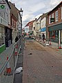 Butcher Row, Beverley - geograph.org.uk - 856609.jpg 480 × 640; 325 KB
-
 Clifton Hotel, Goole - geograph.org.uk - 1776922.jpg 640 × 490; 203 KB
-
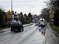
 Cycle path beside Hull Road (A1174) (geograph 4349918).jpg 640 × 480; 66 KB
-
 Eastgate, Beverley - geograph.org.uk - 793231.jpg 640 × 594; 104 KB
-

-
 Kingston Road (B1232) - geograph.org.uk - 1774369.jpg 640 × 480; 75 KB
-
 Long Lane towards Beverley (geograph 4400009).jpg 1,600 × 1,062; 812 KB
-
 M62 Sep23 Ouse Bridge Works 01.jpg 4,176 × 2,784; 3.5 MB
-
 M62 Sep23 Ouse Bridge Works 02.jpg 4,176 × 2,784; 3.45 MB
-
 M62 Sep23 Ouse Bridge Works 03.jpg 4,176 × 2,784; 3.49 MB
-
 M62 Sep23 Ouse Bridge Works 04.jpg 4,176 × 2,784; 3.54 MB
-
 M62 Sep23 Ouse Bridge Works 05.jpg 4,176 × 2,784; 3.46 MB
-
 M62 Sep23 Ouse Bridge Works 06.jpg 4,176 × 2,784; 3.6 MB
-
 M62 Sep23 Ouse Bridge Works 07.jpg 4,176 × 2,784; 3.52 MB
-
 M62 Sep23 Ouse Bridge Works 08.jpg 4,176 × 2,784; 3.49 MB
-
 M62 Sep23 Ouse Bridge Works 09.jpg 4,176 × 2,784; 3.45 MB
-
 M62 Sep23 Ouse Bridge Works 10.jpg 4,176 × 2,784; 3.47 MB
-
 M62 Sep23 Ouse Bridge Works 11.jpg 4,176 × 2,784; 3.43 MB
-
 McDonald's, Willerby (geograph 2931097).jpg 1,024 × 768; 149 KB
-
 New Beverley bypass on Long Lane (geograph 4400016).jpg 1,600 × 1,062; 634 KB
-
 New Bypass for Beverley (geograph 4075307).jpg 1,600 × 1,064; 557 KB
-
 New Street Lights for Sheriff Highway (geograph 5379492).jpg 3,197 × 4,061; 1.71 MB
-
 Newbald or Cherry Burton^ - geograph.org.uk - 825102.jpg 640 × 274; 107 KB
-
 Northfield, Keyingham - geograph.org.uk - 215912.jpg 640 × 480; 108 KB
-
 Northfield, Keyingham - geograph.org.uk - 215931.jpg 640 × 456; 111 KB
-
 Obstacle Course, Swanland - geograph.org.uk - 1568024.jpg 640 × 480; 333 KB
-
 Old Cottages, West End, Swanland - geograph.org.uk - 1568513.jpg 640 × 567; 351 KB
-
 Once a main road now a cul-de-sac (geograph 3988513).jpg 4,608 × 3,456; 4.54 MB
-
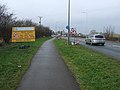
 Road to Melbourne - geograph.org.uk - 180074.jpg 640 × 480; 91 KB
-
 Roadworks on Hull Road (A1174) (geograph 4349922).jpg 640 × 480; 57 KB
-
 Roadworks on Hull Road (A1174) (geograph 4349923).jpg 640 × 480; 48 KB
-
 Roadworks on Main Street, Willerby (geograph 4479289).jpg 2,448 × 1,624; 1.76 MB
-
 Sculcoates Bridge, Kingston upon Hull Oct23 01.jpg 4,176 × 2,784; 3.47 MB
-
 Sculcoates Bridge, Kingston upon Hull Oct23 02.jpg 4,176 × 2,784; 3.42 MB
-
 Sculcoates Bridge, Kingston upon Hull Oct23 03.jpg 4,176 × 2,784; 3.46 MB
-
 Sculcoates Bridge, Kingston upon Hull Oct23 04.jpg 4,176 × 2,784; 3.57 MB
-
 Sculcoates Bridge, Kingston upon Hull Oct23 05.jpg 4,176 × 2,784; 4.2 MB
-
 Sculcoates Bridge, Kingston upon Hull Oct23 06.jpg 4,176 × 2,784; 3.48 MB
-
 Sculcoates Bridge, Kingston upon Hull Oct23 07.jpg 4,176 × 2,784; 3.43 MB
-
 Sculcoates Bridge, Kingston upon Hull Oct23 08.jpg 4,176 × 2,784; 4.23 MB
-
 Sculcoates Bridge, Kingston upon Hull Oct23 09.jpg 4,176 × 2,784; 4.15 MB
-
 Sculcoates Bridge, Kingston upon Hull Oct23 10.jpg 4,176 × 2,784; 3.44 MB
-
 Sea Field, Mappleton - geograph.org.uk - 456516.jpg 640 × 451; 105 KB
-
 Skidby, A164 roadworks IMG 1882 - panoramio.jpg 1,200 × 800; 292 KB
-
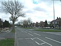
 Springfield Avenue, Brough - geograph.org.uk - 900137.jpg 640 × 458; 95 KB
-
 Stepney Grove, Bridlington - geograph.org.uk - 1709638.jpg 800 × 600; 91 KB
-
 Street Scene, Market Weighton - geograph.org.uk - 590076.jpg 640 × 480; 112 KB
-
 Street Scene, South Cave - geograph.org.uk - 590052.jpg 640 × 480; 83 KB
-
 Swanland - geograph.org.uk - 1570793.jpg 640 × 511; 303 KB
-

-
 The A63 near North Ferriby - geograph.org.uk - 306089.jpg 640 × 480; 95 KB
-
 The Fat Badger public house, Bridlington (geograph 5064393).jpg 640 × 480; 67 KB
-
 The North Ferriby to Hessle road. - geograph.org.uk - 63112.jpg 640 × 480; 123 KB
-
 The Post Office, West End, Swanland - geograph.org.uk - 1568044.jpg 640 × 480; 279 KB
-
 The road to Weeton - geograph.org.uk - 322558.jpg 640 × 371; 77 KB
-
 The Star Inn on Main Street, Willerby (geograph 4479279).jpg 2,448 × 1,624; 1.12 MB
-

-
 Water Company Repairs - geograph.org.uk - 183343.jpg 640 × 480; 98 KB


_(geograph_4349918).jpg)


_-_geograph.org.uk_-_1774369.jpg)
.jpg)


.jpg)
.jpg)
.jpg)
.jpg)


.jpg)

_(geograph_4349922).jpg)
_(geograph_4349923).jpg)
.jpg)


.jpg)


.jpg)
_(24780094514).jpg)
