Category:Roads in the Northern Territory
Jump to navigation
Jump to search
States of Australia: New South Wales · Queensland · South Australia · Tasmania · Victoria · Western Australia
Internal territories of Australia: Australian Capital Territory · Northern Territory
External territories of Australia:
Internal territories of Australia: Australian Capital Territory · Northern Territory
External territories of Australia:
Wikimedia category | |||||
| Upload media | |||||
| Instance of | |||||
|---|---|---|---|---|---|
| Category combines topics | |||||
| Northern Territory | |||||
federal territory of Australia | |||||
| Instance of | |||||
| Part of | |||||
| Named after | |||||
| Location | AUS | ||||
| Located in or next to body of water | |||||
| Capital | |||||
| Legislative body | |||||
| Highest judicial authority |
| ||||
| Head of state |
| ||||
| Head of government |
| ||||
| Inception |
| ||||
| Population |
| ||||
| Area |
| ||||
| Elevation above sea level |
| ||||
| Replaces |
| ||||
| Replaced by |
| ||||
| official website | |||||
 | |||||
Subcategories
This category has the following 6 subcategories, out of 6 total.
Media in category "Roads in the Northern Territory"
The following 22 files are in this category, out of 22 total.
-
Buntime Highway.png 452 × 599; 140 KB
-
Carpentaria Highway 0316.svg 721 × 463; 111 KB
-
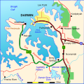
Cox Peninsula Road 0216.svg 478 × 478; 94 KB
-
Daly River Road 0316.svg 489 × 340; 83 KB
-
Donohue Highway 0216.svg 737 × 457; 247 KB
-
Driving in NT.JPG 768 × 1,024; 82 KB
-
En route to Uluru (13113362364).jpg 5,616 × 3,744; 17.57 MB
-
Gunn Point Road - Howard Springs.jpg 997 × 1,500; 349 KB
-
Kata Tjuta Rd.jpg 4,032 × 3,024; 2.89 MB
-
Larapinta Drive 0417.svg 1,150 × 843; 179 KB
-
Larapinta Drive 200117-01.jpg 341 × 256; 28 KB
-
Larapinta Drive 200117-02.jpg 341 × 256; 28 KB
-
Mac Donnell road.JPG 768 × 1,024; 184 KB
-
Mt-ebenezer.jpg 363 × 190; 13 KB
-
Northern Territory 0216.svg 666 × 1,061; 152 KB
-
NTRoads showing Kalkarindji in Red on White.png 1,640 × 2,031; 502 KB
-
NTRoads showing Rabbit Flat.png 1,640 × 2,031; 506 KB
-
NTRoads v2P.png 1,640 × 2,031; 510 KB
-
NTRoads.png 1,671 × 2,031; 379 KB
-
Palmerston-CBD-NT.jpg 1,000 × 665; 196 KB
-
PineGap-sign.jpg 1,741 × 1,159; 231 KB
-
Route A15.png 65 × 44; 3 KB


