Category:Roads in Qatar
Jump to navigation
Jump to search
Wikimedia category | |||||
| Upload media | |||||
| Instance of | |||||
|---|---|---|---|---|---|
| Category combines topics | |||||
 | |||||
Media in category "Roads in Qatar"
The following 136 files are in this category, out of 136 total.
-
Aerial shot of Al Wakrah Hospital in 2014.jpg 1,206 × 677; 486 KB
-
Aerial shot of Wadi Al Banat and Al Kharayej.jpg 1,146 × 702; 219 KB
-
Aerial view of Al Egla and Jabal Thuaileb.jpg 1,092 × 702; 297 KB
-
Aerial view of Aspire Publishing in Mehairja and Al Buwairda Road.jpg 1,266 × 869; 185 KB
-
Aerial view of Aspire Zone in Baaya and Mehairja (cropped Aspire Zone).jpg 1,536 × 1,361; 283 KB
-
Aerial view of Aspire Zone in Baaya and Mehairja.jpg 1,536 × 2,048; 443 KB
-
Aerial view of Lusail Expressway.png 1,920 × 1,080; 2.74 MB
-
Aerial view of the Lusail Plaza Towers in 2022.png 1,920 × 1,080; 3.26 MB
-
Aerial view of Umm Besher with CentrePoint Mall in centre.jpg 1,275 × 660; 604 KB
-
Al Adhbah exit on Al Shamal Road.jpg 1,231 × 934; 63 KB
-
Al Istiqlal Street and Independence Roundabout at night.jpg 1,647 × 1,094; 232 KB
-
Al Istiqlal Street and Independence Roundabout in Qatar.jpg 1,094 × 1,647; 326 KB
-
Al Kheesa Road in Al Kharaitiyat.jpg 1,820 × 1,343; 236 KB
-
Al Khor Airstrip Overpass on Al Khor Road.jpg 1,719 × 1,081; 741 KB
-
Al Mamoura and Fereej Al Soudan in Al Rayyan (Fereej Al Soudan).jpg 720 × 547; 156 KB
-
Al Mamoura and Fereej Al Soudan in Al Rayyan.jpg 1,332 × 684; 284 KB
-
Al Markhiya Street in Madinat Khalifa North.jpg 2,002 × 1,033; 207 KB
-
Al Messila metro station off Al Rayyan Road.jpg 1,362 × 1,123; 197 KB
-
Al Rayyan Road in Madinat Khalifa South.jpg 1,510 × 926; 227 KB
-
Al Seej exit on Dukhan Road.jpg 1,511 × 1,046; 220 KB
-
Al Shamal Highway and Al Ebb Street Interchange.jpg 1,256 × 925; 163 KB
-
Al Shaqab metro station in Old Al Rayyan.jpg 2,048 × 1,152; 133 KB
-
Al Wahda Arches at the beginning of the Lusail Expressway in Onaiza.png 1,280 × 720; 1.39 MB
-
Al Wahda Arches in Lusail.jpg 2,048 × 1,430; 241 KB
-
Al Wahda Arches Qatar Architect Erik Behrens Aerial Photo.jpg 1,610 × 2,012; 2.19 MB
-
Al Wakrah road running through town.jpg 1,205 × 560; 63 KB
-
Al Wukair Road in Al Wakrah during night.jpg 1,147 × 716; 315 KB
-
Beginning of Duhail Al Gharrafa Bridge in Al Gharrafa.jpg 1,771 × 1,061; 254 KB
-
C Ring Road in Umm Ghuwailina.png 1,024 × 645; 411 KB
-
Camel crossing the road south of Al Wakrah in Qatar.jpg 1,417 × 941; 232 KB
-
Car dealership on Old Airport Street in Al Thumama.jpg 3,264 × 2,448; 1.26 MB
-
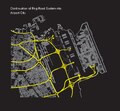
Configuration of future road systems.pdf 543 × 502; 3.28 MB
-
Construction of houses in Al Mashaf.jpg 1,565 × 1,022; 248 KB
-
D Ring Road in Nuaija 44.jpg 1,591 × 955; 306 KB
-
Dhukkan Highway, Qatar - panoramio (cropped).jpg 1,097 × 822; 928 KB
-
Dhukkan Highway, Qatar - panoramio.jpg 1,527 × 860; 503 KB
-
Diverging traffic on Onaiza St in Qatar.jpg 2,592 × 1,944; 3.16 MB
-
Doha City - panoramio (1).jpg 1,500 × 843; 554 KB
-
Dukhan Road in Rawdat Al Jahhaniya with the Doha Metro in the background.jpg 2,048 × 1,152; 126 KB
-
Dukhan Road near Al Seej exit.jpg 1,450 × 971; 122 KB
-
ELSeedProject SalwaRoad.jpeg 2,592 × 1,936; 1.73 MB
-
Empty road in Qanat Quartier in The Pearl.jpg 2,825 × 1,885; 468 KB
-
Entrance to Al Wukair on Al Wukair Road.jpg 1,590 × 1,058; 98 KB
-
Entrance to Umm Bab on Umm Bab Road.jpg 1,132 × 922; 844 KB
-
Exit 15 on Orbital Highway in Al Wakrah.jpg 1,170 × 648; 58 KB
-
Exit 39 of Al Gharrafa Street in Al Gharrafa.jpg 2,048 × 1,152; 212 KB
-
Far view of Sidra Hospital from Exit 37 of Al Gharrafa Street.jpg 2,048 × 1,152; 173 KB
-
G Ring Rd, Doha, Qatar - Dec 26, 2017.webm 49 s, 848 × 480; 7.67 MB
-
Gate 1 Interchange in Mesaieed.jpg 1,963 × 1,472; 1.56 MB
-
Highway to Mesaieed 2019.jpg 1,122 × 648; 224 KB
-
Intersection of Lusail Street and West Bay Lagoon Street in West Bay Lagoon.png 1,920 × 1,080; 2.44 MB
-
Intersection of Ras Abu Aboud Street and Al Corniche Road.png 1,920 × 1,080; 2.59 MB
-
Intersection of Salwa Road and Umm Al Seneem Street in Ain Khaled.png 711 × 392; 249 KB
-
Landscaped median between Pearl Boulevard and Costa Malaz Drive.jpg 2,048 × 1,536; 581 KB
-
Lezárt határ.jpg 2,048 × 1,536; 1.1 MB
-
Lilac landscape qatar (cropped).JPG 3,966 × 1,941; 2.02 MB
-
Lilac landscape qatar.JPG 4,000 × 3,000; 3.67 MB
-
Lilac qatar.JPG 4,000 × 3,000; 3.92 MB
-
Lusail metro station and Lusail Stadium construction in October 2020.jpg 1,901 × 905; 248 KB
-
Mohammed Eid Mohammed Thani Al Thani Mosque in Al Gharrafa.jpg 1,853 × 1,012; 213 KB
-
Onaiza Street Al Markhiya Street Junction in Doha.jpg 1,647 × 1,094; 429 KB
-
Pearl Boulevard-Medina Avenue intersection in The Pearl-Qatar.jpg 2,048 × 1,536; 509 KB
-
Pedestrian crossing connecting Ain Khaled and Industrial Area.jpg 1,335 × 711; 277 KB
-
Pedestrian path between Pearl Boulevard and Marina Drive.jpg 2,048 × 1,536; 493 KB
-
Qatar landscape lilac.JPG 4,000 × 3,000; 3.79 MB
-
Qatar, Al Jumailiyah (8), road.JPG 2,448 × 1,836; 1,012 KB
-
Qatar, Al Jumailiyah (9), normal street.JPG 2,448 × 1,608; 919 KB
-
Qatar, Al Khor (23).JPG 2,448 × 1,836; 1.15 MB
-
Qatar, Al Khurayb (3), street.JPG 2,448 × 1,560; 956 KB
-
Qatar, Al Utouriya (2), main road.JPG 3,672 × 1,848; 1.32 MB
-
Qatar, Al Utouriya (5), road to Al Jumailiyah.JPG 2,448 × 1,836; 1.13 MB
-
Qatar, Dukhan Highway.JPG 2,448 × 1,836; 1.03 MB
-
Qatar, Road from Al Khor to Al Ghuwayriyah.jpg 2,448 × 1,836; 852 KB
-
Qatar, road from Zubarah to Al-Ghuwairiyah.JPG 1,959 × 1,469; 1.08 MB
-
Qatar, Simaisma (1), entry road.JPG 2,448 × 1,836; 1.27 MB
-
Qatar, Umm Garn (Umm Qarn)(2), large walled residences.JPG 2,448 × 1,836; 1.4 MB
-
Qatar, Umm Garn (Umm Qarn)(5), residential area under construction.jpg 2,410 × 1,783; 1.13 MB
-
Qatari Emiri Naval Base in Hamad Port.jpg 1,576 × 1,051; 110 KB
-
Residential compounds in Umm Al Juwashen district of Al Rayyan.jpg 2,048 × 1,152; 173 KB
-
Road in Education City Qatar.jpg 1,638 × 1,087; 357 KB
-
Road signs on Onaiza Street in Doha.jpg 2,592 × 1,944; 3.59 MB
-
Road south-west from Al Wakrah.jpg 1,155 × 768; 150 KB
-
Road to Al Huwaila.jpg 3,699 × 2,476; 668 KB
-
Sabah Al-Ahmad Corridor in Abu Hamour.jpg 1,486 × 1,065; 245 KB
-
Salwa Road in 2014.jpg 2,448 × 3,264; 1.14 MB
-
Salwa Road near Al Ghanim Al Jadeed exit.jpg 1,338 × 952; 133 KB
-
Salwa Road passing through Fereej Al Soudan and Al Maamoura.jpg 1,329 × 735; 320 KB
-
Sandy road in Al Thakhira near the beach.jpg 3,456 × 2,304; 3.14 MB
-
Sawda Natheel Road.jpg 1,609 × 1,071; 450 KB
-
Service road near Dukhan Highway.jpg 1,634 × 1,087; 176 KB
-
Shops along Umm Salal Ali Road in Umm Salal Ali.jpg 1,562 × 1,112; 1.29 MB
-
Sign for Barzan Olympic Park in Umm Salal Ali.jpg 1,036 × 868; 44 KB
-
Sign for Ehsan Club on Al Shamal Road in Madinat ash Shamal.jpg 1,653 × 1,039; 77 KB
-
Sign for Khawzan in Qatar.jpg 1,413 × 942; 945 KB
-
Sign for Mesaieed hospital.jpg 1,077 × 714; 199 KB
-
Signage for Mesaieed International School on Mesaieed Road.jpg 1,161 × 648; 269 KB
-
The on-ramp to Al Shamal Road near Umm Salal Mohammed.jpg 1,980 × 1,574; 1.64 MB
-
The Plaza on C Ring Road in Umm Ghuwailina.png 1,280 × 720; 862 KB
-
Trees lining Mesaieed Road in Mesaieed.jpg 2,048 × 1,152; 296 KB
-
Turn off to Al Karaana off Salwa Road.jpg 1,119 × 891; 73 KB
-
Turn off to Al Mashaf on Al Wukair Road.jpg 1,262 × 982; 79 KB
-
Turn off to Madinat Al Kaaban on Al Shamal Road.jpg 1,182 × 927; 65 KB
-
Turn off to Umm Leghab West.jpg 2,048 × 942; 113 KB
-
Turn off to Umm Salal Ali Road from Al Shamal Road.jpg 1,103 × 932; 658 KB
-
Umm Birka Road in Al Khor Industrial Area.jpg 1,521 × 991; 94 KB
-
Umm Slal North Road in Bu Fasseela.jpg 1,701 × 1,386; 189 KB
-
Unpaved ghost road in Al Shamal Qatar.jpg 3,872 × 2,592; 7.03 MB
-
View of Ain Khaled and Al Aziziya from Salwa Road.jpg 1,332 × 708; 285 KB
-
View of Ain Sinan off Al Shamal Road.jpg 1,132 × 904; 52 KB
-
View of Al Ittihad New Bridge in Al Gharrafa from Al Gharrafa Street.jpg 2,048 × 1,152; 192 KB
-
View of Al Kharayej district from Al Khor Expressway in 2020.jpg 1,585 × 1,071; 280 KB
-
View of Al Maamoura from Mesaimeer Road.jpg 1,516 × 988; 220 KB
-
View of Al Tadamon Motors in Fereej Al Murra off of Salwa Road.jpg 926 × 720; 280 KB
-
View of Al Waab and Abu Hamour from Salwa Road (Abu Hamour).jpg 721 × 574; 145 KB
-
View of Al Waab and Abu Hamour from Salwa Road (Al Waab).jpg 780 × 574; 156 KB
-
View of Al Waab and Abu Hamour from Salwa Road.jpg 1,332 × 717; 278 KB
-
View of Al Wajbah from Dukhan Road.jpg 1,438 × 929; 406 KB
-
View of cement industries off Umm Bab Road (cropped).jpg 869 × 749; 404 KB
-
View of cement industries off Umm Bab Road.jpg 2,048 × 1,152; 174 KB
-
View of Fereej Al Soudan and Al Mamoura from Salwa Road (Al Mamoura).jpg 698 × 578; 157 KB
-
View of Fereej Al Soudan and Al Mamoura from Salwa Road.jpg 1,332 × 723; 305 KB
-
View of residences in Jeryan Jenaihat off Al Shamal Road.jpg 1,158 × 938; 50 KB
-
View of Saina Al Humaidi from Al Shamal Road.jpg 1,132 × 938; 710 KB
-
View of shops in Al Sakhama from Al Shamal Road.jpg 1,086 × 930; 46 KB
-
View of The Gulf English School in Al Gharrafa from Al Gharrafa Street.jpg 2,048 × 1,152; 145 KB
-
View of Umm Salal Mohammed from Al Shamal Highway.jpg 1,283 × 893; 927 KB
-
View of Yanbu Street in Fereej Bin Kulaib from Khalifa Street.jpg 1,162 × 854; 75 KB
-
Waddan Mall in Mesaieed next to roundabout.jpg 981 × 498; 213 KB
-
Welcome sign to Mesaieed.jpg 2,028 × 1,068; 210 KB
-
Welcome to Dukhan sign on Zekreet Bridge.jpg 1,571 × 973; 131 KB
-
West bay chorniche, Doha, Qatar - panoramio (16).jpg 1,501 × 846; 857 KB
-
West bay chorniche, Doha, Qatar - panoramio (6).jpg 1,501 × 846; 808 KB
-
West Bay Lagoon aerial shot in 2014.jpg 1,095 × 699; 324 KB
-
Worker carrying water down a winding two lane road in Al Shamal.jpg 3,872 × 2,592; 4.27 MB


