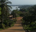
Category:Roads in Liberia
Jump to navigation
Jump to search
Countries of Africa: Algeria · Angola · Benin · Botswana · Burkina Faso · Burundi · Cameroon · Cape Verde · Central African Republic · Chad · Democratic Republic of the Congo · Republic of the Congo · Djibouti · Egypt‡ · Equatorial Guinea · Eritrea · Eswatini · Ethiopia · Gabon · The Gambia · Ghana · Guinea · Guinea-Bissau · Ivory Coast · Kenya · Lesotho · Liberia · Libya · Madagascar · Malawi · Mali · Mauritania · Mauritius · Morocco · Mozambique · Namibia · Niger · Nigeria · Rwanda · São Tomé and Príncipe · Senegal · Seychelles · Sierra Leone · Somalia · South Africa · South Sudan · Sudan · Tanzania · Togo · Tunisia · Uganda · Zambia · Zimbabwe
Other areas: Canary Islands · Madeira · Mayotte · Réunion · Western Sahara
‡: partly located in Africa
Other areas: Canary Islands · Madeira · Mayotte · Réunion · Western Sahara
‡: partly located in Africa
Wikimedia category | |||||
| Upload media | |||||
| Instance of | |||||
|---|---|---|---|---|---|
| Category combines topics | |||||
| Category contains | |||||
 | |||||
Subcategories
This category has the following 3 subcategories, out of 3 total.
Media in category "Roads in Liberia"
The following 39 files are in this category, out of 39 total.
-
- panoramio (2629).jpg 3,968 × 2,976; 3.97 MB
-
SCHWAB(1947) Fig. 030 Trails and Road.jpg 1,472 × 1,062; 912 KB
-
U.S.DOC(1965) Liberia. Map Highway system.jpg 875 × 771; 302 KB
-
Billboard on the highway.jpg 5,893 × 3,929; 3.29 MB
-
Farm Path.jpg 1,696 × 954; 541 KB
-
Liberia rainbow.jpg 3,072 × 2,304; 4.09 MB
-
Liberia, Africa - panoramio (104).jpg 1,280 × 853; 939 KB
-
Liberia, Africa - panoramio (106).jpg 853 × 1,280; 724 KB
-
Liberia, Africa - panoramio (108).jpg 853 × 1,280; 1.05 MB
-
Liberia, Africa - panoramio (161).jpg 1,024 × 680; 613 KB
-
Liberia, Africa - panoramio (2).jpg 400 × 623; 253 KB
-
Liberia, Africa - panoramio (222).jpg 2,048 × 1,536; 513 KB
-
Liberia, Africa - panoramio (28).jpg 1,024 × 768; 348 KB
-
Liberia, Africa - panoramio (281).jpg 1,600 × 900; 429 KB
-
Liberia, Africa - panoramio (288).jpg 1,920 × 1,080; 370 KB
-
Liberia, Africa - panoramio (29).jpg 1,024 × 768; 370 KB
-
Liberia, Africa - panoramio (299).jpg 1,600 × 1,200; 402 KB
-
Liberia, Africa - panoramio (60).jpg 873 × 1,024; 295 KB
-
Liberia, Africa 2012 - panoramio (10).jpg 3,696 × 2,448; 2.23 MB
-
Liberia, Africa 2012 - panoramio (11).jpg 3,696 × 2,448; 2.27 MB
-
Liberia, Africa 2012 - panoramio (12).jpg 3,696 × 2,448; 2.26 MB
-
Liberia, Africa 2012 - panoramio (18).jpg 1,723 × 1,119; 857 KB
-
Liberia, Africa 2013 - panoramio (11).jpg 640 × 480; 262 KB
-
Liberia, West Africa - panoramio (39).jpg 576 × 383; 312 KB
-
Liberian Self made wheel called Push Push.jpg 3,430 × 1,701; 1.39 MB
-
Monrovia to Gbarnga highway.jpg 6,000 × 4,000; 6.72 MB
-
Monrovia, Liberia - panoramio (23).jpg 1,024 × 768; 358 KB
-
Monrovia, Liberia - panoramio (89) (cropped).jpg 2,819 × 1,917; 2.96 MB
-
Monrovia, Liberia - panoramio (89).jpg 3,872 × 2,592; 4.61 MB
-
On the move like a boef.jpg 1,944 × 2,592; 2.81 MB
-
Paving the way to end Ebola 141216-A-AN514-013.jpg 3,718 × 2,070; 1.07 MB
-
Robertfield highway - panoramio.jpg 1,024 × 768; 322 KB
-
Robertsport2.jpg 326 × 291; 35 KB
-
Sinkor Liberia, Africa - panoramio.jpg 1,024 × 768; 344 KB
-
Steps leading to Lonestar telecommunications tower along Redlight-Ganta Highway.jpg 6,000 × 4,000; 9.97 MB
-
Team of networks.jpg 3,120 × 4,160; 1.82 MB
-
Tubman boulevard un building.jpg 1,024 × 768; 527 KB
-
View from Lonestar telecommunications tower along Redlight-Ganta Highway.jpg 6,000 × 4,000; 10.31 MB


