Category:Roads in Howden
Jump to navigation
Jump to search
Subcategories
This category has the following 2 subcategories, out of 2 total.
H
S
- Streets in Howden (34 F)
Media in category "Roads in Howden"
The following 22 files are in this category, out of 22 total.
-
 A614, Howden - geograph.org.uk - 1633182.jpg 640 × 480; 54 KB
-
 Broad Lane to Howden - geograph.org.uk - 202818.jpg 640 × 480; 104 KB
-
 Crows Nest Farm on the B1228.jpg 640 × 480; 109 KB
-
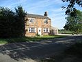
 Elm Tree Manor - geograph.org.uk - 202807.jpg 640 × 480; 105 KB
-
 Entering Howden - geograph.org.uk - 1257454.jpg 640 × 480; 56 KB
-
 Field pegged out for development - geograph.org.uk - 1259586.jpg 640 × 480; 55 KB
-
 House on Barnhill Lane, Howden (geograph 4158298).jpg 1,600 × 1,495; 564 KB
-
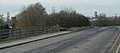 Howdendyke to Howden - geograph.org.uk - 611208.jpg 640 × 281; 39 KB
-
 M62 junction 37 - geograph.org.uk - 1299284.jpg 640 × 480; 49 KB
-
 Selby Road Howden - geograph.org.uk - 1257462.jpg 640 × 480; 67 KB
-
 Station Road - geograph.org.uk - 202910.jpg 640 × 480; 100 KB
-
 The A614 - geograph.org.uk - 248001.jpg 640 × 480; 100 KB
-
 The A614 at Howden Kitchens - geograph.org.uk - 1247281.jpg 640 × 480; 87 KB
-
 The B1228 - geograph.org.uk - 202908.jpg 640 × 480; 106 KB
-
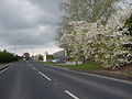
 The B1228 Approaching Howden - geograph.org.uk - 202868.jpg 640 × 480; 103 KB
-
 The B1228 leaving Howden - geograph.org.uk - 1259604.jpg 640 × 480; 55 KB
-
 The B1228 towards Howden Station - geograph.org.uk - 1257469.jpg 640 × 480; 51 KB
-
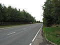
 The M62 Motorway - geograph.org.uk - 202817.jpg 640 × 480; 109 KB
-
 The M62 Motorway - geograph.org.uk - 202822.jpg 640 × 480; 112 KB
-

-
 The Road to Howden Station - geograph.org.uk - 202864.jpg 640 × 480; 106 KB
-
 Thorpe Road - geograph.org.uk - 217814.jpg 640 × 480; 93 KB


.jpg)


