Category:Roads in Glasgow
Jump to navigation
Jump to search
Council areas (municipalities) of Scotland: Aberdeen · Aberdeenshire · Angus · Argyll and Bute · Clackmannanshire · Dumfries and Galloway · Dundee · East Ayrshire · East Dunbartonshire · East Lothian · East Renfrewshire · Edinburgh · Falkirk · Fife · Glasgow · Highland · Inverclyde · Midlothian · Moray · North Ayrshire · North Lanarkshire · Outer Hebrides · Orkney Islands · Perth and Kinross · Renfrewshire · Scottish Borders · Shetland Islands · South Ayrshire · South Lanarkshire · Stirling · West Dunbartonshire · West Lothian
Subcategories
This category has the following 32 subcategories, out of 32 total.
A
B
- Bilsland Drive Aqueduct (7 F)
C
D
- Dirt roads in Glasgow (2 F)
G
M
P
- Possil Road Aqueduct (8 F)
R
- Road signs in Glasgow (29 F)
S
Media in category "Roads in Glasgow"
The following 159 files are in this category, out of 159 total.
-
 Aikenhead Road (geograph 1920463).jpg 640 × 480; 65 KB
-
 Aikinhead Road, King's Park - geograph.org.uk - 2637466.jpg 640 × 480; 82 KB
-

-
 Another beautiful day in Glasgow (38491812446).jpg 4,608 × 3,456; 4.19 MB
-
 Ardencraig Road - geograph.org.uk - 717473.jpg 640 × 480; 58 KB
-
 Atlas Road - geograph.org.uk - 3258483.jpg 640 × 362; 98 KB
-
 Auchinlea Road - geograph.org.uk - 2467661.jpg 640 × 480; 297 KB
-
 B766 Carmunnock by-pass (geograph 3527850).jpg 640 × 480; 56 KB
-
 Baillieston, Caledonia Road (geograph 2146302).jpg 600 × 453; 35 KB
-
 Baillieston, the new Serpents Twist (geograph 2821381).jpg 1,024 × 768; 145 KB
-
 Balgrayhill Road (geograph 3258534).jpg 640 × 429; 120 KB
-
 Barrhead Road (geograph 3896811).jpg 1,024 × 640; 277 KB
-
 Barrhead Road (geograph 4681993).jpg 800 × 600; 453 KB
-
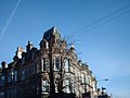
 Belhaven Terrace, Glasgow, Scotland, UK.jpg 4,288 × 2,848; 6.06 MB
-
 Boghall Road (geograph 2912730).jpg 640 × 480; 265 KB
-
 Burnham Road, Scotstoun - geograph.org.uk - 987616.jpg 640 × 480; 92 KB
-
 Bus lanes, Anderston Quay (geograph 6195803).jpg 1,024 × 683; 150 KB
-
 Bus stop and shelter on Wellhouse Road (geograph 5447383).jpg 640 × 480; 55 KB
-
 Bus stop on Tollcross Road (geograph 5446568).jpg 640 × 480; 74 KB
-
 Calderbank Avenue 2008 - geograph.org.uk - 1474618.jpg 480 × 640; 77 KB
-
 Calderbank Road (geograph 6885496).jpg 3,000 × 2,000; 7.28 MB
-
 Cambuslang Industrial Estate (geograph 2952701).jpg 640 × 481; 67 KB
-
 Cambuslang Road in Clydesmill Industrial Estate (geograph 7813912).jpg 1,024 × 768; 413 KB
-
 Carmunnock Road (geograph 2637436).jpg 640 × 480; 140 KB
-
 Carmunnock Road (geograph 3893181).jpg 1,024 × 576; 237 KB
-
 Carmunnock Road (geograph 4648524).jpg 1,600 × 1,200; 396 KB
-
 Carmunnock Road by Kings Park (geograph 3527876).jpg 640 × 481; 97 KB
-
 Carmunnock village - geograph.org.uk - 6042244.jpg 2,000 × 1,333; 2.64 MB
-
 Carntyne Road (geograph 5335997).jpg 640 × 480; 46 KB
-
 Castlemilk, next right - geograph.org.uk - 1300344.jpg 640 × 480; 132 KB
-
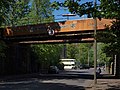
 Cathcart railway bridge - geograph.org.uk - 2140241.jpg 640 × 445; 138 KB
-
 Cathcart Road at Crosshill station (geograph 4671033).jpg 1,024 × 768; 148 KB
-
 Clarence Drive railway bridge - geograph.org.uk - 3419649.jpg 640 × 480; 157 KB
-
 Clarence Drive railway bridge - geograph.org.uk - 3419651.jpg 640 × 480; 136 KB
-
 Clarence Drive railway bridge - geograph.org.uk - 3419663.jpg 640 × 389; 113 KB
-
 Clarkston Road, Cathcart - geograph.org.uk - 5409897.jpg 640 × 480; 181 KB
-
 Corkerhill Road (geograph 4541532).jpg 3,380 × 2,208; 2.86 MB
-
 Cowal Road - geograph.org.uk - 4889182.jpg 640 × 480; 168 KB
-
 Cowal Road, Maryhill (geograph 5570820).jpg 1,298 × 1,600; 476 KB
-
 Croftfoot Drive and Croftfoot Road (geograph 5780788).jpg 1,600 × 1,200; 369 KB
-
 Croftside Avenue (geograph 2635834).jpg 640 × 480; 86 KB
-
 Crossroads in Croftfoot (geograph 3241587).jpg 640 × 480; 69 KB
-
 Crossroads on the A74 at Mount Vernon (geograph 1685050).jpg 4,000 × 3,000; 4.54 MB
-
 Cumbernauld Road (A80) (geograph 5336755).jpg 640 × 480; 58 KB
-
 Cumbernauld Road (geograph 5816542).jpg 1,024 × 682; 301 KB
-
 Cumbernauld Road, Dennistoun - geograph.org.uk - 439237.jpg 640 × 480; 121 KB
-
 Cycle lane and the A74 at Broomhouse (geograph 7756233).jpg 1,024 × 768; 396 KB
-
 Cycle lane and the A74 at Mount Vernon (geograph 7756232).jpg 1,024 × 768; 384 KB
-
 Cycle Lane on London Road (geograph 7813911).jpg 1,024 × 768; 376 KB
-
 Daffodils grow by Great Western Road - geograph.org.uk - 796971.jpg 640 × 480; 106 KB
-
 Down the hill (geograph 6045490).jpg 2,000 × 1,333; 1.69 MB
-
 Drakemire Drive - geograph.org.uk - 1300292.jpg 640 × 480; 106 KB
-
 Drill hall, 230 Auldhouse Road - geograph.org.uk - 5453745.jpg 1,600 × 842; 206 KB
-
 East End Regeneration Route (geograph 3062624).jpg 640 × 430; 92 KB
-
 East End Regeneration Route (geograph 3062652).jpg 640 × 498; 117 KB
-
 Easterhouse Road (geograph 5447409).jpg 640 × 480; 70 KB
-
 Entrance to Kings Park Train Station - geograph.org.uk - 729977.jpg 640 × 480; 59 KB
-
 Esso petrol station, Garscube Road (geograph 6547367).jpg 1,600 × 999; 240 KB
-
 Flats on Lainshaw Drive - geograph.org.uk - 1300333.jpg 640 × 480; 119 KB
-
 Flats on Riverford Road - geograph.org.uk - 1178344.jpg 640 × 480; 116 KB
-
 Garscadden Road - geograph.org.uk - 877623.jpg 640 × 452; 76 KB
-
 Germiston - geograph.org.uk - 1262142.jpg 640 × 480; 100 KB
-
 Hamilton Road, Fullarton (geograph 4020554).jpg 640 × 480; 60 KB
-
 Heavy filthy.jpg 3,648 × 2,736; 4.36 MB
-
 Houses on Walnut Road (geograph 5300564).jpg 1,600 × 980; 277 KB
-
 Housing development at Ellismuir Park near Baillieston (geograph 7117319).jpg 1,024 × 768; 323 KB
-
 Housing on Hamilton Road - geograph.org.uk - 1281524.jpg 640 × 480; 122 KB
-
 Huntly Road, Glasgow, Scotland, UK.jpg 4,288 × 2,848; 6.32 MB
-
 Kennishead Road (geograph 3413449).jpg 640 × 480; 311 KB
-
 King's Park Avenue (geograph 5410049).jpg 640 × 480; 133 KB
-
 Langlands Road (geograph 5974251).jpg 1,600 × 1,145; 370 KB
-
 Langside railway station, Glasgow (geograph 3855339).jpg 1,024 × 768; 198 KB
-
 Leaving Glasgow on Robroyston Road - geograph.org.uk - 1336433.jpg 640 × 480; 117 KB
-
 Linthouse (geograph 2089033).jpg 640 × 412; 117 KB
-
 London Road, Parkhead - geograph.org.uk - 662387.jpg 640 × 480; 87 KB
-
 Looking along Menock Road (geograph 2932011).jpg 480 × 640; 49 KB
-
 Luv Tattoo and Piercing (geograph 4784149).jpg 640 × 480; 126 KB
-
 Mini-roundabout on Netherlee Road (geograph 2468399).jpg 800 × 449; 127 KB
-
 Modern Castlemilk houses - geograph.org.uk - 1300314.jpg 640 × 480; 114 KB
-
 Mosspark Boulevard - geograph.org.uk - 1364900.jpg 640 × 360; 107 KB
-
 Netherlee Road (geograph 2468646).jpg 640 × 480; 121 KB
-
 New Road, Oatlands - geograph.org.uk - 735532.jpg 640 × 480; 43 KB
-
 Nitshill Road - geograph.org.uk - 1319123.jpg 640 × 480; 96 KB
-
 Now leaving Glasgow - geograph.org.uk - 1188959.jpg 640 × 480; 115 KB
-
 Partick Bridge, Glasgow - DSC06265.JPG 3,648 × 2,736; 3.59 MB
-
 Peat Road (geograph 4454168).jpg 3,504 × 2,336; 3.38 MB
-
 Peat Road - geograph.org.uk - 1319297.jpg 640 × 480; 115 KB
-
 Pylon beside Boghall Road (geograph 6978531).jpg 800 × 600; 65 KB
-
 Queens Drive Guardian - geograph.org.uk - 730036.jpg 640 × 480; 45 KB
-
 Railway arch over Carmunnock Road - geograph.org.uk - 1138181.jpg 640 × 480; 127 KB
-
 Railway bridge at Clarence Drive - geograph.org.uk - 580151.jpg 640 × 480; 100 KB
-
 Railway bridge at Langside station - geograph.org.uk - 3475743.jpg 800 × 600; 132 KB
-
 Railway bridge over Shawmoss Road - geograph.org.uk - 5468873.jpg 1,024 × 682; 170 KB
-
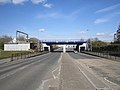
 Railway Bridges, Shettleston (geograph 1785042).jpg 4,000 × 3,000; 4.98 MB
-
 Railway Bridges, Shettleston - geograph.org.uk - 128715.jpg 640 × 480; 99 KB
-
 Rebuilt railway bridge (geograph 3434765).jpg 640 × 480; 254 KB
-
 Road junction, Dowanhill - geograph.org.uk - 20465.jpg 640 × 480; 111 KB
-
 Road near Silverburn - geograph.org.uk - 1285091.jpg 640 × 479; 51 KB
-
 Road near Silverburn - geograph.org.uk - 1285099.jpg 640 × 479; 47 KB
-
 Road passing Shawfield Stadium (geograph 2644548).jpg 640 × 480; 107 KB
-

-
 Robroyston Road - geograph.org.uk - 1336410.jpg 640 × 480; 129 KB
-
 Roundabout on Parkhouse Road (geograph 6264276).jpg 1,024 × 683; 144 KB
-
 Royston Road (geograph 5347285).jpg 2,848 × 2,136; 1.24 MB
-
 Salvation Army, Tollcross Road - geograph.org.uk - 1168001.jpg 640 × 480; 136 KB
-
 Scotstounhill - Anniesland Road at Queen Victoria Drive - geograph.org.uk - 4172359.jpg 2,048 × 1,536; 1.57 MB
-
 Scotstounhill - Kingsway, looking east - geograph.org.uk - 4172332.jpg 2,048 × 1,536; 1.96 MB
-
 Scotstounhill - Kingsway, looking west - geograph.org.uk - 4172326.jpg 2,048 × 1,536; 1.51 MB
-
 Scotstounhill - Queen Victoria Drive, looking north - geograph.org.uk - 4172352.jpg 2,048 × 1,536; 1.58 MB
-
 Serpent's Twist (2) - geograph.org.uk - 3629298.jpg 1,024 × 768; 109 KB
-
 Shawmoss Road railway bridge - geograph.org.uk - 3016686.jpg 800 × 638; 103 KB
-
 Sheildhall Road, Ibrox - geograph.org.uk - 1092480.jpg 640 × 480; 104 KB
-
 Shettleston Road - geograph.org.uk - 3495968.jpg 640 × 389; 118 KB
-
 Shieldhall Road (geograph 4836527).jpg 1,776 × 1,287; 481 KB
-
 Shops on Shieldhall Road (geograph 3629113).jpg 1,024 × 768; 139 KB
-
 South View of Berryknowes Road From Outside Cardonald Railway Station (geograph 6799450).jpg 6,720 × 4,480; 6.29 MB
-
 Southbrae Drive - geograph.org.uk - 300354.jpg 640 × 480; 76 KB
-
 St Georges Road (geograph 3291215).jpg 640 × 480; 107 KB
-
 St Kenneth Drive, Linthouse - geograph.org.uk - 734459.jpg 640 × 480; 34 KB
-
 St Rollox Drive (geograph 6551123).jpg 1,600 × 1,029; 296 KB
-
 Summer in the City Glasgow July 2018 (43359407452).jpg 4,608 × 3,072; 4.66 MB
-
 Swinton Avenue - geograph.org.uk - 1654901.jpg 640 × 483; 57 KB
-
 Swinton Crescent - geograph.org.uk - 1654895.jpg 640 × 483; 58 KB
-
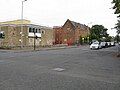
 The Gartocher Bar in Shettleston (geograph 5446590).jpg 640 × 460; 68 KB
-
 The Serpent's Twist - geograph.org.uk - 1499251.jpg 640 × 480; 83 KB
-
 Tollcross Road - geograph.org.uk - 1167999.jpg 640 × 480; 131 KB
-
 Tower Block UK photo glw3-10 (Balgrayhill 1989-1).jpg 2,594 × 1,747; 753 KB
-
 Traffic Lights - geograph.org.uk - 1138176.jpg 640 × 480; 101 KB
-
 Traffic lights at Dyke Road - geograph.org.uk - 845984.jpg 640 × 480; 291 KB
-
 University Avenue, Glasgow - geograph.org.uk - 462665.jpg 640 × 480; 86 KB
-
 Victoria Park Drive South, A814 - geograph.org.uk - 6369793.jpg 800 × 533; 264 KB
-

-
 Wallacewell Road - geograph.org.uk - 1262191.jpg 640 × 480; 109 KB
-
 Welcome to Glasgow (geograph 3241473).jpg 640 × 480; 74 KB
-
 Welcome to Glasgow (geograph 5246980).jpg 1,600 × 996; 286 KB
-

-
 Yoker Mill Road - geograph.org.uk - 482162.jpg 640 × 480; 75 KB
-
 Yorkhill Hospitals - geograph.org.uk - 2616927.jpg 640 × 388; 94 KB
-
 Alderman Road, Yoker - geograph.org.uk - 845981.jpg 640 × 480; 293 KB
-
 Anderston Quay - geograph.org.uk - 1475421.jpg 640 × 480; 103 KB
-
 Bannachra Track - geograph.org.uk - 421092.jpg 640 × 480; 130 KB
-
 Bend in road at Upper Balwill - geograph.org.uk - 394897.jpg 640 × 480; 98 KB
-
 Castlemilk Drive - geograph.org.uk - 717460.jpg 480 × 640; 35 KB
-
 Cresswell Lane, Hillhead, Glasgow - geograph.org.uk - 558650.jpg 640 × 480; 93 KB
-
 Danes Drive - geograph.org.uk - 740867.jpg 640 × 464; 35 KB
-
 Entrance to Auchenfin - geograph.org.uk - 91772.jpg 640 × 480; 115 KB
-
 Great Western Road - geograph.org.uk - 737367.jpg 640 × 480; 43 KB
-
 Great Western Road - geograph.org.uk - 761248.jpg 640 × 480; 61 KB
-
 Kingsway, Scotstoun - geograph.org.uk - 521195.jpg 640 × 480; 86 KB
-
 Langlands Road - geograph.org.uk - 269999.jpg 480 × 640; 181 KB
-
 Looking downhill on Beaconsfield Road - geograph.org.uk - 668445.jpg 640 × 480; 97 KB
-
 Minor Road Near Auldhouse - geograph.org.uk - 281939.jpg 480 × 640; 221 KB
-
 Moor Road, Strathblane - geograph.org.uk - 61680.jpg 640 × 480; 158 KB
-
 Motorway - geograph.org.uk - 494616.jpg 640 × 424; 54 KB
-
 Narrow road near Gartnavel Hospitals - geograph.org.uk - 668478.jpg 640 × 480; 116 KB
-
 Road junction at Darnley, near M77 - geograph.org.uk - 16368.jpg 640 × 480; 93 KB
-
 Southbrae Drive, Jordanhill - geograph.org.uk - 521191.jpg 640 × 480; 121 KB
-
 Steep Hill - geograph.org.uk - 80420.jpg 640 × 480; 190 KB
-
 View along Drumry Road East - geograph.org.uk - 362933.jpg 640 × 480; 85 KB
.jpg)


.jpg)


.jpg)
.jpg)
.jpg)
.jpg)
.jpg)
.jpg)

.jpg)

.jpg)
.jpg)
.jpg)

.jpg)
.jpg)
.jpg)
.jpg)
.jpg)
.jpg)
.jpg)

.jpg)


.jpg)


.jpg)

.jpg)
.jpg)
.jpg)
.jpg)
.jpg)
_(geograph_5336755).jpg)
.jpg)

.jpg)
.jpg)
.jpg)

.jpg)


.jpg)
.jpg)
.jpg)

.jpg)


.jpg)

.jpg)
.jpg)


.jpg)
.jpg)
.jpg)
.jpg)

.jpg)

.jpg)
.jpg)
.jpg)


.jpg)


.jpg)

.jpg)


.jpg)

.jpg)


.jpg)


.jpg)
.jpg)


_-_geograph.org.uk_-_3629298.jpg)


.jpg)
.jpg)
.jpg)

.jpg)

.jpg)
.jpg)


.jpg)


.jpg)


.jpg)
.jpg)


