Category:Roads in County Cork
Jump to navigation
Jump to search
Counties of the Republic of Ireland: Carlow · Cavan · Clare · Cork(1) · Donegal · Galway(3) · Kerry · Kildare · Kilkenny · Laois · Leitrim · Louth · Mayo · Meath · Monaghan · Roscommon · Sligo · Tipperary(4) · Westmeath · Wicklow – Separate cities: Cork(1) · Dublin(2) · Galway(3) – Former counties: Former counties of Northern Ireland: Antrim · Armagh ·
Wikimedia category | |||||
| Upload media | |||||
| Instance of | |||||
|---|---|---|---|---|---|
| Category combines topics | |||||
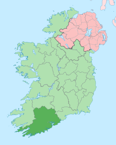
| County Cork | |||||
county in Ireland | |||||
| Instance of | |||||
| Location | Munster, Ireland | ||||
| Capital | |||||
| Legislative body |
| ||||
| Executive body |
| ||||
| Official language | |||||
| Population |
| ||||
| Area |
| ||||
| official website | |||||
 | |||||
Subcategories
This category has the following 63 subcategories, out of 63 total.
5
- 512 road (Ireland) (1 F)
D
H
- Healy Pass, County Cork (52 F)
J
- Jack Lynch Tunnel (5 F)
L
- L2202 road (Ireland) (7 F)
- L2472 road (Ireland) (1 F)
- L2489 road (Ireland) (1 F)
- L2493 road (Ireland) (1 F)
- L2496 road (Ireland) (1 F)
- L2752 road (Ireland) (1 F)
- L2760 road (Ireland) (3 F)
- L2785 road (Ireland) (1 F)
- L2789 road (Ireland) (1 F)
- L2989 road (Ireland) (2 F)
- L3217 road (Ireland) (1 F)
- L4033 road (Ireland) (1 F)
- L4704 road (Ireland) (2 F)
- L4756 road (Ireland) (1 F)
- L5166 road (Ireland) (2 F)
- L5684 road (Ireland) (1 F)
- L6518 road (Ireland) (1 F)
- L8239 road (Ireland) (1 F)
- L8752 road (Ireland) (1 F)
- L95892-2 road (Ireland) (1 F)
N
- N20 road (Ireland) (12 F)
- N22 road (Ireland) (65 F)
- N27 road (Ireland) (2 F)
- N28 road (Ireland) (2 F)
- N71 road (Ireland) (115 F)
- N72 road (Ireland) (25 F)
R
- R512 road (Ireland) (6 F)
- R513 road (Ireland) (4 F)
- R575 road (Ireland) (1 F)
- R579 road (Ireland) (1 F)
- R584 road (Ireland) (2 F)
- R586 road (Ireland) (6 F)
- R587 road (Ireland) (1 F)
- R589 road (Ireland) (2 F)
- R591 road (Ireland) (1 F)
- R596 road (Ireland) (1 F)
- R597 road (Ireland) (1 F)
- R599 road (Ireland) (1 F)
- R600 road (Ireland) (48 F)
- R601 road (Ireland) (3 F)
- R603 road (Ireland) (2 F)
- R604 road (Ireland) (2 F)
- R605 road (Ireland) (1 F)
- R610 road (Ireland) (4 F)
- R611 road (Ireland) (1 F)
- R612 road (Ireland) (1 F)
- R618 road (Ireland) (5 F)
- R619 road (Ireland) (1 F)
- R624 road (Ireland) (24 F)
- R627 road (Ireland) (6 F)
- R629 road (Ireland) (1 F)
- R630 road (Ireland) (4 F)
- R632 road (Ireland) (4 F)
- R637 road (Ireland) (3 F)
- R639 road (Ireland) (16 F)
- R907 road (Ireland) (1 F)
T
Media in category "Roads in County Cork"
The following 200 files are in this category, out of 1,498 total.
(previous page) (next page)-
"Steep hill down" road sign, Republic of Ireland - geograph.org.uk - 3041124.jpg 2,395 × 2,050; 2.22 MB
-
"Welcome to Cork" sign - geograph.org.uk - 4179857.jpg 640 × 480; 155 KB
-
2017-06-15 7356x4904 cork barrack street.jpg 7,356 × 4,904; 2.88 MB
-
2022-08-25 Timoleague (cropped).jpg 3,409 × 2,074; 2.62 MB
-
2022-08-25 Timoleague.jpg 3,968 × 2,976; 4.26 MB
-
203 bus at stop on Watercourse Road, Cork - geograph.org.uk - 6332378.jpg 1,024 × 768; 294 KB
-
59 km to Skibbereen - geograph.org.uk - 5844841.jpg 800 × 600; 787 KB
-
98 Street - Skibbereen - geograph.org.uk - 654749.jpg 407 × 640; 198 KB
-
A big house and a memorial - geograph.org.uk - 6257478.jpg 1,600 × 1,200; 887 KB
-
A busy Kinsale street - geograph.org.uk - 596656.jpg 640 × 480; 66 KB
-
A Colourful Kinsale Street - geograph.org.uk - 596662.jpg 640 × 504; 103 KB
-
A fine hedge - geograph.org.uk - 6257397.jpg 1,600 × 1,200; 894 KB
-
A fine row of conifers - geograph.org.uk - 6257510.jpg 1,600 × 1,200; 947 KB
-
A good lunch (geograph 6250962).jpg 1,600 × 1,007; 406 KB
-
A helpful sign - geograph.org.uk - 6257606.jpg 1,600 × 1,200; 972 KB
-
A hidden river - geograph.org.uk - 6256727.jpg 1,600 × 1,200; 1.23 MB
-
A lane west of Ross Carbery - geograph.org.uk - 4466647.jpg 1,024 × 768; 348 KB
-
A multitude of signs - geograph.org.uk - 6439852.jpg 1,024 × 666; 177 KB
-
A narrow lane, Glengarriff - geograph.org.uk - 263367.jpg 640 × 480; 95 KB
-
A potholed road - geograph.org.uk - 6257393.jpg 1,600 × 1,200; 852 KB
-
A road in Faran with a sign indicating turns - geograph.org.uk - 4861913.jpg 1,600 × 1,200; 397 KB
-
A rural crossroads - geograph.org.uk - 2915474.jpg 1,024 × 768; 197 KB
-
A slip road off a loop road - geograph.org.uk - 2916860.jpg 1,024 × 768; 265 KB
-
A stone row - geograph.org.uk - 6257232.jpg 1,600 × 1,200; 968 KB
-
A street scene in Cork with tram and passengers! (16222787771).jpg 2,000 × 1,495; 1.54 MB
-
A twisty minor lane through farmland - geograph.org.uk - 5158066.jpg 1,464 × 2,000; 1.14 MB
-
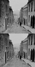
A typical Irish street in Cork, Ireland LC-USZ62-123727 - Edit 2.gif 1,874 × 1,771; 1.77 MB
-
A typical Irish street in Cork, Ireland LC-USZ62-123727.gif 1,874 × 1,771; 1.77 MB
-
A very narrow road - geograph.org.uk - 3551808.jpg 800 × 600; 213 KB
-
A very wide junction - geograph.org.uk - 3551727.jpg 800 × 600; 155 KB
-
A view over Togher - geograph.org.uk - 4001184.jpg 1,024 × 576; 214 KB
-
A wealth of interest - geograph.org.uk - 2915504.jpg 1,024 × 768; 231 KB
-
Abandoned at Gortnakilly - geograph.org.uk - 1832760.jpg 3,456 × 2,304; 1.89 MB
-
Abandoned building - geograph.org.uk - 6745094.jpg 1,024 × 768; 128 KB
-
Abandoned cottage - geograph.org.uk - 4171708.jpg 4,000 × 2,664; 4.41 MB
-
Abandoned road, abandoned vehicle, Ballysimon - geograph.org.uk - 6272410.jpg 1,024 × 768; 176 KB
-
Abbey hotel.jpg 1,024 × 768; 134 KB
-
Ace Signs, Sitecast Industrial Estate, Cork - geograph.org.uk - 3034930.jpg 3,648 × 2,736; 2.31 MB
-
Actons Builders Suppliers, Kinsale - geograph.org.uk - 4182969.jpg 640 × 480; 156 KB
-
Adrigole Harbour - geograph.org.uk - 5818891.jpg 1,024 × 768; 140 KB
-
Adrigole Harbour - geograph.org.uk - 5818893.jpg 1,024 × 768; 158 KB
-
Aghabullogue (geograph 5155003).jpg 2,000 × 1,308; 1.44 MB
-
Aghalode Bridge - geograph.org.uk - 5814458.jpg 1,024 × 748; 142 KB
-
AIB Bank, Millstreet - geograph.org.uk - 5005364.jpg 1,024 × 768; 169 KB
-
Albert Quay, Cork - geograph.org.uk - 3727945.jpg 2,592 × 1,936; 1.56 MB
-
Allen's, Riverstick - geograph.org.uk - 2945068.jpg 1,024 × 768; 178 KB
-
Allihies - geograph.org.uk - 2005067.jpg 1,024 × 765; 281 KB
-
Allihies-1-2 - Flickr - Ragnhild & Neil Crawford.jpg 1,400 × 933; 385 KB
-
Almost a traffic island - geograph.org.uk - 3551875.jpg 800 × 600; 189 KB
-
Amigos Piazza Place, Cobh - geograph.org.uk - 4182455.jpg 640 × 480; 180 KB
-
An interested cow - geograph.org.uk - 2116931.jpg 640 × 480; 195 KB
-
An Irish crossroads - geograph.org.uk - 3550800.jpg 800 × 600; 140 KB
-
An Irish crossroads - geograph.org.uk - 4193210.jpg 800 × 600; 176 KB
-
An odd arrangement of roads - geograph.org.uk - 2913550.jpg 640 × 480; 98 KB
-
Anchor Bar, East Hill, Cobh - geograph.org.uk - 5840377.jpg 1,065 × 1,600; 557 KB
-
Anchor Tavern, Bantry - geograph.org.uk - 4179121.jpg 640 × 480; 184 KB
-
Anchor Tavern, Bantry - geograph.org.uk - 4179207.jpg 640 × 480; 199 KB
-
Angelas Shop and Coffee Dock (geograph 5002161).jpg 1,024 × 768; 198 KB
-
Angelas Shop.jpg 5,958 × 3,972; 9.72 MB
-
Annes Grove House - geograph.org.uk - 1392642.jpg 640 × 412; 319 KB
-
Another Irish minor road through farmland - geograph.org.uk - 2917902.jpg 1,024 × 768; 284 KB
-
Another wet road near Ross Carbery - geograph.org.uk - 4466654.jpg 1,024 × 768; 490 KB
-
Anyone for a coffee^ - geograph.org.uk - 3652407.jpg 3,648 × 2,736; 6.7 MB
-
Approaching a junction - geograph.org.uk - 5165066.jpg 2,000 × 1,333; 1.16 MB
-
Approaching Nohaval village - geograph.org.uk - 1398536.jpg 640 × 480; 195 KB
-
Approaching the airport - geograph.org.uk - 2917613.jpg 1,024 × 768; 327 KB
-
Approaching the Junction - geograph.org.uk - 1834181.jpg 3,422 × 2,252; 1 MB
-
Arable land near Rochfordstown - geograph.org.uk - 4033749.jpg 1,024 × 576; 222 KB
-
Arcade, Rosscarbery, Co. Cork (32778709975).jpg 1,307 × 2,000; 1.56 MB
-
Archdeacon Duggan Bridge, Kinsale - geograph.org.uk - 5830360.jpg 800 × 600; 648 KB
-
Ardgroom Main Street 1987 08 17.jpg 3,339 × 2,161; 7.29 MB
-
Arrival at Cork - geograph.org.uk - 3561197.jpg 640 × 427; 146 KB
-
Ashe Street Clonakilty - geograph.org.uk - 4965777.jpg 2,706 × 3,385; 1.65 MB
-
Astna Square, Clonakilty - geograph.org.uk - 4178765.jpg 640 × 480; 181 KB
-
At the crossroads - geograph.org.uk - 4172439.jpg 4,000 × 2,664; 5.01 MB
-
Avenue of trees, Curraheen Village - geograph.org.uk - 3035149.jpg 2,602 × 3,468; 2.01 MB
-
Baker's Road, Cork - geograph.org.uk - 6331765.jpg 1,024 × 768; 253 KB
-
Ballincolla, Co. Cork, Ireland - panoramio.jpg 3,072 × 2,304; 3.16 MB
-
Ballincollig Technology Park - geograph.org.uk - 989509.jpg 640 × 480; 72 KB
-
Ballineen.jpg 240 × 180; 21 KB
-
Ballinspittal - geograph.org.uk - 239478.jpg 640 × 480; 72 KB
-
Ballinspittle - geograph.org.uk - 5123015.jpg 2,000 × 1,333; 1.36 MB
-
Ballinspittle - geograph.org.uk - 5158128.jpg 2,000 × 1,333; 1.22 MB
-
Ballintemple village.jpg 3,072 × 2,304; 2.82 MB
-
Ballintemple, Cork, Ireland - panoramio (4).jpg 4,552 × 3,414; 4.66 MB
-
Bally's Cross Roads - geograph.org.uk - 5297561.jpg 5,184 × 3,888; 5.47 MB
-
Ballydehob, Main Street - geograph.org.uk - 747988.jpg 640 × 480; 57 KB
-
Ballyhooly Castle - geograph.org.uk - 6418058.jpg 1,024 × 768; 137 KB
-
Ballyhooly, Co. Cork, late 19th century (7406536002).jpg 2,000 × 1,501; 1.59 MB
-
Ballyhooly, County Cork - geograph.org.uk - 1796444.jpg 3,579 × 1,938; 4.04 MB
-
Baltimore Waterfront, 1 - geograph.org.uk - 4807256.jpg 1,600 × 1,200; 835 KB
-
Bandon Bridge - geograph.org.uk - 2386413.jpg 3,456 × 2,304; 1.55 MB
-
Bandon Fireater - geograph.org.uk - 2386505.jpg 2,304 × 3,456; 1.47 MB
-
Bandon, New Road - geograph.org.uk - 5845466.jpg 800 × 533; 461 KB
-
Bank of Ireland, Bantry - geograph.org.uk - 4179208.jpg 640 × 480; 190 KB
-
Bank of Ireland, Kinsale.jpg 3,648 × 2,736; 2.41 MB
-
Bantry - Glengarriff Road - geograph.org.uk - 504857.jpg 640 × 480; 157 KB
-
Bar and garage, Cappeen - geograph.org.uk - 5810553.jpg 1,024 × 720; 130 KB
-
Bar And Post Office - geograph.org.uk - 1842796.jpg 3,456 × 2,304; 1.1 MB
-
Bar on Chapel Street, Cloyne - geograph.org.uk - 5159944.jpg 1,024 × 768; 149 KB
-
Bare-back rider, Clonakilty - geograph.org.uk - 4178508.jpg 640 × 480; 174 KB
-
Barn at Ballynoe - geograph.org.uk - 6750081.jpg 1,024 × 768; 178 KB
-
Barnancleeve Pass - geograph.org.uk - 3567724.jpg 640 × 427; 214 KB
-
Before the match.jpg 1,600 × 1,200; 769 KB
-
Belgooly.jpg 640 × 480; 186 KB
-
Bend ahead - geograph.org.uk - 4186279.jpg 4,608 × 3,456; 4.95 MB
-
Bend in the road - geograph.org.uk - 5124579.jpg 2,000 × 1,333; 1.08 MB
-
Between the hedges - geograph.org.uk - 2112385.jpg 640 × 480; 120 KB
-
Blackrock - panoramio (1).jpg 1,600 × 1,079; 1.41 MB
-
Blackrock Cork Plaza northwards June 2017.jpg 4,032 × 2,268; 1.31 MB
-
Blackrock Cork Plaza southwards June 2017.jpg 4,032 × 2,268; 1.56 MB
-
Blackrock Road, Cork (15981334943).jpg 2,000 × 1,537; 1.5 MB
-
Blackrock, Cork, Ireland - panoramio (2).jpg 4,608 × 3,456; 6.78 MB
-
Blarney Street, Cork - geograph.org.uk - 3088011.jpg 3,439 × 2,578; 1.43 MB
-
Blarney Street, Cork - geograph.org.uk - 6331526.jpg 1,024 × 768; 239 KB
-
Blarney Woollen Mills - geograph.org.uk - 4179903.jpg 640 × 480; 179 KB
-
Blocked entrance to empty industrial site, Little Island - geograph.org.uk - 3058193.jpg 3,648 × 2,736; 3.11 MB
-
Blue Haven Hotel - geograph.org.uk - 6051645.jpg 1,024 × 681; 138 KB
-
Blue Haven Hotel, Kinsale - geograph.org.uk - 4182877.jpg 640 × 480; 177 KB
-
Bofickil, Minor road to Eyeries - geograph.org.uk - 267052.jpg 640 × 480; 88 KB
-
Bosky road - geograph.org.uk - 2917864.jpg 1,024 × 768; 344 KB
-
Bridge and old ford - geograph.org.uk - 2111722.jpg 640 × 480; 169 KB
-
Bridge over Roxboro River at Midleton - geograph.org.uk - 5820105.jpg 800 × 533; 526 KB
-
Bridge over the River Feale - geograph.org.uk - 5021893.jpg 1,024 × 768; 224 KB
-
Bridge over the river Stick - geograph.org.uk - 2945046.jpg 1,024 × 768; 185 KB
-
Bridge pilaster on disused road bridge - geograph.org.uk - 1396051.jpg 480 × 640; 311 KB
-
Bridge Street and West End, Ballineen - geograph.org.uk - 3569706.jpg 800 × 451; 187 KB
-
Bridge Street, Bantry - geograph.org.uk - 4179139.jpg 640 × 480; 150 KB
-
Bridge Street, Bantry - geograph.org.uk - 4179167.jpg 640 × 480; 191 KB
-
Brighter Glanmire shot.JPG 4,000 × 3,000; 2.76 MB
-
Brigown Road at Brigown Cemetery in Mitchelstown - geograph.org.uk - 5579366.jpg 4,000 × 3,000; 3.06 MB
-
Broomfield Lane - geograph.org.uk - 4910468.jpg 640 × 480; 175 KB
-
Broomfield Lane north of Midleton - geograph.org.uk - 4910502.jpg 640 × 480; 171 KB
-
Broomfield Lane, Midleton - geograph.org.uk - 4910476.jpg 640 × 480; 195 KB
-
Broomfield Lane, North of Midleton - geograph.org.uk - 4910504.jpg 640 × 480; 182 KB
-
Building with round arches, Cork - geograph.org.uk - 4180349.jpg 640 × 480; 160 KB
-
Buildings along Lavitt's Quay, Cork - geograph.org.uk - 4180052.jpg 640 × 480; 170 KB
-
Buildings along St. Patrick's Quay, Cork - geograph.org.uk - 4180047.jpg 640 × 480; 154 KB
-
Bull McCabes Bar and Grill, Kinsale Road - geograph.org.uk - 5840149.jpg 800 × 533; 552 KB
-
Bus depot, Killeagh - geograph.org.uk - 5474744.jpg 1,024 × 768; 173 KB
-
Bus stop on Bishopstown Road - geograph.org.uk - 3095329.jpg 2,736 × 3,648; 4.08 MB
-
Bus stopped on Harbour View Road, Cork 3 - geograph.org.uk - 6331963.jpg 1,024 × 684; 269 KB
-
Bus stops, St Patrick's Street, Cork - geograph.org.uk - 6328203.jpg 1,024 × 768; 296 KB
-
Bus Turning Area, Donnybrook - geograph.org.uk - 757616.jpg 640 × 480; 60 KB
-
Buses on Merchant's Quay - geograph.org.uk - 3728737.jpg 2,592 × 1,936; 1.45 MB
-
Business Park - geograph.org.uk - 4170853.jpg 4,000 × 2,664; 3.72 MB
-
Butlerstown Co Cork - geograph.org.uk - 1110373.jpg 640 × 480; 56 KB
-
Butlerstown Co Cork - geograph.org.uk - 1110374.jpg 640 × 480; 64 KB
-
Buttevant Main street 1800s.jpg 620 × 381; 49 KB
-
Buttevant Main Street 2012 09 08.jpg 3,349 × 2,233; 4.1 MB
-
Buttevant Main Street Intersection with R522 2012 09 08.jpg 3,504 × 2,336; 5.16 MB
-
By The Road To Ardgroom - geograph.org.uk - 456827.jpg 640 × 473; 122 KB
-
Cab 3000, Kinsale - geograph.org.uk - 4182607.jpg 640 × 480; 159 KB
-
Cahergal Junction - geograph.org.uk - 1843863.jpg 3,448 × 2,292; 1.7 MB
-
Cahirmee 001.jpg 3,264 × 2,448; 1.33 MB
-
Cahirmee 002.jpg 3,264 × 2,448; 1.37 MB
-
Cahirmee 003.jpg 3,264 × 2,448; 1.62 MB
-
Cahirmee 004.jpg 3,264 × 2,448; 1.3 MB
-
Cahirmee 005.jpg 3,264 × 2,448; 1.16 MB
-
Cahirmee 006.jpg 3,264 × 2,448; 1.63 MB
-
Cahirmee 007.jpg 3,264 × 2,448; 1.85 MB
-
Cahirmee 008.jpg 3,264 × 2,448; 1.42 MB
-
Cahoo Cross Roads - geograph.org.uk - 2112394.jpg 640 × 480; 135 KB
-
Canalmore - geograph.org.uk - 263729.jpg 640 × 480; 91 KB
-
Car park at Midleton Station - geograph.org.uk - 4910499.jpg 640 × 480; 145 KB
-
Carbery Oils - geograph.org.uk - 3551625.jpg 800 × 600; 185 KB
-
Carlisle Fort, Crosshaven, Co. Cork with sailing boat. (16293051021).jpg 2,000 × 1,499; 1.57 MB
-
Carlisle Place, Monkstown - geograph.org.uk - 5046259.jpg 1,024 × 768; 156 KB
-
Carrigaline Road - geograph.org.uk - 757678.jpg 640 × 480; 104 KB
-
Casey's of Baltimore - geograph.org.uk - 1846905.jpg 3,448 × 2,294; 1.3 MB
-
Castlelyons - The Abbey Bar - geograph.org.uk - 5025405.jpg 1,024 × 768; 121 KB
-
Castlelyons Main Street 2015 08 27.jpg 3,480 × 2,225; 4.13 MB
-
Castlelyons The Abbey 2015 08 27.jpg 3,124 × 2,067; 3.19 MB
-
Castlelyons The Peddlar's Rock 2015 08 27.jpg 3,410 × 2,140; 4.31 MB
-
Castlemartyr Hotel (1) - Baile na Martra (geograph 1888906).jpg 640 × 480; 57 KB
-
Castlemartyr Main Street - geograph.org.uk - 6052719.jpg 800 × 534; 660 KB
-
Castlemartyr, County Cork - geograph.org.uk - 1846429.jpg 3,888 × 2,397; 3.2 MB
-
Castletownbere, Main Street - geograph.org.uk - 6427207.jpg 1,024 × 768; 137 KB
-
Castletownbere.Mainstreet.jpg 4,256 × 2,848; 2.16 MB
-
Castletownshend, Main Street - geograph.org.uk - 1965512.jpg 640 × 480; 71 KB
-
Castletownshend, Main Street - geograph.org.uk - 1965513.jpg 640 × 480; 89 KB
-
Castletownshend, Main Street - geograph.org.uk - 1965514.jpg 640 × 480; 72 KB


