Category:Road signs in Botswana
Jump to navigation
Jump to search
Countries of Africa: Algeria · Angola · Benin · Botswana · Burkina Faso · Cameroon · Cape Verde · Chad · Democratic Republic of the Congo · Djibouti · Egypt‡ · Eritrea · Eswatini · Ethiopia · The Gambia · Ghana · Guinea · Guinea-Bissau · Ivory Coast · Kenya · Lesotho · Liberia · Libya · Madagascar · Malawi · Mali · Mauritius · Morocco · Mozambique · Namibia · Niger · Nigeria · Rwanda · São Tomé and Príncipe · Senegal · Seychelles · Sierra Leone · South Africa · South Sudan · Sudan · Tanzania · Togo · Tunisia · Uganda · Zambia · Zimbabwe
Other areas: Canary Islands · Madeira · Réunion · Western Sahara
‡: partly located in Africa
Other areas: Canary Islands · Madeira · Réunion · Western Sahara
‡: partly located in Africa
English: This category is for photographs. For diagrams, see Category:Diagrams of road signs of Botswana.
overview of road signs in Botswana | |||||
| Upload media | |||||
| Instance of |
| ||||
|---|---|---|---|---|---|
| Facet of | |||||
| Location |
| ||||
| |||||
Subcategories
This category has the following 9 subcategories, out of 9 total.
H
P
W
Pages in category "Road signs in Botswana"
This category contains only the following page.
Media in category "Road signs in Botswana"
The following 12 files are in this category, out of 12 total.
-
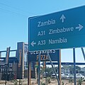
A31 Kazungula.jpg 2,944 × 2,944; 1.81 MB
-
Betesankwe Village.jpg 5,184 × 3,456; 4.82 MB
-
Close to the Ferry Botswana-Zambia - panoramio.jpg 3,504 × 2,336; 2.26 MB
-
Lobatse - panoramio.jpg 960 × 720; 261 KB
-
Makopong Border Post.jpg 2,848 × 2,134; 1.23 MB
-
Malolwane, Kgatleng District, Botswana, Africa.jpg 1,600 × 1,200; 929 KB
-
Nedaleko hranic Botswana - Zambie - Zimbabwe - panoramio.jpg 4,928 × 3,264; 8.45 MB
-
Read the signs!!!.jpg 6,016 × 4,000; 3.47 MB
-
Road sign in Africa 001.jpeg 4,032 × 3,024; 3.71 MB
-
Roadworks near Kazangula.jpg 2,448 × 3,264; 1.33 MB
-
The direction to Palapye.jpg 1,024 × 768; 136 KB
-
Traffic flow of kt motsete road.jpg 6,016 × 4,000; 19.53 MB


