Category:Road maps of state highways in Idaho
Jump to navigation
Jump to search
States of the United States: Alabama · Arizona · Arkansas · California · Colorado · Connecticut · Delaware · Florida · Georgia · Idaho · Illinois · Iowa · Kansas · Louisiana · Maine · Maryland · Massachusetts · Michigan · Missouri · Nevada · New Jersey · New Mexico · New York · North Carolina · Ohio · Oklahoma · Oregon · Pennsylvania · South Carolina · South Dakota · Utah · Virginia · Washington · Wyoming
Media in category "Road maps of state highways in Idaho"
The following 11 files are in this category, out of 11 total.
-
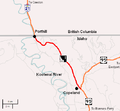
Idaho Highway 1 map.png 533 × 492; 40 KB
-
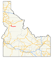
Highways in Idaho with SH 14 highlighted (2010 TL and 2005 NHPN).png 648 × 727; 126 KB
-
Idaho State Highway 14 (2010 TL and 2005 NHPN).png 1,335 × 727; 96 KB
-
Idaho Highway 41 map.png 433 × 322; 26 KB
-
Highways in Idaho with SH 71 highlighted (2010 TL and 2005 NHPN).png 648 × 727; 131 KB
-
Idaho State Highway 71 (2010 TL and 2005 NHPN).png 1,335 × 727; 147 KB
-
Highways in Idaho with SH 72 highlighted (2010 TL and 2005 NHPN).png 648 × 727; 130 KB
-
Idaho State Highway 72 (2010 TL and 2005 NHPN).png 1,335 × 727; 72 KB
-
Highways in Idaho with SH 75 highlighted (2010 TL and 2005 NHPN).png 643 × 727; 128 KB
-
Idaho State Highway 75 (2010 TL and 2005 NHPN).png 1,335 × 727; 362 KB
-
Id75map.svg 974 × 517; 193 KB


