Category:Road maps of Munich
Jump to navigation
Jump to search
Media in category "Road maps of Munich"
The following 5 files are in this category, out of 5 total.
-
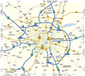
Karte Fernstraßen München.png 2,473 × 2,211; 643 KB
-
Karte Mittlerer Ring München.png 1,499 × 1,392; 530 KB
-
Münchner Hauptstraßennetzplan 1963.jpg 2,015 × 1,755; 512 KB
-
WV-Munich districts for travel purposes.png 3,000 × 2,318; 1.39 MB
-
WV-Munich districts for travel purposes.svg 918 × 709; 1.57 MB


