Category:Road junctions in England
Jump to navigation
Jump to search
Wikimedia category | |||||
| Upload media | |||||
| Instance of | |||||
|---|---|---|---|---|---|
| Category combines topics | |||||
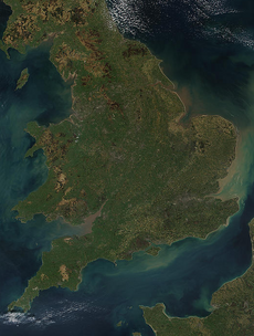
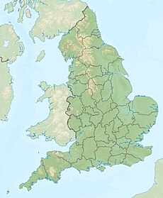
| England | |||||
country in north-west Europe, part of the United Kingdom | |||||
| Spoken text audio | |||||
| Pronunciation audio | |||||
| Instance of | |||||
| Name in native language |
| ||||
| Named after | |||||
| Patron saint | |||||
| Location |
| ||||
| Capital | |||||
| Basic form of government |
| ||||
| Official language | |||||
| Anthem |
| ||||
| Currency | |||||
| Head of state |
| ||||
| Head of government |
| ||||
| Highest point | |||||
| Population |
| ||||
| Area |
| ||||
| Replaces |
| ||||
| Different from | |||||
| official website | |||||
 | |||||
Subcategories
This category has the following 32 subcategories, out of 32 total.
B
C
- Road junctions in Cornwall (160 F)
D
E
- Road junctions in Essex (74 F)
G
H
K
L
M
N
O
P
S
- Road junctions in Shropshire (75 F)
W
- Road junctions in West Sussex (103 F)
Media in category "Road junctions in England"
The following 119 files are in this category, out of 119 total.
-
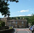
Facit Mill, Market Street, in Facit, Whitworth Lancashire in 2007.jpg 1,802 × 2,404; 3.6 MB
-
A story of contrasts - geograph.org.uk - 1281657.jpg 640 × 504; 166 KB
-
A11 junction - geograph.org.uk - 1084575.jpg 640 × 480; 86 KB
-
A11 junction at Red Lodge - geograph.org.uk - 1638686.jpg 640 × 480; 98 KB
-
Adams Hill - Knutsford - geograph.org.uk - 3873477.jpg 2,898 × 2,328; 2.88 MB
-
Approaching Somerset - geograph.org.uk - 1619027.jpg 640 × 480; 104 KB
-
Aylesford, Kent 03.jpg 5,152 × 3,864; 4.24 MB
-
Barn Adjacent And On South Side Of Nos 23 And 25.jpg 4,496 × 3,000; 4.35 MB
-
Barn conversion in Farley, Wiltshire, England.jpg 4,608 × 2,304; 8.5 MB
-
Barn, house and road junction, Farley, Wiltshire, England.jpg 4,608 × 3,072; 16.61 MB
-
Beech Street junction with Golden Lane view south 01.jpg 3,648 × 2,736; 3.11 MB
-
Beeston MMB 83 Marlborough Road.jpg 4,077 × 2,547; 3.52 MB
-
Belton-in-Rutland 04.jpg 4,000 × 3,000; 4.57 MB
-
Belton-in-Rutland 08.jpg 4,000 × 3,000; 3.34 MB
-
Belton-in-Rutland 09.jpg 4,000 × 3,000; 4.24 MB
-
Belton-in-Rutland 17.jpg 4,000 × 3,000; 3.01 MB
-
Bomish Lane junction - geograph.org.uk - 1499275.jpg 640 × 480; 49 KB
-
Both lead to Hope Cove - geograph.org.uk - 1076708.jpg 640 × 480; 82 KB
-
Callow - Lane Junction - geograph.org.uk - 1470069.jpg 640 × 480; 89 KB
-
Careby road bridge.jpg 640 × 480; 72 KB
-
Central Street junction with Gee Street view south 01.jpg 3,648 × 2,736; 3.89 MB
-
Central Street junction with Lever Street view northeast 01.jpg 3,648 × 2,736; 3.1 MB
-
Central Street junction with Seward Street view south 01.jpg 3,648 × 2,736; 3.16 MB
-
Stainbeck Corner01.jpg 3,152 × 1,626; 766 KB
-
Crossroads, Ashampstead - geograph.org.uk - 678081.jpg 640 × 480; 185 KB
-
Dunkirk Flyover - geograph.org.uk - 680563.jpg 640 × 460; 80 KB
-
East Hagbourne - geograph.org.uk - 129930.jpg 640 × 480; 82 KB
-
Eldon Street junction with South Place and Willson Street view northeast 01.jpg 3,648 × 2,736; 3.73 MB
-
EngelsKruispunt.JPG 3,456 × 2,304; 2.34 MB
-
Farmer's Arms junction, Fulford - geograph.org.uk - 1464006.jpg 640 × 472; 79 KB
-
Finsbury Pavement junction with City Road and Worship Street view south 01.jpg 3,648 × 2,736; 3.28 MB
-
Finsbury Pavement junction with Finsbury Square (north side) view south 01.jpg 3,648 × 2,736; 3.77 MB
-
Five Lane Ends - geograph.org.uk - 1362059.jpg 640 × 480; 105 KB
-
Flyover at Bilbrough Top - geograph.org.uk - 1315528.jpg 640 × 478; 137 KB
-
Forest road junction - geograph.org.uk - 816701.jpg 640 × 480; 86 KB
-
Fork in the road for Brunslow - geograph.org.uk - 873046.jpg 640 × 480; 178 KB
-
Gainsford Crescent junction - geograph.org.uk - 1206798.jpg 640 × 479; 91 KB
-
Glaisdale Drive - geograph.org.uk - 1557409.jpg 640 × 479; 63 KB
-
Golden Lane junction with Banner Street view north 01.jpg 3,648 × 2,736; 3.07 MB
-
Hallow - new housing - geograph.org.uk - 850779.jpg 640 × 480; 66 KB
-
Harpur Hill Road - geograph.org.uk - 6792921.jpg 4,482 × 4,000; 1.58 MB
-
High Croft Way - Starkey Lane - geograph.org.uk - 1016762.jpg 640 × 411; 182 KB
-
Highgate Junction - geograph.org.uk - 4397607.jpg 800 × 600; 94 KB
-
Highgate Road Junction - geograph.org.uk - 2409277.jpg 800 × 600; 115 KB
-
Hoar Cross - geograph.org.uk - 198840.jpg 640 × 480; 93 KB
-
Holy Cross near Clent - geograph.org.uk - 387851.jpg 640 × 426; 120 KB
-
Junction at Fulford - geograph.org.uk - 1463933.jpg 640 × 480; 97 KB
-
Junction by the Curlew - geograph.org.uk - 2888675.jpg 3,872 × 2,592; 4.38 MB
-
Junction in Poulton - geograph.org.uk - 1288511.jpg 640 × 427; 79 KB
-
Junction of Askern Road and the A19 - geograph.org.uk - 1229698.jpg 640 × 480; 43 KB
-
Junction of Goose Lane and Port Lane - geograph.org.uk - 1136745.jpg 640 × 445; 209 KB
-
Junction of Lumley Road with the A259 - geograph.org.uk - 805438.jpg 640 × 480; 53 KB
-
Junction of Main Street and Meadow Lane, Cononley - panoramio (3).jpg 1,222 × 1,181; 252 KB
-
Junction of Speke Road and Banks Road.jpg 4,545 × 3,357; 10.44 MB
-
Junction of Victoria Road and the A5268, Chester - geograph.org.uk - 4854063.jpg 3,184 × 2,123; 1.99 MB
-
Junction on the edge of Southrop - geograph.org.uk - 1592838.jpg 640 × 480; 48 KB
-
Lane junction, Mendlesham Green - geograph.org.uk - 888890.jpg 640 × 453; 72 KB
-
Little Waldingfield junction.jpg 4,608 × 3,456; 3.26 MB
-
M4 Junction 20 westbound - geograph.org.uk - 2029295.jpg 3,036 × 2,010; 2.29 MB
-
M4 Motorway From Train - geograph.org.uk - 2420602.jpg 640 × 480; 66 KB
-
M5 Junction 16 southbound - geograph.org.uk - 2030205.jpg 3,036 × 2,010; 1.81 MB
-
Meadow Park, Staining - geograph.org.uk - 1394612.jpg 640 × 480; 135 KB
-
Mossley Avenue, Wallisdown - geograph.org.uk - 1537402.jpg 640 × 485; 79 KB
-
Newton Tony - Junction - geograph.org.uk - 1409591.jpg 640 × 480; 67 KB
-
Nottingham MMB I6 A52 Clifton Boulevard.jpg 3,996 × 2,472; 3.24 MB
-
Nottingham MMB I7 A52 Clifton Boulevard.jpg 4,014 × 2,415; 3.17 MB
-
Nottingham MMB 41 Middleton Boulevard.jpg 2,343 × 1,439; 1.38 MB
-
Nuns Road - geograph.org.uk - 1344015.jpg 640 × 457; 305 KB
-
Parkend railway station MMB 01.jpg 3,795 × 2,306; 3.44 MB
-
Pearce Lane Junction with Watson Lane - geograph.org.uk - 365062.jpg 640 × 480; 159 KB
-
Pinfold Hollow, Cuddington - geograph.org.uk - 163153.jpg 640 × 480; 75 KB
-
Preston New Road at the junction with Whitegate Drive, Blackpool - panoramio (1217).jpg 3,888 × 2,592; 3.58 MB
-
Road junction A683 at Jordan Lane-geograph-4003628.jpg 533 × 640; 130 KB
-
Road junction at Pylle - geograph.org.uk - 1310948.jpg 640 × 480; 159 KB
-
Road junction below Haldon Belvedere - geograph.org.uk - 1589712.jpg 640 × 480; 76 KB
-
Road junction near Heysham power stations - geograph.org.uk - 5013200.jpg 1,024 × 742; 138 KB
-
Road junction near Hulland. - geograph.org.uk - 178786.jpg 640 × 480; 124 KB
-
Road junction near Whalley - geograph.org.uk - 844258.jpg 640 × 480; 72 KB
-
Road Junction, Uddens Drive, Stapehill - geograph.org.uk - 1778942.jpg 800 × 600; 162 KB
-
Route 63 - geograph.org.uk - 165986.jpg 640 × 470; 108 KB
-
Rural crossroads - geograph.org.uk - 113088.jpg 640 × 480; 103 KB
-
Sillitoe Court, Faraday Road - geograph.org.uk - 1591031.jpg 640 × 479; 89 KB
-
Skegness Clock Tower - geograph.org.uk - 15132.jpg 480 × 640; 82 KB
-
Stratford station MMB 38 Stratford Centre.jpg 3,372 × 2,445; 3.82 MB
-
Switch Island Junction with M57.png 800 × 600; 85 KB
-
Switch Island Junction with M58.png 1,024 × 768; 141 KB
-
Switch Island Roundabout.png 800 × 600; 45 KB
-
The A11 - geograph.org.uk - 69283.jpg 640 × 481; 58 KB
-
The Cross Roads, Yorkley, Forest of Dean (4641709).jpg 1,200 × 915; 105 KB
-
The Green, Kingston-on-Soar - geograph.org.uk - 1170713.jpg 640 × 479; 166 KB
-
The New Hall Tavern - geograph.org.uk - 140421.jpg 640 × 426; 113 KB
-
The road to Cottisford - geograph.org.uk - 344174.jpg 480 × 640; 111 KB
-
The Royal Albert at Blacker Hill - geograph.org.uk - 1714901.jpg 2,560 × 1,920; 888 KB
-
Threekingham-Bar-by-Glyn-Drury.jpg 640 × 480; 43 KB
-
Towthorpe Junction - geograph.org.uk - 715752.jpg 640 × 480; 98 KB
-
Verandah Cottage, Haslemere 01.jpg 4,000 × 3,000; 3.43 MB
-
Wallisdown, Lion Works - geograph.org.uk - 926141.jpg 640 × 480; 73 KB
-
Wath Bridge - geograph.org.uk - 1505839.jpg 480 × 640; 113 KB
-
Wilsill MMB 02 B6265.jpg 4,209 × 2,106; 3.57 MB
-
Moorwood Moor - geograph.org.uk - 578160.jpg 640 × 480; 155 KB
-
Road junction - geograph.org.uk - 319573.jpg 640 × 480; 226 KB


