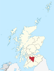
Category:Rivers of South Lanarkshire
Jump to navigation
Jump to search
Wikimedia category | |||||
| Upload media | |||||
| Instance of | |||||
|---|---|---|---|---|---|
| Category combines topics | |||||
| South Lanarkshire | |||||
local government area of Scotland | |||||
| Instance of | |||||
| Part of |
| ||||
| Location | Scotland | ||||
| Capital | |||||
| Legislative body |
| ||||
| Inception |
| ||||
| Population |
| ||||
| Area |
| ||||
 | |||||
Subcategories
This category has the following 24 subcategories, out of 24 total.
A
C
- Calder Water, Strathaven (13 F)
- Camps Water (5 F)
D
- Daer Water (16 F)
- Duneaton Water (28 F)
E
- Elvan Water (12 F)
F
G
- Garrion Burn (7 F)
- Glengavel Water (3 F)
I
L
M
N
- North Medwin (14 F)
P
- Poniel Water (5 F)
R
S
W
- Westruther Burn (4 F)
Media in category "Rivers of South Lanarkshire"
The following 26 files are in this category, out of 26 total.
-
Bothwell Castle - geograph.org.uk - 377698.jpg 640 × 427; 72 KB
-
Cander Water - geograph.org.uk - 276677.jpg 480 × 640; 268 KB
-
Cander Water - geograph.org.uk - 3948049.jpg 640 × 480; 323 KB
-
Gabions by the Logan Water - geograph.org.uk - 691513.jpg 640 × 480; 105 KB
-
Little Calder - geograph.org.uk - 995151.jpg 480 × 640; 210 KB
-
Little Calder Near Caldergreen - geograph.org.uk - 794399.jpg 480 × 640; 237 KB
-
Meander on the Shortcleuch Water - geograph.org.uk - 1004339.jpg 640 × 480; 75 KB
-
Portrail Water - geograph.org.uk - 719693.jpg 640 × 480; 154 KB
-
Portrail Water towards Overfingland - geograph.org.uk - 719684.jpg 640 × 480; 132 KB
-
Snaip Bridge - geograph.org.uk - 630257.jpg 640 × 480; 94 KB
-
The Stanley - geograph.org.uk - 525346.jpg 640 × 480; 161 KB
-
Bottomess Wood - geograph.org.uk - 64226.jpg 640 × 480; 108 KB
-
Culter Water. - geograph.org.uk - 135660.jpg 640 × 480; 78 KB
-
Elvan Water - geograph.org.uk - 134747.jpg 640 × 480; 81 KB
-
Little Calder in Whitelee Forest - geograph.org.uk - 154639.jpg 640 × 480; 128 KB
-
Meandering Duneaton Water - geograph.org.uk - 341641.jpg 640 × 480; 181 KB
-
Midlock Water - geograph.org.uk - 375642.jpg 640 × 480; 161 KB
-
Mouse Water - geograph.org.uk - 617237.jpg 640 × 480; 144 KB
-
Mouse Water near Cleghorn - geograph.org.uk - 365354.jpg 427 × 640; 193 KB
-
Mouse Water near Lockhart Mill - geograph.org.uk - 617236.jpg 640 × 480; 177 KB
-
Rapids Near Hazelbank - geograph.org.uk - 143002.jpg 640 × 480; 178 KB
-
River Deposition - geograph.org.uk - 151475.jpg 640 × 480; 66 KB
-
View from Oggscastle Bridge - geograph.org.uk - 151346.jpg 640 × 480; 126 KB
-
View Up Valley of Duneaton Water - geograph.org.uk - 342345.jpg 640 × 480; 201 KB


