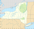
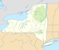
Category:Rivers of New York (state)
Jump to navigation
Jump to search
States of the United States: Alabama · Alaska · Arizona · Arkansas · California · Colorado · Connecticut · Delaware · Florida · Georgia · Hawaii · Idaho · Illinois · Indiana · Iowa · Kansas · Kentucky · Louisiana · Maine · Maryland · Massachusetts · Michigan · Minnesota · Mississippi · Missouri · Montana · Nebraska · Nevada · New Hampshire · New Jersey · New Mexico · New York · North Carolina · North Dakota · Ohio · Oklahoma · Oregon · Pennsylvania · Rhode Island · South Carolina · South Dakota · Tennessee · Texas · Utah · Vermont · Virginia · Washington · West Virginia · Wisconsin · Wyoming – Washington, D.C.
Guam · Puerto Rico
Guam · Puerto Rico
Wikimedia category | |||||
| Upload media | |||||
| Instance of | |||||
|---|---|---|---|---|---|
| Category combines topics | |||||
| Category contains | |||||
| New York | |||||
state of the United States of America | |||||
| Pronunciation audio | |||||
| Instance of |
| ||||
| Part of | |||||
| Named after | |||||
| Location |
| ||||
| Located in or next to body of water | |||||
| Capital | |||||
| Legislative body | |||||
| Executive body | |||||
| Highest judicial authority | |||||
| Head of government |
| ||||
| Inception |
| ||||
| Highest point | |||||
| Population |
| ||||
| Area |
| ||||
| Elevation above sea level |
| ||||
| Replaces |
| ||||
| Different from | |||||
| Maximum temperature record |
| ||||
| Minimum temperature record |
| ||||
| official website | |||||
 | |||||
Subcategories
This category has the following 122 subcategories, out of 122 total.
*
+
.
A
B
- Beaver River (New York) (14 F)
- Bog River (6 F)
- Boreas River (3 F)
- Bowmans Creek (2 F)
- Brimstone Creek (2 F)
- Broadstreet Hollow Creek (1 F)
C
- Caroga Creek (1 F)
- Chemung River (13 F)
- Chenango River (9 F)
- Cripple Creek (New York) (2 F)
D
E
- East Canada Creek (2 F)
- East Kill (5 F)
- East Stony Creek (2 F)
F
G
H
- Hayden Creek (New York) (1 F)
- Herkimer Creek (1 F)
- Holmes Lake Outlet (1 F)
J
- Jackson Creek (6 F)
K
- Kunjamuk River (1 F)
M
- Maritje Kill (8 F)
- Mettawee River (1 F)
- Mine Kill (2 F)
N
- North Winfield Creek (1 F)
- Nowadaga Creek (5 F)
O
- Oak Orchard Creek (18 F)
- Oaks Creek (4 F)
- Oneida Creek (1 F)
- Oneida River (4 F)
- Otego Creek (1 F)
P
- Piseco Outlet (2 F)
- Poesten Kill (11 F)
R
S
- Salmon River (New York) (16 F)
- Seneca River (New York) (7 F)
- South Branch Moose River (4 F)
- Sprite Creek (1 F)
T
- Tibbetts Brook (24 F)
- Tin Brook (3 F)
- Tioughnioga River (10 F)
- Twitchell Creek (7 F)
U
- Unadilla River (3 F)
- Uphill Brook (2 F)
W
- Wappinger Creek (10 F)
Media in category "Rivers of New York (state)"
The following 109 files are in this category, out of 109 total.
-
1867 Beers Map of Yonkers - Tibbetts Brook 01.jpg 3,000 × 3,703; 2.71 MB
-
1867 Beers Map of Yonkers - Tibbetts Brook 02.jpg 1,701 × 2,575; 1.3 MB
-
1867 Beers Map of Yonkers - Tibbetts Brook 03.jpg 1,701 × 2,575; 1.29 MB
-
377 lachute river.jpg 2,112 × 2,816; 3.56 MB
-
A kayaker on the W. Branch of Sacandaga.jpg 4,898 × 3,266; 2.33 MB
-
Adirondack Afternoon - Flickr - Mobilus In Mobili.jpg 5,472 × 3,648; 29.49 MB
-
Austinburg Bridge.jpg 640 × 480; 105 KB
-
Autumn Trees 2.JPG 4,288 × 3,216; 3.52 MB
-
Bashakill.jpg 3,264 × 2,448; 2.53 MB
-
Batten Kill and Tributaries 2.jpg 891 × 600; 90 KB
-
Batten Kill Tributaries.jpg 891 × 600; 90 KB
-
Batten Kill.png 1,017 × 684; 64 KB
-
Bog River Flow, St Lawrence County, NY.JPG 3,264 × 2,448; 4.51 MB
-
Bronxville NY Bronx River.jpg 865 × 368; 169 KB
-
Canacadea Creek Hornell NY.jpg 800 × 464; 452 KB
-
Chautauqua Belle on the Chadakoin River.jpg 1,373 × 1,099; 340 KB
-
Cowanesque River.jpg 2,560 × 1,920; 954 KB
-
Coxing Kill (14121234518).jpg 2,248 × 4,000; 5.1 MB
-
Coxing Kill (15356160170).jpg 3,648 × 5,472; 4.71 MB
-
Coxing Kill (15541799675).jpg 5,472 × 3,648; 4.12 MB
-
Dwaar Kill from Bruyn Turnpike.jpg 1,719 × 2,112; 3.21 MB
-
Earthen Dam top reverse view.JPG 2,058 × 1,372; 2.59 MB
-
East Canada Creek, New York - Apr. 2014 (13987345770).jpg 1,024 × 768; 214 KB
-
Fast flowing Schoarie Creek, Esperance, NY (13603475924).jpg 1,024 × 768; 219 KB
-
Fingerprint of water in Prospect Park.jpg 4,096 × 3,072; 3.93 MB
-
FMIB 42062 Stocking Halfway Brook, Near Saranac Lake.jpeg 1,341 × 773; 417 KB
-
FMIB 43079 Undeveloped Water Power on the Indian River.jpeg 1,539 × 1,139; 666 KB
-
FMIB 43080 Upper Schroon River Valley, a well forested drainage area.jpeg 1,535 × 1,123; 687 KB
-
FMIB 43205 Trees on Outlet Bay Thrown by Ice.jpeg 811 × 1,162; 300 KB
-
From the 7 Train 18 - Corona Shops.jpg 5,472 × 3,648; 4.27 MB
-
From the 7 Train 19 - Flushing River.jpg 5,472 × 3,648; 4.43 MB
-
From the 7 Train 20 - Flushing River.jpg 5,472 × 3,648; 2.97 MB
-
From the 7 Train 21 - Flushing River & Van Wyck.jpg 5,472 × 3,648; 4.01 MB
-
From the 7 Train 22 - Van Wyck & Skyview Center.jpg 5,472 × 3,648; 4.28 MB
-
Jessup River in Aug 2020 from a canoe.jpg 4,272 × 2,848; 13.47 MB
-
La Chute - 2021 - 471.jpg 4,272 × 2,848; 17.96 MB
-
MacNaughton Run.JPG 683 × 566; 67 KB
-
Mad River NY.jpg 3,024 × 4,032; 3.53 MB
-
Mamaroneck River jeh.JPG 3,072 × 2,304; 1.26 MB
-
Marshy End of Cedar River Flow.jpg 1,024 × 768; 154 KB
-
Marty Plante on the Big Drop, Schroon River, April 2019.jpg 2,257 × 1,475; 408 KB
-
Mettawee River.jpg 3,992 × 2,995; 12.21 MB
-
Mill Bridge PC jeh.JPG 3,072 × 2,304; 648 KB
-
Muddy Kill.jpg 1,728 × 2,355; 956 KB
-
Mushrooms on tree beside River.jpg 1,600 × 1,067; 1.12 MB
-
Naples Creek Image.jpg 3,264 × 2,448; 1.63 MB
-
Near Ramapo Station, Eerie Railway.jpg 2,488 × 1,584; 950 KB
-
Neversink river.jpg 685 × 1,024; 514 KB
-
New York State Route 22 New York State Route 22 (35881151856).jpg 4,608 × 3,456; 7.46 MB
-
New York State Route 22 New York State Route 22 (35881156316).jpg 4,608 × 3,456; 7.42 MB
-
Ninemile.jpg 600 × 800; 293 KB
-
Nissequogue River Delta.jpg 3,504 × 2,336; 3.9 MB
-
Nissequogue River.jpg 2,591 × 1,522; 683 KB
-
NormansKill.png 705 × 413; 40 KB
-
North Country Road on the Wading River Green.JPG 5,152 × 3,864; 7.75 MB
-
NY 171 bridge in Frankfort.jpg 640 × 480; 69 KB
-
Bogg River looking west (NYPL b11708219-G91F094 074F).tiff 2,988 × 1,728; 14.77 MB
-
The Outlet, Upper St. Regis Lakes. N. Y (NYPL b12647398-66801).tiff 2,440 × 1,492; 10.42 MB
-
On the St. Regis River, New York (NYPL b12647398-66802).tiff 2,424 × 1,519; 10.54 MB
-
Oak Orchard River - Route 279.jpg 2,304 × 1,728; 1.37 MB
-
Otter Kill in Hamptonburgh, NY.jpg 1,578 × 1,933; 799 KB
-
Bowlder above Artists Grotto, Palensville, by J. Loeffler 2.jpg 2,619 × 1,303; 1.1 MB
-
Bowlder above Artists Grotto, Palensville, by J. Loeffler.jpg 2,610 × 1,321; 920 KB
-
Popolopen Creek, Gorge, & Torne, Highlands, NY.JPG 3,872 × 2,592; 2.41 MB
-
River near Orgon Mountain, Piseco Road, New York - panoramio.jpg 3,008 × 2,000; 3.8 MB
-
River, tree and bridge.jpg 1,600 × 1,067; 1.29 MB
-
Riviere Hinchinbrooke.jpg 2,414 × 3,200; 4.11 MB
-
Saw kill river (west).jpg 4,288 × 2,848; 6.11 MB
-
Schroon River.jpg 4,272 × 2,848; 1.78 MB
-
Shawangunk Kill.jpg 806 × 715; 256 KB
-
South Sandy Creek at Lakeview WMA.jpg 3,088 × 2,056; 2.75 MB
-
St Regis River from Azure Mtn.jpg 1,434 × 950; 505 KB
-
St-Regis-Falls NY 2.JPG 2,048 × 1,536; 925 KB
-
Stark Rd Stream (6871736038).jpg 1,024 × 686; 275 KB
-
Stream - panoramio - dans362.jpg 3,648 × 2,736; 2.91 MB
-
Suspension bridge over river.jpg 1,600 × 1,067; 1.45 MB
-
Tannery Brook from Tinker Street.jpg 3,024 × 4,032; 4.2 MB
-
Ten Mile River.jpg 1,536 × 2,048; 1.55 MB
-
Tin Brook, Walden, NY.jpg 2,146 × 1,838; 4.03 MB
-
Upper Fall Winter.jpg 600 × 398; 54 KB
-
USA New York rivers locator map with grid.svg 900 × 600; 664 KB
-
USA New York rivers locator map.svg 900 × 600; 437 KB
-
USA New York rivers NAD27 locator map with grid.svg 900 × 750; 561 KB
-
USA New York rivers NAD27 locator map.svg 900 × 750; 453 KB
-
View from the Washington Street Bridge, Jamestown, New York - 20210131 - 01.jpg 5,567 × 3,127; 5.15 MB
-
View from the Washington Street Bridge, Jamestown, New York - 20210131 - 02.jpg 3,980 × 2,387; 2.7 MB
-
VlomanKill.png 307 × 277; 15 KB
-
W. Branch of Sacandaga - 279.jpg 5,840 × 3,894; 23.43 MB
-
Warrensburg Hydroelectric Dam.jpg 4,032 × 3,024; 2.79 MB
-
Westsacandaga.jpg 2,048 × 1,536; 1.43 MB
-
While Lake Brook in Sullivan County of New York State, USA.jpg 6,000 × 4,000; 8.31 MB
-
WoodCreekNY-June.JPG 4,032 × 3,024; 2.35 MB
-
Wpdms ev26188 long island sound.jpg 316 × 218; 18 KB
-
Wpdms usgs photo fresh kills.jpg 460 × 350; 68 KB
-
Artists Grotto, Palensville, by J. Loeffler 2.jpg 2,619 × 1,307; 1.04 MB
-
Artists Grotto, Palensville, by J. Loeffler.jpg 2,607 × 1,315; 1.03 MB
-
Below Belle Falls, Palensville, by J. Loeffler.jpg 2,615 × 1,307; 1.01 MB


