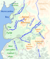
Category:Rivers of Lancashire
Jump to navigation
Jump to search
Ceremonial counties of England: Bedfordshire · Berkshire · Buckinghamshire · Cambridgeshire · Cheshire · Cornwall · Cumbria · Derbyshire · Devon · Dorset · Durham · East Riding of Yorkshire · East Sussex · Essex · Gloucestershire · Greater London · Greater Manchester · Hampshire · Herefordshire · Hertfordshire · Isle of Wight · Kent · Lancashire · Leicestershire · Lincolnshire · Merseyside · Norfolk · North Yorkshire · Northamptonshire · Northumberland · Nottinghamshire · Oxfordshire · Rutland · Shropshire · Somerset · South Yorkshire · Staffordshire · Suffolk · Surrey · Tyne and Wear · Warwickshire · West Midlands · West Sussex · West Yorkshire · Wiltshire · Worcestershire
City-counties: Bristol ·
Former historic counties: Huntingdonshire ·
Other former counties:
City-counties: Bristol ·
Former historic counties: Huntingdonshire ·
Other former counties:
Wikimedia category | |||||
| Upload media | |||||
| Instance of | |||||
|---|---|---|---|---|---|
| Category combines topics | |||||
| Lancashire | |||||
ceremonial county in North-West England, United Kingdom | |||||
| Instance of | |||||
| Part of | |||||
| Location |
| ||||
| Capital | |||||
| Population |
| ||||
| Area |
| ||||
| Different from | |||||
| Said to be the same as | Lancashire (historic county of England, ceremonial county of England, 1844) | ||||
| official website | |||||
 | |||||
Subcategories
This category has the following 47 subcategories, out of 47 total.
B
- River Brennand (8 F)
- River Brock (76 F)
C
- River Calder, Wyre (15 F)
- River Cocker, Lancashire (20 F)
D
G
- Green Brook, Lancashire (13 F)
- River Greta (Lune) (18 F)
H
I
K
L
- Limestone Brook (9 F)
- River Lostock (10 F)
- River Loud (10 F)
M
- Mearley Brook (29 F)
O
P
R
- River Roddlesworth (8 F)
- River Roeburn (6 F)
S
- Sabden Brook (11 F)
- River Spodden (16 F)
T
- River Tawd (4 F)
- Three Pools Waterway (1 F)
W
Y
Media in category "Rivers of Lancashire"
The following 14 files are in this category, out of 14 total.
-
Broad Fleet - geograph.org.uk - 1563171.jpg 640 × 480; 47 KB
-
Ease Gill - geograph.org.uk - 73697.jpg 640 × 440; 104 KB
-
Ings Beck - geograph.org.uk - 166939.jpg 640 × 480; 132 KB
-
Rivers of Lancashire.png 600 × 714; 400 KB
-
Topography of Lancashire.png 682 × 812; 235 KB
-
White Coppice Quarry - 7315918404.jpg 1,024 × 768; 1,018 KB
-
Whitendale - geograph.org.uk - 567516.jpg 640 × 480; 147 KB
-
Bleadale Water - geograph.org.uk - 607711.jpg 640 × 480; 120 KB
-
Ease Gill - geograph.org.uk - 481863.jpg 640 × 480; 109 KB
-
Ease Gill Kirk - geograph.org.uk - 485178.jpg 640 × 480; 102 KB
-
On the wing - geograph.org.uk - 313802.jpg 640 × 479; 134 KB
-
River Goit from a bridge at White Coppice - geograph.org.uk - 131048.jpg 480 × 640; 129 KB
-
Whitendale River - geograph.org.uk - 39964.jpg 640 × 480; 68 KB


