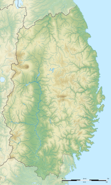
Category:Rivers of Iwate prefecture
Jump to navigation
Jump to search
日本語: 岩手県の河川
English: Rivers of Iwate prefecture, Japan
Wikimedia category | |||||
| Upload media | |||||
| Instance of | |||||
|---|---|---|---|---|---|
| Category combines topics | |||||
| Iwate Prefecture | |||||
prefecture of Japan | |||||
| Instance of | |||||
| Named after |
| ||||
| Location | Japan | ||||
| Capital | |||||
| Legislative body |
| ||||
| Executive body | |||||
| Anthem |
| ||||
| Head of government |
| ||||
| Mascot |
| ||||
| Legal form |
| ||||
| Highest point | |||||
| Population |
| ||||
| Area |
| ||||
| Replaces |
| ||||
| official website | |||||
 | |||||
Subcategories
This category has the following 14 subcategories, out of 14 total.
Media in category "Rivers of Iwate prefecture"
The following 47 files are in this category, out of 47 total.
-
A snowy creek in Iwate.jpg 2,816 × 2,112; 1.09 MB
-
A snowy river in Iwate 01.jpg 1,920 × 1,080; 872 KB
-
A snowy river in Iwate 02.jpg 2,816 × 2,112; 1.33 MB
-
A snowy river in Iwate 03.jpg 2,816 × 2,112; 1.25 MB
-
A snowy river in Iwate 04.jpg 2,816 × 2,112; 1.29 MB
-
A snowy river in Iwate.jpg 1,920 × 1,080; 898 KB
-
A snowy rocky river in Iwate 01.jpg 2,816 × 2,112; 1.34 MB
-
A snowy rocky river in Iwate 02.jpg 2,816 × 2,112; 1.21 MB
-
A snowy rocky river in Iwate.jpg 2,816 × 2,112; 1.35 MB
-
Cherries on the Sarugaishi.jpg 800 × 542; 131 KB
-
Hayamameganebridge.jpg 1,600 × 1,200; 834 KB
-
Kakkonda River and Kakkonda no Oiwaya cliff columnar joints. A.jpg 6,000 × 4,000; 9.82 MB
-
Kakkonda River and Kakkonda no Oiwaya cliff columnar joints. B.jpg 6,000 × 4,000; 10.99 MB
-
Kakkonda River and Kakkonda no Oiwaya cliff columnar joints. C.jpg 6,000 × 4,000; 14.06 MB
-
Kappa-buchi01s3872.jpg 3,872 × 2,592; 3.75 MB
-
Kappa-buchi02s3872.jpg 3,872 × 2,592; 3.45 MB
-
Kappa-buchi03s3872.jpg 3,872 × 2,592; 3.73 MB
-
Kesenriver001.JPG 1,600 × 1,200; 846 KB
-
Kujiriver.jpg 3,456 × 2,592; 3.32 MB
-
Mabechi river.jpg 4,000 × 3,000; 1.78 MB
-
Mirror rock in Sumida.jpg 1,600 × 1,200; 785 KB
-
Petrified wood exposed on the riverbed of the upstream tributary of the Nesori River. A.jpg 6,000 × 4,000; 9.16 MB
-
Petrified wood exposed on the riverbed of the upstream tributary of the Nesori River. B.jpg 6,000 × 4,000; 12.94 MB
-
Petrified wood exposed on the riverbed of the upstream tributary of the Nesori River. C.jpg 6,000 × 4,000; 12.53 MB
-
Petrified wood exposed on the riverbed of the upstream tributary of the Nesori River. D.jpg 6,000 × 4,000; 12.9 MB
-
Petrified wood exposed on the riverbed of the upstream tributary of the Nesori River. E.jpg 6,000 × 4,000; 12.72 MB
-
Rokando Limestone Cave entrance and Kazakoi Bridge, in 2010-03-06.jpg 1,800 × 2,400; 1.83 MB
-
Rokando Limestone Cave entrance and Kesen River, in 2010-03-06.jpg 2,400 × 1,800; 2.01 MB
-
Sumita Matsubi Bridge facing north.jpg 4,000 × 2,252; 4.38 MB
-
Sumita Matsubi Bridge wide shot.jpg 4,000 × 2,252; 4.64 MB
-
View of a snowy river in Iwate.jpg 2,816 × 2,112; 1.29 MB
-
Waga river map copy.jpg 477 × 564; 76 KB
-
コメガモリ沢.jpg 4,608 × 3,456; 4.38 MB
-
丹藤川 Tando river - panoramio.jpg 1,600 × 1,071; 901 KB
-
丹藤川の流れ Tando river - panoramio.jpg 1,071 × 1,600; 906 KB
-
丹藤川渓流 Tando gorge - panoramio.jpg 1,071 × 1,600; 841 KB
-
久慈川 - panoramio (2).jpg 5,472 × 3,648; 10.74 MB
-
仙人峠駅前橋台跡.jpg 1,568 × 1,044; 885 KB
-
台川 Dai River - panoramio.jpg 1,071 × 1,600; 928 KB
-
志戸平温泉の渓流 - panoramio.jpg 2,592 × 1,944; 1.17 MB
-
県道6号線 - panoramio (4).jpg 1,600 × 1,200; 391 KB
-
県道6号線 - panoramio (5).jpg 1,600 × 1,200; 310 KB
-
県道6号線 - panoramio (8).jpg 1,600 × 1,200; 308 KB
-
馬渕川 - panoramio.jpg 1,600 × 1,200; 389 KB


