Category:Rivers of Dumfries and Galloway
Jump to navigation
Jump to search
Wikimedia category | |||||
| Upload media | |||||
| Instance of | |||||
|---|---|---|---|---|---|
| Category combines topics | |||||
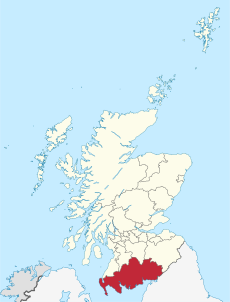
| Dumfries and Galloway | |||||
unitary council area of Scotland | |||||
| Instance of | |||||
| Location | Scotland | ||||
| Capital | |||||
| Legislative body |
| ||||
| Inception |
| ||||
| Population |
| ||||
| Area |
| ||||
| official website | |||||
 | |||||
Subcategories
This category has the following 46 subcategories, out of 46 total.
A
B
- Black Esk (16 F)
C
- Cample Water (4 F)
D
- Daer Water (16 F)
E
H
K
- Kello Water (6 F)
- Kinnel Water (11 F)
L
- Lochar Water (10 F)
M
- Mein Water (1 F)
N
O
- Old Mill Burn, Newbie (9 F)
P
- Pow Water (9 F)
S
- Scaur Water (14 F)
- Shinnel Water (2 F)
- Southwick Water (3 F)
- Spango Water (4 F)
- Stennies Water (6 F)
T
- Tarf Water (34 F)
- Tarras Water (11 F)
U
W
- Wamphray Water (7 F)
- White Esk (16 F)
Media in category "Rivers of Dumfries and Galloway"
The following 17 files are in this category, out of 17 total.
-
A Ford Across Carrick Burn - geograph.org.uk - 1113984.jpg 640 × 480; 191 KB
-
Confluence of a burn and a river - geograph.org.uk - 1574843.jpg 640 × 471; 107 KB
-
Dr. Graham's Garden - panoramio.jpg 1,600 × 1,200; 625 KB
-
Loups of Barnshangan - geograph.org.uk - 633220.jpg 640 × 423; 86 KB
-
River Near Kirkton - geograph.org.uk - 354735.jpg 480 × 640; 200 KB
-
Tarf Water - geograph.org.uk - 1244397.jpg 640 × 428; 61 KB
-
The Birnock Water at Moffat - geograph.org.uk - 763352.jpg 640 × 480; 86 KB
-
The Black Water's of Dee - geograph.org.uk - 1475324.jpg 640 × 447; 109 KB
-
The Lake from Wellington Bridge, Kirkton - geograph.org.uk - 354728.jpg 480 × 640; 182 KB
-
The Unthank Burn - geograph.org.uk - 742124.jpg 640 × 480; 131 KB
-
View of Snademill (geograph 3629164).jpg 1,600 × 1,060; 757 KB
-
Water of Ae flowing south - geograph.org.uk - 1067303.jpg 640 × 480; 99 KB
-
Water of Tarf from Barlae Bridge - geograph.org.uk - 619391.jpg 640 × 480; 131 KB
-
Water of Tarf from Barlae Bridge - geograph.org.uk - 619393.jpg 640 × 480; 106 KB
-
Waterfall on the Louran Burn - geograph.org.uk - 507292.jpg 640 × 480; 183 KB
-
Waterfall on The Mill Burn - geograph.org.uk - 513677.jpg 640 × 480; 176 KB
-
The mouth of the Alticry - geograph.org.uk - 212454.jpg 640 × 480; 63 KB


