Category:Rivers in Ukraine in 2015
Jump to navigation
Jump to search
Subcategories
This category has the following 7 subcategories, out of 7 total.
D
- Danube in Ukraine in 2015 (2 F)
- Dnieper in Ukraine in 2015 (1 F)
- Dniester in Ukraine in 2015 (5 F)
H
S
- Southern Bug in 2015 (35 F)
- Styr (river) in Ukraine in 2015 (13 F)
W
- Western Bug in Ukraine in 2015 (11 F)
Media in category "Rivers in Ukraine in 2015"
The following 52 files are in this category, out of 52 total.
-
 Frozen river.jpg 2,260 × 2,260; 1.98 MB
-
 Kilov-Rudjakiv.jpg 2,000 × 1,500; 1.14 MB
-
 NNP Dnistrovskyi Canyon m RB.jpg 3,195 × 4,000; 7.13 MB
-
 Piskivka river in Ukraine.jpg 2,912 × 1,840; 5.74 MB
-
 Pluzhne Romanov valley.jpg 2,736 × 2,052; 1.5 MB
-
 Sylnia river.jpg 4,525 × 2,952; 11.64 MB
-
 Waterfall on Kamjanka river Apostolove district Dnipropetrovsk region Ukraine DSCF7297.jpg 3,264 × 2,448; 4.72 MB
-
 Waterfall on Kamjanka river, Apostolove district, Dnipropetrovsk region, Ukraine.jpg 3,264 × 2,448; 4.86 MB
-
 Великі пороги.jpg 5,183 × 2,918; 11.36 MB
-
 Весеннее пробуждение.jpg 960 × 1,280; 265 KB
-
 Вечір на Стадні, село Стави - panoramio (1).jpg 2,592 × 1,456; 859 KB
-
 Вечір на Стадні, село Стави - panoramio (2).jpg 2,592 × 1,456; 808 KB
-
 Вечір на Стадні, село Стави - panoramio.jpg 2,592 × 1,456; 843 KB
-
 Дертка 2015 2957.jpg 2,698 × 1,904; 1.16 MB
-
 Каньйон в Южноукраїнську 01.jpg 4,000 × 3,000; 6.74 MB
-
 Каньйон річки Південний Буг.jpg 4,000 × 3,000; 6.76 MB
-
 Краса течії.jpg 4,608 × 2,439; 5.6 MB
-
 Кришталевий Айдар.jpg 2,448 × 3,264; 4.03 MB
-
 Ландшафти Дніпра.jpg 2,819 × 1,993; 2.18 MB
-
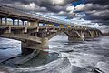 Міст Метро (Київ).jpg 2,732 × 1,821; 2 MB
-
 Миколаївська-церква-1.jpg 2,500 × 1,871; 1.36 MB
-
 На березі річки Горинь.jpg 900 × 843; 657 KB
-
 На р. Сула вид на м. Ромни.jpg 3,264 × 2,176; 1.61 MB
-
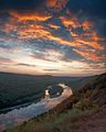
 Осінній ранок на схилі Південного Бугу.jpg 3,200 × 2,125; 7.54 MB
-
 Остріг 2015 022.jpg 2,736 × 2,052; 1.97 MB
-
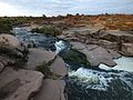
 Південний Буг, Южноукраїнськ.jpg 4,000 × 3,000; 7.14 MB
-
 Р. Прип'ять с. Любязь.jpg 2,048 × 1,536; 1.15 MB
-
 Р. Стугна, м. Українка.jpg 5,184 × 3,456; 7.31 MB
-
 Р.Теребля НПП Синевир.jpg 5,184 × 3,456; 2.13 MB
-
 Ріка Черемош в районі сел. Ростоки.jpg 4,000 × 3,000; 3.89 MB
-
 Ріка Черемош підрізає одну з середньовисотних гір разом з автотрасою Вижниця-Путила.jpg 4,000 × 3,000; 3.1 MB
-
 Річка Айдар восени.jpg 3,264 × 2,448; 3.23 MB
-
 Річка Айдар.jpg 3,264 × 2,448; 3.51 MB
-
 Річка Вовча в тумані.jpg 1,440 × 1,080; 615 KB
-
 Річка Утка.jpg 4,425 × 2,950; 1.01 MB
-
 Ранок над Південним Бугом.jpg 4,507 × 2,578; 8.14 MB
-
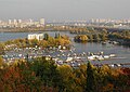
 Речной флот на Днепре - panoramio.jpg 1,280 × 960; 1,019 KB
-
 Сіверський Дінець.jpg 4,256 × 2,344; 9.79 MB
-
 Світанок на Бузькому Гарді.jpg 3,200 × 2,100; 7.15 MB
-
 Семена камыша летят по ветру на берегу реки.png 1,728 × 1,152; 2.75 MB
-
 Сивір 2015 2955.jpg 2,736 × 2,052; 1.32 MB
-
 Синевір. Природній парк (4).jpg 2,464 × 1,632; 2.1 MB
-
 Синевір. Природній парк (8).jpg 2,464 × 1,632; 2.07 MB
-
 Синевир. 9.jpg 31,228 × 8,015; 216.45 MB
-
 Синевир. Національний природний парк 01.jpg 3,264 × 2,448; 2.57 MB
-
 Синевир. Національний природний парк 03.jpg 3,264 × 2,448; 2.75 MB
-
 Скалистый берег Днепра - panoramio.jpg 1,700 × 905; 1,021 KB
-
 Скалы - panoramio (100).jpg 1,280 × 795; 735 KB
-
 Старый Днепр - panoramio.jpg 1,280 × 880; 982 KB
-
 Сула біля м. Ромни.jpg 3,264 × 2,176; 1.81 MB
-
 Чарівний Айдар влітку.jpg 3,264 × 2,448; 4.52 MB
-
 Четвертий перехід.jpg 5,184 × 3,456; 9.2 MB


.jpg)
.jpg)


.jpg)


.jpg)
.jpg)


.jpg)


