Category:River South Esk, Angus
Jump to navigation
Jump to search
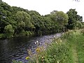
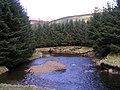
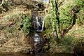
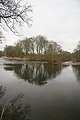
The River South Esk, Angus, Scotland, flows into the North Sea below Brechin.
river in Angus, Scotland, UK, flows into the North Sea at Montrose  | |||||
| Upload media | |||||
| Instance of | |||||
|---|---|---|---|---|---|
| Location | Angus, Scotland | ||||
| Length |
| ||||
| Mouth of the watercourse |
| ||||
 | |||||
Subcategories
This category has the following 7 subcategories, out of 7 total.
Media in category "River South Esk, Angus"
The following 77 files are in this category, out of 77 total.
-
 Along the Esk - geograph.org.uk - 907442.jpg 640 × 480; 107 KB
-
 Bend In the River - geograph.org.uk - 799914.jpg 640 × 480; 99 KB
-
-

-
 Cortachy In Scotland (22).jpg 750 × 1,000; 230 KB
-
 Cortachy In Scotland (7).jpg 1,000 × 750; 248 KB
-
 Cortachy In Scotland (9).jpg 1,000 × 750; 297 KB
-
 Dismantled Railway Bridge - geograph.org.uk - 1968270.jpg 640 × 480; 94 KB
-
 Ford across River South Esk - geograph.org.uk - 517302.jpg 427 × 640; 125 KB
-
 Forties Pipeline Booster Pumping Station - geograph.org.uk - 870444.jpg 640 × 402; 113 KB
-
 Giant Hogweed - geograph.org.uk - 517310.jpg 640 × 427; 120 KB
-
 Glen Clova - geograph.org.uk - 1744002.jpg 640 × 427; 227 KB
-
 Glen Clova from above Moulnie Craig - geograph.org.uk - 1003907.jpg 640 × 480; 50 KB
-
 Glen Clova near Moulzie - geograph.org.uk - 1055010.jpg 455 × 640; 107 KB
-
 Glen Doll - geograph.org.uk - 3427.jpg 640 × 395; 42 KB
-
 Island in the South Esk - geograph.org.uk - 1202735.jpg 427 × 640; 194 KB
-
 Island in the South Esk - geograph.org.uk - 1202747.jpg 427 × 640; 221 KB
-
 Justinhaugh (4).jpg 1,200 × 900; 310 KB
-

-
 Maryton, Montrose - geograph.org.uk - 719748.jpg 640 × 425; 61 KB
-
 Montrose viaduct 170433.jpg 1,024 × 768; 255 KB
-
 Near the head of the glen - geograph.org.uk - 1055017.jpg 640 × 462; 102 KB
-
 Old (New) Esk Bridge - geograph.org.uk - 37747.jpg 480 × 640; 84 KB
-
 Ordnance Survey Sheet NO 45 Forfar, Published 1957.jpg 7,365 × 7,540; 4.28 MB
-

-
 Over the River South Esk - geograph.org.uk - 1744565.jpg 427 × 640; 251 KB
-
 River Esk From Bridge.jpg 1,100 × 825; 277 KB
-
 River South Esk - geograph.org.uk - 1055026.jpg 453 × 640; 94 KB
-
 River South Esk - geograph.org.uk - 1744648.jpg 640 × 427; 236 KB
-
 River South Esk - geograph.org.uk - 3424.jpg 640 × 393; 25 KB
-
 River South Esk - geograph.org.uk - 500383.jpg 640 × 480; 58 KB
-
 River South Esk - geograph.org.uk - 676035.jpg 640 × 427; 55 KB
-
 River South Esk - geograph.org.uk - 799906.jpg 640 × 480; 72 KB
-
 River South Esk - geograph.org.uk - 828552.jpg 640 × 446; 74 KB
-
 River South Esk - geograph.org.uk - 828582.jpg 640 × 480; 88 KB
-
 River South Esk 01.jpg 3,024 × 4,032; 2.07 MB
-
 River South Esk 02.jpg 3,024 × 4,032; 1.47 MB
-
 River South Esk 03.jpg 3,024 × 4,032; 3.44 MB
-
 River South Esk At Glen Clova.jpg 1,100 × 825; 185 KB
-
 River South Esk at Montrose Harbour - geograph.org.uk - 1001801.jpg 640 × 427; 56 KB
-

-

-
 River South Esk in Glen Clova - geograph.org.uk - 1743682.jpg 640 × 427; 208 KB
-
 River South Esk near Acharn - geograph.org.uk - 650120.jpg 600 × 430; 69 KB
-
 River South Esk towards Moulzie - geograph.org.uk - 792833.jpg 640 × 480; 84 KB
-
 River South Esk, Middle Drums - geograph.org.uk - 1548230.jpg 640 × 481; 162 KB
-
 River South Esk, Middle Drums - geograph.org.uk - 1548236.jpg 640 × 480; 144 KB
-
 River South Esk. - geograph.org.uk - 117803.jpg 640 × 480; 59 KB
-
 Riverbank track - geograph.org.uk - 907461.jpg 480 × 640; 105 KB
-
 Scurdie ness.jpg 600 × 800; 259 KB
-
 Small pier, Ferryden - geograph.org.uk - 1544097.jpg 640 × 481; 118 KB
-
 South Esk - geograph.org.uk - 870449.jpg 430 × 640; 100 KB
-
 South Esk River Justinhaugh.jpg 1,000 × 750; 176 KB
-
 South Esk River near Dun - geograph.org.uk - 122405.jpg 640 × 475; 111 KB
-
 The mouth of the River South Esk - geograph.org.uk - 364702.jpg 640 × 480; 129 KB
-
 The River South Esk near Moulzie - geograph.org.uk - 410015.jpg 640 × 480; 119 KB
-
 The South Esk, Glen Clova. - geograph.org.uk - 516493.jpg 640 × 480; 51 KB
-
 Through the Valley - Flickr - Neillwphoto.jpg 5,829 × 3,875; 15.87 MB
-
 Upper Glen Clova - geograph.org.uk - 228994.jpg 640 × 480; 93 KB
-

-
 Wildlife Centre, Rossie - geograph.org.uk - 487534.jpg 480 × 640; 124 KB
-
 Glen Clova - geograph.org.uk - 170891.jpg 640 × 480; 68 KB
-
-
 River South Esk - geograph.org.uk - 173747.jpg 640 × 437; 166 KB
-
 River South Esk - geograph.org.uk - 222465.jpg 640 × 427; 264 KB
-
 River South Esk - geograph.org.uk - 410941.jpg 640 × 480; 142 KB
-
 River South Esk at Acharn - geograph.org.uk - 313612.jpg 600 × 399; 70 KB
-
 River South Esk at Aucharn - geograph.org.uk - 313617.jpg 600 × 399; 49 KB
-
 River South Esk at Gella Bridge - geograph.org.uk - 650112.jpg 600 × 450; 68 KB
-

-
 River South Esk. - geograph.org.uk - 118128.jpg 640 × 480; 115 KB
-
 South Esk from Cortachy Bridge - geograph.org.uk - 101339.jpg 640 × 480; 142 KB
-
 South Esk River - geograph.org.uk - 115824.jpg 640 × 475; 103 KB
-
 South Esk. - geograph.org.uk - 118134.jpg 640 × 480; 98 KB
-
 The Lurgies on South Esk River - geograph.org.uk - 110782.jpg 640 × 475; 72 KB
-
 The River South Esk - geograph.org.uk - 479514.jpg 480 × 640; 139 KB
-
 The River South Esk near Acharn - geograph.org.uk - 410022.jpg 640 × 480; 124 KB


.jpg)
.jpg)
.jpg)


.jpg)


_Esk_Bridge_-_geograph.org.uk_-_37747.jpg)


