Category:River Ayr Way
Jump to navigation
Jump to search

long-distance path in southern Scotland  | |||||
| Upload media | |||||
| Instance of |
| ||||
|---|---|---|---|---|---|
| Location | East Ayrshire, Scotland | ||||
| |||||
The River Ayr Way is a public footpath in East Ayrshire and South Ayrshire, along the River Ayr, in southwestern Scotland.
Media in category "River Ayr Way"
The following 77 files are in this category, out of 77 total.
-
 Ash (Fraxinus excelsior) coppiced bowl.JPG 4,608 × 3,456; 3.64 MB
-
 Bridge and boardwalk on the River Ayr Way - geograph.org.uk - 519616.jpg 640 × 480; 129 KB
-
 Bridge on the River Ayr Way - geograph.org.uk - 464395.jpg 640 × 480; 86 KB
-
 Crossing the Road - geograph.org.uk - 464371.jpg 640 × 478; 119 KB
-
 Early Purple Orchid - geograph.org.uk - 464608.jpg 450 × 600; 65 KB
-
 Following An Old Meander - geograph.org.uk - 578946.jpg 640 × 480; 115 KB
-
 Footbridge on the River Ayr Way - geograph.org.uk - 851079.jpg 640 × 480; 132 KB
-
 Gadgirth Holm view, River Ayr, South Ayrshire, Scotland.jpg 4,896 × 2,752; 5 MB
-
 Haugh.JPG 2,288 × 1,712; 1.66 MB
-
 Hazel, Corylus avellana. Epicormic growth. River Ayr. Holehouse Holm, East Ayrshire.jpg 4,896 × 2,752; 5.85 MB
-
 Lime (Tilia sps) frost crack.JPG 3,218 × 4,438; 6.38 MB
-
 Lime coppicing, Catrine.JPG 3,714 × 2,990; 6.52 MB
-
 Mill Lane - Haugh to Damhead.JPG 2,288 × 1,712; 2.27 MB
-
 New bridge on the River Ayr Way - geograph.org.uk - 500727.jpg 640 × 480; 89 KB
-
 Old Howford Bridge, River Ayr, Mauchline end arches.jpg 3,986 × 2,736; 2.57 MB
-
 Old Howford Bridge, River Ayr, Mauchline side wall supports.jpg 3,684 × 2,751; 3.32 MB
-
 Old Howford Bridge, River Ayr. Upstream view.jpg 4,896 × 2,752; 3.33 MB
-
 On The River Ayr Way - geograph.org.uk - 569697.jpg 640 × 480; 106 KB
-
 On The River Ayr Way - geograph.org.uk - 569701.jpg 640 × 469; 126 KB
-
 On The River Ayr Way - geograph.org.uk - 569712.jpg 446 × 600; 64 KB
-
 On The River Ayr Way - geograph.org.uk - 569727.jpg 640 × 466; 126 KB
-
 On The River Ayr Way - geograph.org.uk - 569736.jpg 640 × 480; 96 KB
-
 R. Ayr Walk - geograph.org.uk - 351882.jpg 640 × 426; 84 KB
-
 River Ayr at Holehouse Mill. Holehouse Holm, Sorn, East Ayrshire.jpg 4,896 × 2,752; 3.43 MB
-
 River Ayr Gorge woodlands - Ballochmyle.JPG 2,286 × 1,710; 3.27 MB
-
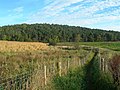
 River Ayr Way - geograph.org.uk - 347352.jpg 640 × 480; 127 KB
-
 River Ayr Way - geograph.org.uk - 347410.jpg 640 × 480; 161 KB
-
 River Ayr Way - geograph.org.uk - 347444.jpg 640 × 480; 149 KB
-
 River Ayr Way - geograph.org.uk - 347454.jpg 640 × 480; 195 KB
-
 River Ayr Way - geograph.org.uk - 350721.jpg 640 × 480; 188 KB
-
 River Ayr Way - geograph.org.uk - 360366.jpg 640 × 480; 130 KB
-
 River Ayr Way - geograph.org.uk - 360431.jpg 640 × 480; 147 KB
-
 River Ayr Way - geograph.org.uk - 360477.jpg 640 × 480; 119 KB
-
 River Ayr Way - geograph.org.uk - 360515.jpg 640 × 480; 145 KB
-
 River Ayr Way - geograph.org.uk - 360529.jpg 640 × 480; 156 KB
-
 River Ayr Way after Oswald's Bridge - geograph.org.uk - 347369.jpg 640 × 480; 162 KB
-
 River Ayr Way after Tarholm - geograph.org.uk - 347374.jpg 640 × 480; 175 KB
-
 River Ayr Way approaching Daldorch - geograph.org.uk - 347501.jpg 640 × 480; 144 KB
-

-
 River Ayr way approaching Wellwood Bridge - geograph.org.uk - 360544.jpg 640 × 480; 147 KB
-
 River Ayr Way at Annbank - geograph.org.uk - 347423.jpg 640 × 480; 180 KB
-
 River Ayr Way at Catrine - geograph.org.uk - 350739.jpg 640 × 480; 152 KB
-
 River Ayr Way at Catrine - geograph.org.uk - 350742.jpg 640 × 480; 167 KB
-
 River Ayr Way at Holm Fields - geograph.org.uk - 347359.jpg 640 × 480; 120 KB
-
 River Ayr Way at Tarholm Bridge - geograph.org.uk - 347387.jpg 640 × 480; 167 KB
-
 River Ayr Way at Wellflat Bank - geograph.org.uk - 347494.jpg 640 × 480; 190 KB
-
 River Ayr Way by Upper Wellwood - geograph.org.uk - 360494.jpg 640 × 480; 171 KB
-
 River Ayr Way near Auchincruive - geograph.org.uk - 347397.jpg 640 × 480; 180 KB
-
 River Ayr Way near Kames - geograph.org.uk - 360463.jpg 640 × 480; 138 KB
-
 River Ayr Way near Stair - geograph.org.uk - 347465.jpg 640 × 480; 142 KB
-
 River Ayr Way passes under the A76 - geograph.org.uk - 350734.jpg 640 × 480; 167 KB
-
 River Ayr Way Wellflat Bank - geograph.org.uk - 347512.jpg 640 × 480; 182 KB
-
 River Ayr Way, River Ayr and A70 road - geograph.org.uk - 360400.jpg 640 × 480; 212 KB
-
 Site of Glenbuck Station - geograph.org.uk - 464375.jpg 640 × 466; 104 KB
-
 Sorn Castle from the River Ayr Way - geograph.org.uk - 519591.jpg 640 × 480; 117 KB
-
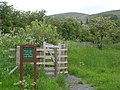
 Take to the Air on the Ayr Way - geograph.org.uk - 1537310.jpg 640 × 480; 125 KB
-
 Tarholm Bridge - geograph.org.uk - 764256.jpg 640 × 480; 93 KB
-
 Tarholm Bridge and the River Ayr Way - geograph.org.uk - 1247415.jpg 640 × 480; 123 KB
-
 The old Howford Bridge, River Ayr. An upstream view.jpg 4,026 × 2,184; 2.54 MB
-
 The old Howford Bridge, River Ayr. Catrine House side view.jpg 4,571 × 2,056; 2.68 MB
-
 The old Howford Bridge, River Ayr. Upstream view.jpg 4,417 × 2,228; 2.67 MB
-
 The old Wagonway Cutting - geograph.org.uk - 764244.jpg 640 × 480; 171 KB
-
 The River Ayr Way - geograph.org.uk - 1247376.jpg 640 × 480; 171 KB
-
 The River Ayr Way - geograph.org.uk - 1247426.jpg 640 × 480; 119 KB
-
 The River Ayr Way - geograph.org.uk - 464580.jpg 640 × 479; 102 KB
-
 The River Ayr Way - geograph.org.uk - 500771.jpg 480 × 640; 144 KB
-
 The River Ayr Way - geograph.org.uk - 569739.jpg 640 × 462; 97 KB
-
 The River Ayr Way - geograph.org.uk - 569745.jpg 640 × 480; 100 KB
-
 The River Ayr Way - geograph.org.uk - 569751.jpg 450 × 600; 106 KB
-
 The River Ayr Way - geograph.org.uk - 578945.jpg 640 × 478; 128 KB
-
 The River Ayr Way - geograph.org.uk - 734021.jpg 640 × 480; 146 KB
-
 The River Ayr Way - geograph.org.uk - 851084.jpg 640 × 480; 124 KB
-
 The River Ayr Way approaching Tarholm - geograph.org.uk - 1247420.jpg 640 × 480; 157 KB
-
 The River Ayr Way at Daldorch - geograph.org.uk - 1038230.jpg 640 × 480; 117 KB
-

-
 The River Ayr Way west of Catrine - geograph.org.uk - 734047.jpg 640 × 491; 136 KB
-
 Timber bridge on the River Ayr Way - geograph.org.uk - 500757.jpg 480 × 640; 83 KB
_coppiced_bowl.JPG)


_frost_crack.JPG)


