Category:Ridgeway National Trail in Oxfordshire
Jump to navigation
Jump to search

Media in category "Ridgeway National Trail in Oxfordshire"
The following 200 files are in this category, out of 368 total.
(previous page) (next page)-

-
 A misty Ridgeway - geograph.org.uk - 1172969.jpg 640 × 480; 112 KB
-

-
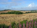
 Acres of wheat, Uffington Down - geograph.org.uk - 1370640.jpg 640 × 426; 110 KB
-
 Arable field on The Ridgeway - geograph.org.uk - 1395715.jpg 640 × 427; 65 KB
-
 Arable land north of The Ridgeway - geograph.org.uk - 1395722.jpg 640 × 427; 71 KB
-
 Ascending onto Swyncombe Downs - geograph.org.uk - 586566.jpg 640 × 480; 113 KB
-
-
 Aston Rowant Nature Reserve - geograph.org.uk - 745083.jpg 640 × 480; 114 KB
-
 B4494 on Middlehill Down - geograph.org.uk - 1006544.jpg 640 × 480; 55 KB
-
 Back of the Ridgeway - geograph.org.uk - 1629851.jpg 640 × 480; 71 KB
-
 Back to Mongewell - geograph.org.uk - 1728705.jpg 600 × 800; 173 KB
-
 Back to South Stoke - geograph.org.uk - 1323721.jpg 400 × 600; 63 KB
-
 Barley Crop - geograph.org.uk - 26237.jpg 640 × 480; 177 KB
-
 Beech wood 1982 - geograph.org.uk - 880033.jpg 640 × 507; 121 KB
-
 Bench mark on the pillar - geograph.org.uk - 1730830.jpg 625 × 800; 170 KB
-
 Betterton Down - geograph.org.uk - 703270.jpg 640 × 480; 146 KB
-
 Betterton Down - geograph.org.uk - 703271.jpg 640 × 480; 136 KB
-
 Boardwalk under Moulsford railway bridge - geograph.org.uk - 950232.jpg 480 × 640; 119 KB
-
 Britwell Hill - geograph.org.uk - 932688.jpg 640 × 480; 110 KB
-
 Byway above Chilton - geograph.org.uk - 834325.jpg 640 × 480; 130 KB
-
 Chiltern Way - geograph.org.uk - 1270075.jpg 640 × 480; 147 KB
-
 Chiltern Way and Ridgeway - geograph.org.uk - 1271063.jpg 640 × 480; 152 KB
-
-
 Chinnor, The Ridgeway (1) - geograph.org.uk - 752924.jpg 640 × 480; 110 KB
-
 Chinnor, The Ridgeway (2) - geograph.org.uk - 752955.jpg 640 × 480; 82 KB
-
 Chinnor, The Ridgeway (3) - geograph.org.uk - 753203.jpg 640 × 480; 89 KB
-
 Churn Farm - geograph.org.uk - 1155093.jpg 640 × 426; 141 KB
-
 Churn Farm - geograph.org.uk - 1155152.jpg 640 × 426; 184 KB
-
 Crowell, Restricted Byway to Crowell Hill - geograph.org.uk - 753268.jpg 640 × 480; 111 KB
-
 The Ridgeway - geograph.org.uk - 1728693.jpg 1,024 × 768; 220 KB
-
 Didcot Power Station - geograph.org.uk - 18099.jpg 640 × 480; 104 KB
-
 Didcot Power Station - geograph.org.uk - 525634.jpg 640 × 480; 80 KB
-

-
 Downland, East Ginge - geograph.org.uk - 838099.jpg 640 × 480; 124 KB
-
 Dragon Hill, Oxfordshire - geograph.org.uk - 10181.jpg 640 × 410; 80 KB
-
 East Hendred (Newbury Road) - geograph.org.uk - 1440073.jpg 640 × 480; 126 KB
-
 Entrance to the pub - geograph.org.uk - 1323784.jpg 640 × 426; 106 KB
-
 Farmland above Ashbury - geograph.org.uk - 918666.jpg 640 × 480; 157 KB
-
 Farmland above Ashbury - geograph.org.uk - 918674.jpg 640 × 480; 133 KB
-
 Farmland above Ashbury - geograph.org.uk - 918678.jpg 640 × 480; 175 KB
-
 Farmland above Ashbury - geograph.org.uk - 919565.jpg 640 × 480; 117 KB
-
 Farmland above Ashbury - geograph.org.uk - 919577.jpg 640 × 480; 125 KB
-
 Farmland above Ashbury - geograph.org.uk - 919583.jpg 640 × 480; 154 KB
-
 Farmland above Lockinge - geograph.org.uk - 703263.jpg 640 × 480; 169 KB
-
 Farmland along the Ridgeway path - geograph.org.uk - 815229.jpg 640 × 480; 95 KB
-
 Farmland along the Ridgeway path - geograph.org.uk - 815231.jpg 640 × 480; 68 KB
-
 Farmland and track, Chilton Downs - geograph.org.uk - 834315.jpg 640 × 480; 106 KB
-
 Farmland beside the Ridgeway, Lockinge - geograph.org.uk - 938084.jpg 640 × 427; 101 KB
-
 Farmland on East Ginge Down - geograph.org.uk - 837897.jpg 640 × 480; 110 KB
-
 Farmland, Britwell Hill - geograph.org.uk - 931445.jpg 640 × 480; 108 KB
-
 Farmland, Britwell Hill - geograph.org.uk - 932681.jpg 640 × 480; 143 KB
-
 Farmland, Ewelme Park - geograph.org.uk - 677141.jpg 640 × 480; 166 KB
-
 Farmland, Ewelme Park - geograph.org.uk - 677144.jpg 640 × 480; 160 KB
-
 Farmland, Sparsholt - geograph.org.uk - 1575385.jpg 640 × 480; 164 KB
-
 Field of Pigs below Britwell Hill - geograph.org.uk - 585796.jpg 640 × 480; 71 KB
-
 Field of rape on The Ridgeway - geograph.org.uk - 1308839.jpg 640 × 427; 90 KB
-
 Field of rape on The Ridgeway - geograph.org.uk - 1308840.jpg 640 × 427; 90 KB
-
 Field South of Ashbury - geograph.org.uk - 1012234.jpg 640 × 480; 87 KB
-
 Fields by the Ridgeway - geograph.org.uk - 1483506.jpg 640 × 421; 82 KB
-
 Footpath off Timbers Lane - geograph.org.uk - 1712072.jpg 2,592 × 1,944; 2.41 MB
-
 Footpath on East Hendred Down - geograph.org.uk - 1005119.jpg 640 × 480; 77 KB
-
 Footpath on Rams Hill - geograph.org.uk - 1011469.jpg 640 × 480; 77 KB
-
 Footpath sign on the Ridgeway - geograph.org.uk - 1371785.jpg 640 × 426; 93 KB
-
 Footpath to the Devil's Punchbowl - geograph.org.uk - 1009558.jpg 640 × 480; 85 KB
-
 Footpath to the Ridgeway - geograph.org.uk - 1729818.jpg 1,024 × 768; 176 KB
-

-
 Gate by the path - geograph.org.uk - 1323686.jpg 640 × 426; 99 KB
-
 Gatehouse at Ewelme Park - geograph.org.uk - 586599.jpg 640 × 480; 73 KB
-
 Goring and Streatley Station - geograph.org.uk - 592180.jpg 640 × 480; 99 KB
-
 Goring and Streatley station - geograph.org.uk - 922282.jpg 640 × 427; 196 KB
-
 Grim's Ditch between Mongewell and Nuffield 01.jpg 4,000 × 3,000; 6.12 MB
-
 Grim's Ditch between Mongewell and Nuffield 02.jpg 4,000 × 3,000; 5.73 MB
-
 Grim's Ditch between Mongewell and Nuffield 03.jpg 4,000 × 3,000; 5.65 MB
-
 Grim's Ditch between Mongewell and Nuffield 04.jpg 4,000 × 3,000; 5.79 MB
-
 Grim's Ditch between Mongewell and Nuffield 05.jpg 4,000 × 3,000; 5.45 MB
-
 Grim's Ditch between Mongewell and Nuffield 06.jpg 4,000 × 3,000; 5.64 MB
-
 Grim's Ditch between Mongewell and Nuffield 07.jpg 4,000 × 3,000; 5.56 MB
-
 Grim's Ditch between Mongewell and Nuffield 08.jpg 4,000 × 3,000; 5.78 MB
-
 Grim's Ditch between Mongewell and Nuffield 09.jpg 4,000 × 3,000; 5.41 MB
-
 Grim's Ditch between Mongewell and Nuffield 10.jpg 4,000 × 3,000; 5.51 MB
-
 Grim's Ditch between Mongewell and Nuffield 11.jpg 4,000 × 3,000; 6.13 MB
-
 Grim's Ditch between Mongewell and Nuffield 12.jpg 4,000 × 3,000; 6.24 MB
-
 Grim's Ditch between Mongewell and Nuffield 13.jpg 4,000 × 3,000; 5.32 MB
-
 Grim's Ditch between Mongewell and Nuffield 14.jpg 4,000 × 3,000; 5.3 MB
-
 Grim's Ditch between Mongewell and Nuffield 15.jpg 4,000 × 3,000; 4.62 MB
-
 Grim's Ditch between Mongewell and Nuffield 16.jpg 4,000 × 3,000; 4.47 MB
-
 Grim's Ditch between Mongewell and Nuffield 17.jpg 4,000 × 3,000; 5.98 MB
-
 Grim's Ditch between Mongewell and Nuffield 18.jpg 4,000 × 3,000; 5.89 MB
-
 Grim's Ditch between Mongewell and Nuffield 19.jpg 4,000 × 3,000; 6.2 MB
-
 Grim's Ditch between Mongewell and Nuffield 20.jpg 4,000 × 3,000; 6.16 MB
-
 Grim's Ditch between Mongewell and Nuffield 21.jpg 4,000 × 3,000; 6.72 MB
-
 Grim's Ditch between Mongewell and Nuffield 22.jpg 4,000 × 3,000; 5.85 MB
-
 Grim's Ditch between Mongewell and Nuffield 23.jpg 4,000 × 3,000; 6.03 MB
-
 Grim's Ditch between Mongewell and Nuffield 24.jpg 4,000 × 3,000; 6.43 MB
-
 Grim's Ditch between Mongewell and Nuffield 25.jpg 4,000 × 3,000; 6.13 MB
-
 Grim's Ditch between Mongewell and Nuffield 26.jpg 4,000 × 3,000; 6.36 MB
-
 Grim's Ditch between Mongewell and Nuffield 27.jpg 4,000 × 3,000; 6.6 MB
-
 Grim's Ditch between Mongewell and Nuffield 28.jpg 4,000 × 3,000; 5.65 MB
-
 Grim's Ditch between Mongewell and Nuffield 29.jpg 4,000 × 3,000; 5.75 MB
-
 Grim's Ditch between Mongewell and Nuffield 30.jpg 4,000 × 3,000; 6.31 MB
-
 Grim's Ditch between Mongewell and Nuffield 31.jpg 4,000 × 3,000; 5.78 MB
-
 Grim's Ditch between Mongewell and Nuffield 32.jpg 4,000 × 3,000; 6.41 MB
-
 Grim's Ditch between Mongewell and Nuffield 33.jpg 4,000 × 3,000; 5.5 MB
-
 Grim's Ditch between Mongewell and Nuffield 34.jpg 4,000 × 3,000; 5.83 MB
-
 Grim's Ditch near Woodlands - geograph.org.uk - 592068.jpg 640 × 480; 96 KB
-
 Grounds, Ewelme Park - geograph.org.uk - 1082195.jpg 640 × 480; 196 KB
-
 Hackpen Hill, Letcombe Regis - geograph.org.uk - 1167366.jpg 640 × 480; 58 KB
-
 Housing by the Ridgeway - geograph.org.uk - 842406.jpg 640 × 426; 56 KB
-
 Icknield Way, Lewknor.jpg 640 × 480; 111 KB
-
 Farmland, Kingston Lisle - geograph.org.uk - 1576772.jpg 640 × 480; 125 KB
-
 Lane to Sparsholt - geograph.org.uk - 1009561.jpg 640 × 480; 68 KB
-
 Lawn by the river - geograph.org.uk - 1323693.jpg 640 × 426; 54 KB
-
 Court Hill Centre - geograph.org.uk - 1006609.jpg 640 × 480; 68 KB
-

-

-
 Log pile at Bachelor's Hill - geograph.org.uk - 1006791.jpg 640 × 427; 188 KB
-
 Lonesome Farm - geograph.org.uk - 1728710.jpg 1,024 × 768; 154 KB
-
 Long Plantation from the Ridgeway - geograph.org.uk - 1011486.jpg 640 × 480; 102 KB
-
 Long straight road - geograph.org.uk - 1729834.jpg 1,024 × 768; 149 KB
-
 Looking over a field towards the Ridgeway - geograph.org.uk - 1761285.jpg 1,500 × 1,000; 235 KB
-
 Lord Wantage Memorial on the Ridgeway.jpg 427 × 640; 47 KB
-
 Middlehill Down - geograph.org.uk - 57027.jpg 640 × 480; 165 KB
-
 Missing Dog - geograph.org.uk - 1323623.jpg 400 × 600; 78 KB
-
 Mongewell Park - geograph.org.uk - 1658696.jpg 640 × 480; 129 KB
-
 Moulsford from the Ridgeway Path - geograph.org.uk - 507645.jpg 640 × 482; 98 KB
-

-
 Abandoned wheelbarrow at North Stoke, Oxfordshire.jpg 640 × 480; 102 KB
-
 Paddocks, Ewelme Park - geograph.org.uk - 1082197.jpg 640 × 480; 168 KB
-

-
 Parkland by Swyncombe House - geograph.org.uk - 586585.jpg 640 × 480; 80 KB
-
 Parkland, Swyncombe - geograph.org.uk - 677151.jpg 640 × 480; 135 KB
-
 Pasture, Nuffield - geograph.org.uk - 769666.jpg 640 × 480; 80 KB
-
 Pasture, Nuffield - geograph.org.uk - 769674.jpg 640 × 480; 125 KB
-
 Path to the bypass - geograph.org.uk - 1143145.jpg 400 × 600; 85 KB
-
 Path to the park - geograph.org.uk - 842380.jpg 640 × 426; 106 KB
-
 Permissive Footpath - geograph.org.uk - 1308316.jpg 640 × 480; 72 KB
-
 Permissive Footpath - geograph.org.uk - 1712272.jpg 2,592 × 1,944; 2.5 MB
-
 Private road - geograph.org.uk - 1323791.jpg 640 × 426; 69 KB
-
 Rams Hill Fort - geograph.org.uk - 76039.jpg 640 × 427; 114 KB
-
 Reservoir near Letcombe Bassett - geograph.org.uk - 58590.jpg 640 × 480; 136 KB
-
 Restricted Byway - geograph.org.uk - 1297087.jpg 640 × 480; 96 KB
-

-
 Restricted Byway towards Churn Farm - geograph.org.uk - 1155186.jpg 426 × 640; 190 KB
-

-
 Restricted Byway towards the Ridgeway - geograph.org.uk - 1155190.jpg 640 × 428; 187 KB
-
 Ridgeway 20040424.jpg 2,000 × 194; 78 KB
-
 Ridgeway above Ardington Down - geograph.org.uk - 1005169.jpg 640 × 480; 65 KB
-
 Ridgeway above East Ginge Down - geograph.org.uk - 1005131.jpg 640 × 480; 69 KB
-
 Ridgeway approaching Moulsford Bridge - geograph.org.uk - 592114.jpg 640 × 480; 63 KB
-
 Ridgeway approaching South Stoke - geograph.org.uk - 592151.jpg 640 × 480; 96 KB
-
 Ridgeway at Ewelme Park - geograph.org.uk - 592053.jpg 640 × 480; 93 KB
-
 Ridgeway at North Farm - geograph.org.uk - 585799.jpg 640 × 480; 101 KB
-
 Ridgeway beside the Thames - geograph.org.uk - 592110.jpg 640 × 480; 96 KB
-
 Ridgeway entering Mongewell - geograph.org.uk - 592084.jpg 640 × 480; 146 KB
-
 Ridgeway in Cleeve - geograph.org.uk - 592164.jpg 640 × 480; 80 KB
-
 Ridgeway mongwell.jpg 3,456 × 2,304; 5.68 MB
-
 Ridgeway near Ardington Down - geograph.org.uk - 1005151.jpg 640 × 480; 64 KB
-
 Ridgeway near Cobditch Hill - geograph.org.uk - 585793.jpg 640 × 480; 109 KB
-
 Ridgeway near Littlestoke Manor - geograph.org.uk - 592107.jpg 640 × 480; 82 KB
-
 Ridgeway north of Swyncombe House - geograph.org.uk - 586572.jpg 640 × 480; 89 KB
-
 Ridgeway Path - geograph.org.uk - 507647.jpg 640 × 482; 146 KB
-
 Ridgeway Path - geograph.org.uk - 762354.jpg 640 × 427; 115 KB
-
 Ridgeway signpost - geograph.org.uk - 592453.jpg 482 × 640; 105 KB
-
 Ridgeway southbound towards Nuffield - geograph.org.uk - 592056.jpg 640 × 480; 70 KB
-
 Ridgeway that way - geograph.org.uk - 1769121.jpg 600 × 800; 113 KB
-
 Ridgeway to Goring - geograph.org.uk - 1323712.jpg 640 × 426; 79 KB
-
 Ridgeway to Mongewell - geograph.org.uk - 1730818.jpg 600 × 800; 137 KB
-
 Road to Ridgeway - geograph.org.uk - 1580513.jpg 640 × 433; 129 KB
-
 Road to Streatley - geograph.org.uk - 1620837.jpg 640 × 427; 76 KB
-
 Road to the downs - geograph.org.uk - 1156014.jpg 428 × 640; 177 KB
-
 Route to Blewbury - geograph.org.uk - 1156209.jpg 640 × 427; 181 KB
-
 Scutchamer Knob by The Ridgeway - geograph.org.uk - 1308847.jpg 640 × 427; 114 KB
-
 Scutchamer.png 1,024 × 680; 1.25 MB
-
 Segsbury Camp - geograph.org.uk - 1111977.jpg 640 × 480; 57 KB
-
 Segsbury Camp - southern ramparts - geograph.org.uk - 1194163.jpg 640 × 421; 71 KB
-
 Segsbury Camp aerial image sunset.jpg 4,000 × 2,250; 3.43 MB
-
 Sheep on Whitehorse Hill - geograph.org.uk - 1370620.jpg 640 × 426; 78 KB
-
 Sign on the corner - geograph.org.uk - 1323613.jpg 400 × 600; 97 KB
-
 Sign on the Ridgeway path - geograph.org.uk - 814979.jpg 640 × 480; 86 KB
-
 Signpost on The Ridgeway - geograph.org.uk - 1308838.jpg 640 × 427; 90 KB
-
 South Stoke - geograph.org.uk - 592153.jpg 640 × 480; 65 KB
-
 South Stoke 2.2 miles - geograph.org.uk - 1159855.jpg 400 × 600; 92 KB
-
 South Stoke from the Ridgeway Path - geograph.org.uk - 507644.jpg 640 × 482; 113 KB
-
 Farmland on the downs above Sparsholt - geograph.org.uk - 704535.jpg 640 × 480; 129 KB
-
 Start of the walk - geograph.org.uk - 689653.jpg 638 × 467; 177 KB
-
 Straight on for the Ridgeway - geograph.org.uk - 847549.jpg 640 × 426; 48 KB
-
 Stubble, Churn - geograph.org.uk - 526030.jpg 640 × 480; 138 KB
-
 Farm buildings, Ewelme Park - geograph.org.uk - 677140.jpg 640 × 480; 148 KB
-

-
 Thames from the Ridgeway at Goring - geograph.org.uk - 592172.jpg 640 × 480; 115 KB
-

-

-
 The Rideway to South Stoke - geograph.org.uk - 1323649.jpg 640 × 426; 59 KB
-
 The Ridgeway (8967539630).jpg 5,123 × 2,933; 4.3 MB
-
 The Ridgeway (8967547340).jpg 3,575 × 2,335; 3.29 MB
-
 The Ridgeway - geograph.org.uk - 1015932.jpg 640 × 480; 169 KB
-
 The Ridgeway - geograph.org.uk - 1015945.jpg 640 × 480; 170 KB
-
 The Ridgeway - geograph.org.uk - 1167372.jpg 640 × 480; 61 KB
-
 The Ridgeway - geograph.org.uk - 1308299.jpg 640 × 480; 109 KB


_-_geograph.org.uk_-_752924.jpg)
_-_geograph.org.uk_-_752955.jpg)
_-_geograph.org.uk_-_753203.jpg)


_-_geograph.org.uk_-_1440073.jpg)


.jpg)
.jpg)


