Category:Rickinghall
Jump to navigation
Jump to search
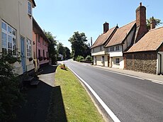
English: Rickinghall is a village in the Mid Suffolk district of Suffolk, England. The village is split between two parishes, Rickinghall Inferior and Rickinghall Superior, which join with Botesdale to make a single built-up area.
village in Suffolk, England, UK | |||||
| Upload media | |||||
| Instance of | |||||
|---|---|---|---|---|---|
| Location |
| ||||
 | |||||
Subcategories
This category has the following 4 subcategories, out of 4 total.
Media in category "Rickinghall"
The following 25 files are in this category, out of 25 total.
-
30 Max - geograph.org.uk - 1262858.jpg 463 × 640; 82 KB
-
Fields near Rickinghall - geograph.org.uk - 338183.jpg 640 × 427; 70 KB
-
Rickinghall Village Name sign on School Road - geograph.org.uk - 5064590.jpg 2,966 × 2,224; 3.8 MB
-
The approach to Rickinghall - geograph.org.uk - 301221.jpg 640 × 456; 181 KB
-
Brassica field near Rickinghall - geograph.org.uk - 338163.jpg 640 × 427; 79 KB
-
Bull Lane - geograph.org.uk - 356309.jpg 640 × 427; 155 KB
-
Chicken Sheds - geograph.org.uk - 362280.jpg 640 × 427; 97 KB
-
Field boundary near Rickinghall - geograph.org.uk - 338166.jpg 640 × 427; 69 KB
-
Fields near Falcons Hall Farm - geograph.org.uk - 356306.jpg 640 × 427; 69 KB
-
Fields near West Hall - geograph.org.uk - 356305.jpg 640 × 427; 60 KB
-
Footpath at West Street Farm - geograph.org.uk - 356299.jpg 640 × 427; 81 KB
-
Footpath junction at West Street - geograph.org.uk - 356296.jpg 640 × 427; 103 KB
-
Footpath to Rickinghall - geograph.org.uk - 356313.jpg 640 × 427; 126 KB
-
Footpath to The Cottage - geograph.org.uk - 356304.jpg 640 × 427; 80 KB
-
Grove Farm, Rickinghall - geograph.org.uk - 357969.jpg 640 × 427; 80 KB
-
Next year's corn - geograph.org.uk - 301236.jpg 640 × 427; 182 KB
-
Potter's Farm, Rickinghall - geograph.org.uk - 271957.jpg 640 × 425; 115 KB
-
Rickinghall Botesdale bypass - geograph.org.uk - 271964.jpg 640 × 377; 93 KB
-
Scama Lane - geograph.org.uk - 357984.jpg 640 × 427; 144 KB
-
Visitors not welcome - geograph.org.uk - 301228.jpg 640 × 427; 222 KB
-
Willow Farm Business Units - geograph.org.uk - 88302.jpg 640 × 480; 158 KB
-
Wood House, Rickinghall - geograph.org.uk - 301231.jpg 640 × 456; 108 KB


