Category:Rethymno Old Harbour
Jump to navigation
Jump to search
| Object location | | View all coordinates using: OpenStreetMap |
|---|
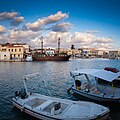
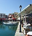
English: Old Venetian harbour of Rethymno.
Français : Vieux port vénitien de Réthymnon.
pre-modern harbor in Crete, Greece | |||||
| Upload media | |||||
| Instance of | |||||
|---|---|---|---|---|---|
| Location | Rethymno Municipality, Rethymno Regional Unit, Crete Region, Decentralized Administration of Crete, Greece | ||||
| Heritage designation |
| ||||
 | |||||
Media in category "Rethymno Old Harbour"
The following 118 files are in this category, out of 118 total.
-
Alter Hafen Rethymnon Kreta.jpg 3,089 × 2,048; 3.12 MB
-
By the harbour lights (13911805120).jpg 2,224 × 3,344; 1.96 MB
-
Crete (15889202499).jpg 1,920 × 462; 887 KB
-
Crete Rethymno3 tango7174.jpg 990 × 600; 284 KB
-
Die Festung von Rethymno.jpg 2,272 × 1,704; 1.62 MB
-
Hafen-R.jpg 771 × 511; 80 KB
-
Harbour pirates -) (14095314062).jpg 2,224 × 3,344; 2.07 MB
-
Harbour snowy mountains Rethymno Crete Greece.jpg 4,515 × 3,045; 10.39 MB
-
K01 331 Réthimno Ri. Kédros.jpg 3,864 × 2,595; 4.98 MB
-
K01 332 Réthimno, venetianischer Hafen.jpg 3,873 × 2,604; 4.59 MB
-
K01 333 Réthimno, venetianischer Hafen.jpg 3,846 × 2,600; 4.33 MB
-
Kreta (GR), Rethymno, Alter Hafen -- 2023 -- 8329.jpg 6,720 × 2,240; 7.65 MB
-
Kreta (GR), Rethymno, Alter Hafen -- 2023 -- 8332.jpg 4,074 × 6,111; 11.59 MB
-
Kreta (GR), Rethymno, Alter Hafen -- 2023 -- 8339.jpg 4,027 × 5,369; 7.76 MB
-
Kreta (GR), Rethymno, Alter Hafen -- 2023 -- 8358.jpg 6,674 × 4,449; 8.16 MB
-
Kreta (GR), Rethymno, Alter Hafen -- 2023 -- 8361.jpg 4,480 × 5,973; 9.51 MB
-
KrRethymno07.jpg 3,280 × 2,170; 1.33 MB
-
KrRethymno08.jpg 3,280 × 2,170; 1.06 MB
-
Leuchtturm Rethymnon Kreta.jpg 3,089 × 2,048; 3.17 MB
-
Old port and lighthouse Rethymno.JPG 4,608 × 3,456; 3.58 MB
-
Old Venetian Harbour in Rethymno 01.jpg 4,352 × 976; 944 KB
-
Old Venetian Harbour in Rethymno 02.jpg 3,872 × 1,024; 780 KB
-
Old Venetian Harbour in Rethymno 03.jpg 2,592 × 1,944; 1.01 MB
-
Port of Rethymnon (25419448).jpg 2,560 × 1,920; 2.31 MB
-
Rethimno Kreta - panoramio.jpg 2,106 × 2,878; 1.41 MB
-
Rethimnon 02 (7703421000).jpg 3,648 × 2,736; 747 KB
-
Rethimnon 03 (7703419562).jpg 3,648 × 2,736; 802 KB
-
Rethimnon 08 (7703411342).jpg 3,648 × 2,736; 829 KB
-
Rethimnon 10a (7703408644).jpg 3,648 × 2,736; 1.17 MB
-
Rethymno (24225301883).jpg 723 × 1,080; 1,003 KB
-
Rethymno (24225303473).jpg 1,613 × 1,080; 1.78 MB
-
Rethymno (24758684731).jpg 1,434 × 1,080; 1.73 MB
-
Rethymno - Harbour.jpg 1,024 × 681; 269 KB
-
Rethymno - Venetian harbor.jpg 3,600 × 2,400; 1.91 MB
-
Rethymno - Venezianischer Hafen1.jpg 4,493 × 2,054; 4.07 MB
-
Rethymno 1.JPG 2,509 × 1,882; 718 KB
-
Rethymno 2.JPG 2,768 × 2,075; 1,009 KB
-
Rethymno Alter Hafen.jpg 5,984 × 3,376; 7.9 MB
-
Rethymno Harbour.jpg 2,848 × 2,136; 4.16 MB
-
Rethymno lighthouse old harbour.jpg 4,455 × 2,362; 7.07 MB
-
Rethymno Old Harbour (15917695010).jpg 1,920 × 968; 1.86 MB
-
Rethymno Old Harbour (16104975225).jpg 1,613 × 1,080; 1.69 MB
-
Rethymno Old Harbour (24244601294).jpg 3,847 × 2,575; 1.05 MB
-
Rethymno old harbour 1.jpg 4,252 × 2,709; 8.43 MB
-
Rethymno Old Harbour 2.jpg 3,984 × 2,588; 2.38 MB
-
Rethymno old harbour 2.jpg 4,252 × 2,841; 7.41 MB
-
Rethymno old harbour 3.jpg 4,252 × 2,834; 7.22 MB
-
Rethymno old harbour 4.jpg 4,961 × 3,307; 10.27 MB
-
Rethymno old harbour 5.jpg 4,961 × 3,307; 9.95 MB
-
Rethymno old harbour 6.jpg 4,961 × 3,308; 10.67 MB
-
Rethymno old harbour lighthouse 1.jpg 3,855 × 2,362; 6.62 MB
-
Rethymno old harbour panorama 1.jpg 6,196 × 2,362; 9.35 MB
-
Rethymno old harbour panorama 2.jpg 9,052 × 3,543; 20.49 MB
-
Rethymno old harbour panorama 3.jpg 4,252 × 4,255; 10.72 MB
-
Rethymno old harbour panorama 4.jpg 5,065 × 2,362; 8.74 MB
-
Rethymno ship.jpg 1,726 × 2,024; 494 KB
-
Rethymno venetian port.jpg 3,264 × 2,448; 2.56 MB
-
Rethymno, pohled do přístavu směrem k majáku.jpg 4,000 × 3,000; 4.44 MB
-
Rethymno, přístav - Kréta - panoramio.jpg 8,513 × 2,911; 9.55 MB
-
Rethymno,venetian port 01.jpg 5,856 × 4,000; 7.17 MB
-
Rethymno,venetian port 02.jpg 6,000 × 3,776; 9.3 MB
-
Rethymno,venetian port 03.jpg 6,000 × 4,000; 7.93 MB
-
Rethymno-harbour(js).jpg 3,888 × 2,504; 4.32 MB
-
Rethymno01.jpg 2,685 × 1,937; 2.51 MB
-
Rethymno02.jpg 2,808 × 2,102; 2.7 MB
-
Rethymno03.jpg 2,751 × 1,866; 2.74 MB
-
Rethymno04.jpg 2,655 × 2,978; 4.04 MB
-
Rethymno09.jpg 3,932 × 2,906; 5.49 MB
-
RethymnoLimani.jpg 2,999 × 4,500; 5.94 MB
-
Rethymnon (30).jpg 1,600 × 1,200; 1.63 MB
-
Rethymnon Hafen.jpg 800 × 537; 128 KB
-
Rethymnon-harbour-at-night.jpg 588 × 377; 49 KB
-
RethymnonEntreePort.jpg 2,048 × 1,536; 1.25 MB
-
Retimno - panoramio (19).jpg 4,000 × 3,000; 3.53 MB
-
Retimno - panoramio (25).jpg 4,000 × 3,000; 3.64 MB
-
Retimno - panoramio (41).jpg 4,000 × 3,000; 3.33 MB
-
Venetian harbour of Rethymno 2009.jpg 2,048 × 1,536; 1.36 MB
-
Venetian Harbour Rethymno By Night.jpg 4,032 × 3,024; 5.16 MB
-
Venetian port of Rethymno.jpg 3,446 × 2,182; 1.71 MB
-
Ενετικό λιμάνι Ρεθύμνου 0301-HDR.jpg 3,648 × 2,736; 3.41 MB
-
Ενετικό λιμάνι Ρεθύμνου 0630.jpg 3,983 × 2,987; 4.39 MB
-
Ενετικό λιμάνι Ρεθύμνου 3124.jpg 3,385 × 4,513; 3.68 MB
-
Ενετικό λιμάνι Ρεθύμνου 3142.jpg 4,332 × 3,249; 4.34 MB
-
Ενετικό λιμάνι Ρεθύμνου 3144.jpg 4,608 × 3,456; 5.22 MB
-
Ενετικό λιμάνι Ρεθύμνου 3146.jpg 4,471 × 3,353; 5.29 MB
-
Ενετικό λιμάνι Ρεθύμνου 3148.jpg 4,519 × 3,389; 4.65 MB
-
Ενετικό λιμάνι Ρεθύμνου 6506.jpg 3,366 × 3,366; 4.14 MB
-
Ενετικό λιμάνι Ρεθύμνου DJI 5025.jpg 4,000 × 3,000; 4.48 MB
-
Ενετικό Λιμάνι Ρεθύμνου.jpg 3,072 × 4,096; 6.84 MB
-
Ενετικό λιμάνι Ρεθύμνου.jpg 3,868 × 2,988; 3.74 MB
-
Ενετικό λιμάνι, Ρέθυμνο.jpg 3,648 × 2,736; 5.01 MB
-
Λιμάνι Ρεθύμνου 6495.jpg 4,555 × 3,416; 4.44 MB
-
Ο Φάρος στο Ενετικό λιμάνι.jpg 3,120 × 4,160; 3.8 MB
-
Περίτεχνα σχέδια στο Φάρο.jpg 3,120 × 4,160; 1.92 MB
-
Ρέθυμνο 0262-HDR-2.jpg 3,873 × 2,905; 4.44 MB
-
Ρέθυμνο 0357.jpg 3,713 × 2,792; 4.31 MB
-
Ρέθυμνο 0579.jpg 4,000 × 3,000; 5.03 MB
-
Ρέθυμνο 2762.JPG 4,543 × 2,720; 2.39 MB
-
Ρεθυμνο.jpg 4,624 × 2,084; 2.83 MB
-
Το ενετικό λιμάνι του Ρεθύμνου - panoramio.jpg 2,048 × 906; 2.51 MB
-
Το ενετικό λιμάνι του Ρεθύμνου.jpg 3,648 × 2,736; 4.26 MB
-
Φάρος Ρεθύμνου (photosiotas) (1).jpg 2,100 × 1,400; 2.68 MB
-
Φάρος Ρεθύμνου (photosiotas) (3).jpg 2,100 × 1,400; 2.66 MB
-
Φάρος Ρεθύμνου (photosiotas) (4).jpg 2,100 × 1,400; 2.49 MB
-
Φάρος Ρεθύμνου 01.jpg 3,024 × 4,032; 5.89 MB
-
Φάρος Ρεθύμνου 02.jpg 3,024 × 4,032; 5.21 MB
-
Φάρος Ρεθύμνου 03.jpg 3,024 × 4,032; 6.43 MB
-
Φάρος Ρεθύμνου 04.jpg 3,024 × 4,032; 6.44 MB
-
Φάρος Ρεθύμνου 3150.jpg 3,456 × 4,608; 3.35 MB
-
Φάρος Ρεθύμνου DJI 5062.jpg 4,000 × 3,000; 4.98 MB
-
Φάρος του Ρεθύμνου 1198.jpg 5,747 × 3,831; 3.74 MB
-
Φάρος του Ρεθύμνου 1201.jpg 5,775 × 3,851; 4.07 MB
-
Φάρος του Ρεθύμνου 1203.jpg 5,761 × 3,841; 5.48 MB
-
Φάρος, λιμάνι Ρεθύμνου.jpg 4,160 × 3,120; 4.16 MB
-
Χιονισμένο Λιμάνι.jpg 1,600 × 960; 510 KB


