Category:Republic of Ireland photographs taken on 2009-01-12
Jump to navigation
Jump to search
| ← | Monday 12 January 2009 | → | ||
| ← | January 2009 | → | ||

Ireland photographs taken on 12 January 2009.
Image files should be categorized here automatically using {{taken on}} template. Direct categorisation is also possible, if automatic is impossible.
Media in category "Republic of Ireland photographs taken on 2009-01-12"
The following 98 files are in this category, out of 98 total.
-

-
 A safe haven - geograph.org.uk - 1118268.jpg 640 × 478; 62 KB
-
 Barn at Port - geograph.org.uk - 1118175.jpg 640 × 479; 69 KB
-
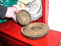
 Beds, Seán Mac Diarmada's House - geograph.org.uk - 1127551.jpg 640 × 479; 36 KB
-
 Blacklion Golf Course - geograph.org.uk - 1118159.jpg 640 × 479; 67 KB
-

-
-

-
 Carrickrevagh Townland - geograph.org.uk - 1118308.jpg 640 × 479; 85 KB
-
 Carrickrevagh Townland - geograph.org.uk - 1118313.jpg 640 × 479; 59 KB
-

-
 Coat of arms, Kiltyclogher Courthouse - geograph.org.uk - 1119083.jpg 479 × 640; 147 KB
-
-
 Corracloona Townland - geograph.org.uk - 1118286.jpg 640 × 479; 78 KB
-
 Corracloona Townland - geograph.org.uk - 1118290.jpg 640 × 479; 69 KB
-
 Corracloona Townland - geograph.org.uk - 1119117.jpg 640 × 479; 49 KB
-
 Cows, Corracloona - geograph.org.uk - 1118293.jpg 640 × 479; 67 KB
-
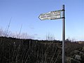
 Direction signs, Kiltyclogher - geograph.org.uk - 1119086.jpg 640 × 479; 61 KB
-
 Dresser, Seán Mac Diarmada's House - geograph.org.uk - 1127588.jpg 479 × 640; 96 KB
-
 Former courthouse, Kiltyclogher - geograph.org.uk - 1119081.jpg 640 × 479; 74 KB
-
 Glenfarne Forest - geograph.org.uk - 1118182.jpg 640 × 479; 92 KB
-
 Glenfarne Forest - geograph.org.uk - 1118186.jpg 640 × 479; 71 KB
-
 Gortaquill Townland - geograph.org.uk - 1118162.jpg 640 × 479; 59 KB
-
 Gortaquill Townland - geograph.org.uk - 1118164.jpg 640 × 479; 59 KB
-
 Interior, Seán Mac Diarmada's House - geograph.org.uk - 1127527.jpg 640 × 479; 50 KB
-
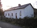
 Irish Cottage, Straduffy - geograph.org.uk - 1119073.jpg 640 × 479; 67 KB
-
 Kiltyclogher Townland - geograph.org.uk - 1119054.jpg 640 × 479; 95 KB
-
 Kiltyclogher Townland - geograph.org.uk - 1119055.jpg 640 × 479; 91 KB
-
 Kiltyclogher Townland - geograph.org.uk - 1119060.jpg 640 × 479; 78 KB
-
 Kiltyclogher, County Leitrim - geograph.org.uk - 1119088.jpg 640 × 479; 61 KB
-
 Laghty Barr - geograph.org.uk - 1118297.jpg 640 × 479; 108 KB
-
 Laghty Barr - geograph.org.uk - 1118328.jpg 640 × 479; 101 KB
-
 Laghty Barr - geograph.org.uk - 1119056.jpg 640 × 479; 81 KB
-
 Laghty Barr - geograph.org.uk - 1119058.jpg 640 × 479; 88 KB
-
 Laghty Barr Townland - geograph.org.uk - 1118322.jpg 640 × 479; 72 KB
-
 Laghty Barr Townland - geograph.org.uk - 1118325.jpg 640 × 479; 83 KB
-
 Laghty Barr Townland - geograph.org.uk - 1118330.jpg 640 × 479; 92 KB
-
 Laghty Barr Townland - geograph.org.uk - 1119057.jpg 640 × 479; 94 KB
-
 Lane at Gortaquinn - geograph.org.uk - 1118166.jpg 640 × 479; 70 KB
-
 Lane at Laghty Barr - geograph.org.uk - 1118317.jpg 640 × 479; 91 KB
-
 Lane at Laghty Barr - geograph.org.uk - 1118333.jpg 640 × 479; 75 KB
-
 Lane at Port - geograph.org.uk - 1118169.jpg 640 × 479; 68 KB
-
 Logs, Laghty Barr - geograph.org.uk - 1118298.jpg 640 × 479; 100 KB
-
 Lough Macnean Upper - geograph.org.uk - 1118190.jpg 640 × 478; 78 KB
-
 Lough Macnean Upper - geograph.org.uk - 1118210.jpg 640 × 479; 58 KB
-
 Lough Macnean Upper - geograph.org.uk - 1118214.jpg 640 × 479; 73 KB
-
 Lough Macnean Upper - geograph.org.uk - 1118232.jpg 640 × 479; 63 KB
-
 Lough Macnean Upper - geograph.org.uk - 1118235.jpg 640 × 479; 74 KB
-
 Lough Macnean Upper - geograph.org.uk - 1118258.jpg 640 × 479; 59 KB
-
 Lough Macnean Upper - geograph.org.uk - 1118266.jpg 640 × 479; 82 KB
-
 Lough Macnean Upper - geograph.org.uk - 1118270.jpg 640 × 479; 62 KB
-
 Lough Macnean Upper, County Leitrim - geograph.org.uk - 1118276.jpg 640 × 479; 62 KB
-
 Main Street, Kiltyclogher - geograph.org.uk - 1119079.jpg 640 × 479; 54 KB
-

-
 Near Kiltyclogher - geograph.org.uk - 1119105.jpg 640 × 479; 59 KB
-
 Near Kiltyclogher - geograph.org.uk - 1119108.jpg 640 × 479; 59 KB
-
 New Beginnings 2000 - geograph.org.uk - 1118250.jpg 640 × 479; 92 KB
-
 Old farm building, Straduffy - geograph.org.uk - 1119070.jpg 640 × 479; 74 KB
-

-
 Plaque, Coracloon National School - geograph.org.uk - 1119115.jpg 640 × 479; 56 KB
-
 Plaque, New Beginnings 2000 - geograph.org.uk - 1118252.jpg 640 × 482; 85 KB
-
 Port Townland - geograph.org.uk - 1118174.jpg 640 × 479; 64 KB
-
 Prince Connell's Grave - geograph.org.uk - 1119120.jpg 640 × 479; 70 KB
-
 Road at Aghavanny - geograph.org.uk - 1119111.jpg 640 × 479; 62 KB
-
 Road at Annagh - geograph.org.uk - 1118178.jpg 640 × 479; 70 KB
-
 Road at Carrickrevagh - geograph.org.uk - 1118222.jpg 640 × 479; 92 KB
-
 Road at Carrickrevagh - geograph.org.uk - 1118229.jpg 640 × 479; 90 KB
-
 Road at Carrickrevagh - geograph.org.uk - 1118241.jpg 640 × 479; 85 KB
-
 Road at Carrickrevagh - geograph.org.uk - 1118243.jpg 640 × 479; 80 KB
-
 Road at Carrickrevagh - geograph.org.uk - 1118310.jpg 640 × 479; 97 KB
-
 Road at Corracloona - geograph.org.uk - 1118280.jpg 640 × 479; 76 KB
-
 Road at Corracloona - geograph.org.uk - 1118282.jpg 640 × 424; 50 KB
-
 Road at Corracloona - geograph.org.uk - 1118288.jpg 640 × 479; 75 KB
-
 Road at Kiltyclogher - geograph.org.uk - 1119063.jpg 640 × 479; 68 KB
-
 Road at Kiltyclogher - geograph.org.uk - 1119066.jpg 640 × 479; 75 KB
-
 Road at Kiltyclogher - geograph.org.uk - 1119099.jpg 640 × 479; 62 KB
-
 Road at Laghty Barr - geograph.org.uk - 1118303.jpg 640 × 364; 63 KB
-
 Road at Laghty Barr - geograph.org.uk - 1118319.jpg 640 × 479; 102 KB
-
 Road at Meenagh - geograph.org.uk - 1118262.jpg 640 × 479; 87 KB
-
 Road at Moneyduff - geograph.org.uk - 1118184.jpg 640 × 479; 93 KB
-
 Road at Straduffy - geograph.org.uk - 1119067.jpg 640 × 479; 75 KB
-
 Road near Kiltyclogher - geograph.org.uk - 1119059.jpg 640 × 479; 67 KB
-

-
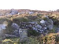
 Ruined dwelling , Kiltyclogher - geograph.org.uk - 1119065.jpg 640 × 479; 107 KB
-
 Sculpture, Glenfarne Forest - geograph.org.uk - 1118220.jpg 640 × 479; 85 KB
-

-

-
 Seán Mac Diarmada's House - geograph.org.uk - 1118481.jpg 640 × 479; 60 KB
-
 Seán Mac Diarmada's House - geograph.org.uk - 1118486.jpg 640 × 479; 70 KB
-
 Sign for Prince Connell's Grave - geograph.org.uk - 1119118.jpg 640 × 479; 42 KB
-
 Sign, Seán Mac Diarmada's House - geograph.org.uk - 1118478.jpg 640 × 479; 106 KB
-
 St Patrick's RC Church, Kiltyclogher - geograph.org.uk - 1119076.jpg 640 × 479; 59 KB
-
 Straduffy Townland - geograph.org.uk - 1119068.jpg 640 × 479; 52 KB
-
 Tuam Townland - geograph.org.uk - 1118158.jpg 640 × 479; 58 KB
-
 Tullintloy Townland - geograph.org.uk - 1119121.jpg 640 × 479; 101 KB
-
 Tullintloy Townland - geograph.org.uk - 1119123.jpg 640 × 479; 76 KB
-
 Tullintloy Townland - geograph.org.uk - 1119125.jpg 640 × 479; 85 KB
-
 Approaching Kiltyclogher - geograph.org.uk - 1119075.jpg 640 × 449; 85 KB


,_Se%C3%A1n_Mac_Diarmada%27s_House_-_geograph.org.uk_-_1127567.jpg)


,_Se%C3%A1n_Mac_Diarmada%27s_House_-_geograph.org.uk_-_1127532.jpg)
,_Se%C3%A1n_Mac_Diarmada%27s_House_-_geograph.org.uk_-_1127548.jpg)


