Category:Republic of Ireland photographs taken on 2008-02-13
Jump to navigation
Jump to search
| ← | Wednesday 13 February 2008 | → | ||
| ← | February 2008 | → | ||

Ireland photographs taken on 13 February 2008.
Image files should be categorized here automatically using {{taken on}} template. Direct categorisation is also possible, if automatic is impossible.
Media in category "Republic of Ireland photographs taken on 2008-02-13"
The following 88 files are in this category, out of 88 total.
-
 Alt Lower - geograph.org.uk - 690065.jpg 640 × 479; 65 KB
-
 Alt Lower Townland - geograph.org.uk - 690077.jpg 640 × 479; 97 KB
-
 Alt Upper - geograph.org.uk - 690085.jpg 640 × 479; 73 KB
-
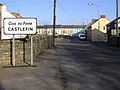 Approaching Castlefin from the south - geograph.org.uk - 689186.jpg 640 × 478; 56 KB
-
 Ardnaglass Townland - geograph.org.uk - 689280.jpg 640 × 479; 70 KB
-
 Aughawee Townland - geograph.org.uk - 689302.jpg 640 × 479; 67 KB
-
 Backlands Townland - geograph.org.uk - 689308.jpg 640 × 479; 44 KB
-
 Ballyarrell Mountain - geograph.org.uk - 689991.jpg 640 × 479; 66 KB
-
 Cashelin Townland - geograph.org.uk - 690017.jpg 640 × 479; 77 KB
-
 Cloghfin Townland - geograph.org.uk - 689204.jpg 640 × 479; 71 KB
-
 Current Lighthouse, Wicklow Head - geograph.org.uk - 692447.jpg 480 × 640; 44 KB
-
 Demesne Townland - geograph.org.uk - 689181.jpg 640 × 479; 62 KB
-
 Demesne Townland - geograph.org.uk - 690052.jpg 640 × 479; 49 KB
-
 Gleneely Hill - geograph.org.uk - 689409.jpg 640 × 479; 71 KB
-
 Gortin South - geograph.org.uk - 689219.jpg 640 × 479; 41 KB
-
 Gortin South - geograph.org.uk - 689222.jpg 640 × 479; 85 KB
-
 Killygordon, County Donegal - geograph.org.uk - 689388.jpg 640 × 479; 57 KB
-
 N21near Tralee4600.jpg 3,813 × 2,497; 1.32 MB
-
 N21nearTralee4600.jpg 3,813 × 2,497; 1.29 MB
-
 Near Ballybun - geograph.org.uk - 690023.jpg 640 × 479; 82 KB
-
 Raws Townland - geograph.org.uk - 690086.jpg 640 × 479; 66 KB
-
 Ruined house, Carranadone - geograph.org.uk - 690040.jpg 640 × 479; 83 KB
-
 Skelpy Townland - geograph.org.uk - 689159.jpg 640 × 479; 55 KB
-

-
 Standing stone, Magherareagh - geograph.org.uk - 689209.jpg 640 × 479; 61 KB
-
 Stranamuck Townland - geograph.org.uk - 689200.jpg 640 × 479; 71 KB
-
 The Front Lighthouse, Wicklow Head. - geograph.org.uk - 692441.jpg 480 × 640; 45 KB
-
 The Rear Lighthouse, Wicklow Head - geograph.org.uk - 692427.jpg 480 × 640; 52 KB
-
 Tullyard Townland - geograph.org.uk - 689166.jpg 640 × 479; 73 KB
-
 Unusual entrance to unusual house - geograph.org.uk - 689284.jpg 640 × 281; 33 KB
-
 Unusual house at Ardnaglass - geograph.org.uk - 689289.jpg 479 × 640; 103 KB
-
 Alt Presbyterian Church - geograph.org.uk - 690061.jpg 479 × 640; 149 KB
-
 Ballyarrell Townland - geograph.org.uk - 690001.jpg 640 × 479; 69 KB
-
 Ballybun Townland - geograph.org.uk - 690025.jpg 640 × 479; 81 KB
-
 Ballybun Townland - geograph.org.uk - 690027.jpg 640 × 275; 41 KB
-
 Ballygonigan Townland - geograph.org.uk - 690005.jpg 640 × 479; 69 KB
-
 Ballygonigan Townland - geograph.org.uk - 690037.jpg 640 × 479; 76 KB
-
 Blairstown Townland - geograph.org.uk - 689326.jpg 640 × 479; 59 KB
-
 Brides Hill Triangulation Pillar. - geograph.org.uk - 692386.jpg 480 × 640; 59 KB
-
 Carranadone Townland - geograph.org.uk - 690042.jpg 640 × 271; 36 KB
-
 Carricknashane Townland - geograph.org.uk - 689331.jpg 640 × 479; 53 KB
-
 Castlefin Congregational Church - geograph.org.uk - 689184.jpg 640 × 479; 77 KB
-
 Cloonarell Townland - geograph.org.uk - 690003.jpg 640 × 479; 63 KB
-
 Cormakilly Townland - geograph.org.uk - 690057.jpg 640 × 479; 54 KB
-
 Cormakilly Townland - geograph.org.uk - 690058.jpg 640 × 479; 75 KB
-
 Dooghan Townland - geograph.org.uk - 689321.jpg 640 × 479; 59 KB
-
 Drumcannon townland - geograph.org.uk - 689400.jpg 640 × 479; 71 KB
-
 Drumcannon townland - geograph.org.uk - 689998.jpg 640 × 479; 75 KB
-
 Drumdoit Townland - geograph.org.uk - 690068.jpg 640 × 479; 77 KB
-
 Dungorman Townland - geograph.org.uk - 690051.jpg 640 × 372; 39 KB
-
 Farm Buildings near Ballygonigan - geograph.org.uk - 690033.jpg 640 × 294; 40 KB
-
 Farmland and view of Wicklow Town. - geograph.org.uk - 692370.jpg 640 × 480; 83 KB
-
 Foyfin Townland - geograph.org.uk - 689175.jpg 640 × 479; 61 KB
-
 Gortnagole Townland - geograph.org.uk - 689291.jpg 640 × 479; 100 KB
-
 Gortnagole Townland - geograph.org.uk - 689294.jpg 640 × 479; 70 KB
-
 Gortnamuck Townland - geograph.org.uk - 690088.jpg 640 × 479; 57 KB
-
 Grahamsland Townland - geograph.org.uk - 689317.jpg 640 × 479; 67 KB
-
 Hillhead Townland - geograph.org.uk - 689324.jpg 640 × 479; 70 KB
-
 Liscooly Townland - geograph.org.uk - 689327.jpg 640 × 479; 58 KB
-
 Magherareagh Townland - geograph.org.uk - 689206.jpg 640 × 479; 75 KB
-
 Maghereaboy Townland - geograph.org.uk - 689364.jpg 640 × 479; 68 KB
-
 Maghereaboy Townland - geograph.org.uk - 689368.jpg 640 × 479; 58 KB
-
 Meenlougher Townland - geograph.org.uk - 689995.jpg 640 × 479; 81 KB
-
 Meenlougher Townland - geograph.org.uk - 690006.jpg 640 × 479; 69 KB
-
 Mounthall Townland - geograph.org.uk - 689403.jpg 640 × 479; 73 KB
-
 N15 at Carricknashane - geograph.org.uk - 689357.jpg 640 × 479; 64 KB
-
 N15 at Stranamuck - geograph.org.uk - 689197.jpg 640 × 479; 60 KB
-
 Near Mullanboy - geograph.org.uk - 690053.jpg 640 × 479; 79 KB
-
 Near Tievebrack - geograph.org.uk - 690009.jpg 640 × 479; 66 KB
-
 R750 Coast Road - geograph.org.uk - 692394.jpg 594 × 640; 95 KB
-
 Road at Backlands - geograph.org.uk - 689306.jpg 640 × 479; 80 KB
-
 Road at Calhame - geograph.org.uk - 690071.jpg 640 × 479; 78 KB
-
 Road at Cashelin - geograph.org.uk - 690020.jpg 640 × 479; 49 KB
-
 Road at Croaghan - geograph.org.uk - 689300.jpg 640 × 479; 48 KB
-
 Road at Drummurphy - geograph.org.uk - 690047.jpg 640 × 479; 68 KB
-
 Road at Killygordon - geograph.org.uk - 689394.jpg 640 × 479; 46 KB
-
 Road at Magherycallaghan - geograph.org.uk - 689169.jpg 640 × 479; 65 KB
-
 Road at Mullanboy - geograph.org.uk - 690055.jpg 640 × 383; 42 KB
-
 Road at Rushy Hill - geograph.org.uk - 689405.jpg 640 × 478; 55 KB
-
 Road at Skelpy - geograph.org.uk - 689161.jpg 640 × 479; 79 KB
-

-
 Road near Magherareagh - geograph.org.uk - 689211.jpg 640 × 479; 51 KB
-
 Rushy Hill - geograph.org.uk - 689990.jpg 640 × 479; 76 KB
-
 Sessiagh Townland - geograph.org.uk - 689313.jpg 640 × 479; 78 KB
-
 Sessiaghallison Townland - geograph.org.uk - 689320.jpg 640 × 479; 73 KB
-
 Shannon Lower - geograph.org.uk - 689311.jpg 640 × 479; 51 KB
-
 Tawnacrom Townland - geograph.org.uk - 689216.jpg 640 × 479; 45 KB
-
 Tievebrack Townland - geograph.org.uk - 690013.jpg 640 × 479; 72 KB


