Category:Renwick, Cumbria
Jump to navigation
Jump to search
village in Cumbria, England  | |||||
| Upload media | |||||
| Instance of | |||||
|---|---|---|---|---|---|
| Location | Kirkoswald, Eden, Cumbria, North West England, England | ||||
 | |||||
Subcategories
This category has only the following subcategory.
A
- All Saint's Church, Renwick (4 F)
Media in category "Renwick, Cumbria"
The following 50 files are in this category, out of 50 total.
-
 Croglin Water - geograph.org.uk - 378668.jpg 640 × 480; 168 KB
-
 Green Lane at Mooredge - geograph.org.uk - 252210.jpg 640 × 426; 255 KB
-
 My Neck's Longer^ - geograph.org.uk - 252209.jpg 640 × 426; 251 KB
-
 Northumberland-Cumbria Boundary - geograph.org.uk - 413564.jpg 640 × 427; 123 KB
-
 Pasture, Renwick - geograph.org.uk - 783151.jpg 640 × 589; 179 KB
-
 Peat haggs near the county border - geograph.org.uk - 613284.jpg 640 × 480; 90 KB
-
 Sickergill Skew Bridge in 1898.jpg 490 × 344; 46 KB
-
 Sickergill Skew Bridge Under Construction.jpg 494 × 350; 48 KB
-
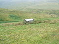
 Track and pasture above Renwick - geograph.org.uk - 782862.jpg 640 × 480; 141 KB
-
 Walled track above Renwick - geograph.org.uk - 1560253.jpg 640 × 480; 82 KB
-
 (Part of) Broad Mea - geograph.org.uk - 608187.jpg 640 × 480; 68 KB
-
 Aviary near Lawyers Cross - geograph.org.uk - 502789.jpg 640 × 480; 81 KB
-
 Bank Farm Unthank - geograph.org.uk - 140973.jpg 640 × 426; 68 KB
-

-
 Border moorland - geograph.org.uk - 613238.jpg 640 × 480; 81 KB
-
 Confluence to form Raven Beck - geograph.org.uk - 599743.jpg 640 × 480; 66 KB
-
 Coom Gill - geograph.org.uk - 613246.jpg 640 × 480; 74 KB
-
 Cumberland sike - geograph.org.uk - 613283.jpg 640 × 480; 81 KB
-
 Cumbrian moorland (2) - geograph.org.uk - 609250.jpg 640 × 480; 97 KB
-
 Cumbrian moorland - geograph.org.uk - 609247.jpg 640 × 480; 112 KB
-
 Cumbrian moorland - geograph.org.uk - 613512.jpg 640 × 480; 71 KB
-
 Eller Beck - geograph.org.uk - 140979.jpg 640 × 426; 70 KB
-
 Field at Viol Moor - geograph.org.uk - 252207.jpg 640 × 426; 199 KB
-
 Huts by Croglin Water - geograph.org.uk - 378669.jpg 640 × 480; 138 KB
-
 Looking east down an unmarked track - geograph.org.uk - 502777.jpg 640 × 480; 73 KB
-
 Moorland above Coglin Water - geograph.org.uk - 613505.jpg 640 × 480; 68 KB
-
 Moorland above Goat Crags - geograph.org.uk - 613510.jpg 640 × 480; 81 KB
-
 Moorland near the county border - geograph.org.uk - 613249.jpg 640 × 480; 100 KB
-
 More Cumbrian moorland - geograph.org.uk - 613515.jpg 640 × 480; 73 KB
-
 Old hut - geograph.org.uk - 502795.jpg 640 × 480; 95 KB
-
 Quarry on Croglin Fell - geograph.org.uk - 502769.jpg 640 × 480; 95 KB
-
 Raven Beck - geograph.org.uk - 114476.jpg 640 × 480; 189 KB
-
 Renwick copper mine - geograph.org.uk - 494637.jpg 438 × 640; 198 KB
-
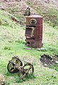
 Renwick mine shaft - geograph.org.uk - 495180.jpg 640 × 404; 176 KB
-
 Road at Viol Moor - geograph.org.uk - 251885.jpg 640 × 426; 280 KB
-
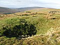 Shakehole - geograph.org.uk - 613254.jpg 640 × 480; 101 KB
-
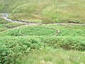 Sheep fold - geograph.org.uk - 502799.jpg 640 × 480; 120 KB
-
 Signpost near Renwick - geograph.org.uk - 257764.jpg 640 × 429; 110 KB
-
 Sike above Goat Crags - geograph.org.uk - 613503.jpg 640 × 480; 71 KB
-
 Small currick near Butt Hill - geograph.org.uk - 502780.jpg 640 × 480; 73 KB
-
 Small rock outcrop on the moor - geograph.org.uk - 613537.jpg 640 × 480; 94 KB
-
 The Cumbria-Northumberland border (2) - geograph.org.uk - 613286.jpg 640 × 480; 76 KB
-
 The Cumbria-Northumberland border (3) - geograph.org.uk - 613511.jpg 640 × 480; 86 KB
-
 The Cumbria-Northumberland border - geograph.org.uk - 613285.jpg 640 × 480; 96 KB
-
 Towards Watch Hill - geograph.org.uk - 613241.jpg 640 × 480; 96 KB
-
 Viol Moor - geograph.org.uk - 141002.jpg 640 × 426; 109 KB
-
 Viol Moor - geograph.org.uk - 251882.jpg 640 × 426; 179 KB
-
 Viol Moor - geograph.org.uk - 251888.jpg 640 × 426; 211 KB
-

-
 Waterfall, Stockdale Beck - geograph.org.uk - 379710.jpg 640 × 480; 143 KB


_Broad_Mea_-_geograph.org.uk_-_608187.jpg)


_-_geograph.org.uk_-_609250.jpg)


_-_geograph.org.uk_-_613286.jpg)
_-_geograph.org.uk_-_613511.jpg)


