Category:Remote views of Mount Keen
Jump to navigation
Jump to search
Media in category "Remote views of Mount Keen"
The following 58 files are in this category, out of 58 total.
-
-
 Boundary Stone - geograph.org.uk - 115993.jpg 640 × 434; 81 KB
-
 Bridge and Mount Keen, Glen Tanar - geograph.org.uk - 717315.jpg 600 × 450; 169 KB
-
 Burn of Cochlie - geograph.org.uk - 1777013.jpg 640 × 359; 91 KB
-
 Burn of Longshanks. - geograph.org.uk - 118194.jpg 640 × 462; 80 KB
-
 Cairn by Mount Keen path - geograph.org.uk - 727819.jpg 640 × 480; 80 KB
-
 Cairn on Sgor an h-Iolaire above Camlet - geograph.org.uk - 1099916.jpg 640 × 429; 112 KB
-
 Cairn, White Hill - geograph.org.uk - 438517.jpg 638 × 448; 66 KB
-
 Coire Gorm. - geograph.org.uk - 118332.jpg 640 × 480; 106 KB
-

-
 Craig of Prony - the summit cairn - geograph.org.uk - 835645.jpg 640 × 429; 89 KB
-

-
 Distant Mount Keen - geograph.org.uk - 1351780.jpg 640 × 480; 50 KB
-
 Foot Bridge - geograph.org.uk - 444673.jpg 640 × 480; 91 KB
-
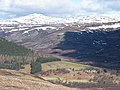
 Glen Esk and Mount Keen - geograph.org.uk - 108452.jpg 640 × 475; 72 KB
-
 Glen Tanar - geograph.org.uk - 695105.jpg 533 × 400; 153 KB
-

-
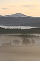
 Glenfenzie at sunset - geograph.org.uk - 864712.jpg 640 × 429; 86 KB
-

-
 Heathery hillside - geograph.org.uk - 1107549.jpg 640 × 481; 88 KB
-
 Hill of Cat - geograph.org.uk - 1323852.jpg 640 × 480; 83 KB
-
 Hill of Doune and Mount Keen - geograph.org.uk - 115973.jpg 640 × 483; 109 KB
-
 Invermark Lodge - geograph.org.uk - 1779722.jpg 640 × 480; 101 KB
-
 Ladder Burn - geograph.org.uk - 341746.jpg 640 × 427; 84 KB
-
-
 Looking to Mount Keen - geograph.org.uk - 123419.jpg 640 × 424; 70 KB
-
 Moorland near Cairn of Meadows - geograph.org.uk - 1776178.jpg 640 × 480; 111 KB
-
 Mount Keen - geograph.org.uk - 1305342.jpg 640 × 480; 66 KB
-
 Mount Keen from Migvie - geograph.org.uk - 1129612.jpg 427 × 640; 22 KB
-
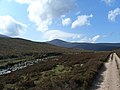
 Mount Keen path - geograph.org.uk - 728030.jpg 640 × 480; 66 KB
-
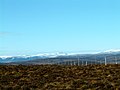
 North To Mount Keen - geograph.org.uk - 22810.jpg 640 × 480; 87 KB
-
 Path down from Burnt Hill - geograph.org.uk - 1016506.jpg 640 × 480; 51 KB
-
 Peaty pool, Earn Skelly - geograph.org.uk - 344092.jpg 640 × 480; 88 KB
-
 Remote house by the Tullich Burn - geograph.org.uk - 1289799.jpg 640 × 427; 83 KB
-
 Rough pasture - geograph.org.uk - 622661.jpg 640 × 452; 67 KB
-

-
 South from Craig Glas - geograph.org.uk - 1398352.jpg 640 × 480; 49 KB
-
 Sturdy Hill - geograph.org.uk - 57630.jpg 640 × 292; 74 KB
-
 Summit of Morven - geograph.org.uk - 274077.jpg 640 × 480; 80 KB
-
 Tap o Noth - geograph.org.uk - 129071.jpg 392 × 552; 35 KB
-
-

-
 The Snub - geograph.org.uk - 118181.jpg 640 × 480; 92 KB
-

-
 The view towards Mount Keen 939m - geograph.org.uk - 717360.jpg 595 × 446; 134 KB
-
 Towards Mount Keen - geograph.org.uk - 461776.jpg 640 × 481; 93 KB
-

-
 Trig Point and Outcrop - geograph.org.uk - 298147.jpg 640 × 481; 67 KB
-
 Tullich Burn and Mount Keen - geograph.org.uk - 1289893.jpg 640 × 427; 60 KB
-
 Upper Glen Mark - geograph.org.uk - 1300749.jpg 640 × 480; 75 KB
-
 Upper Glen Mark. - geograph.org.uk - 445058.jpg 640 × 480; 48 KB
-

-
 View from Maolearn towards Glen Esk - geograph.org.uk - 1107523.jpg 640 × 481; 78 KB
-
 Water of Tanar - geograph.org.uk - 444506.jpg 640 × 480; 71 KB
-
 Water of Tanar and Mount Keen - geograph.org.uk - 717339.jpg 600 × 450; 153 KB
-

-
 West Wirren - geograph.org.uk - 12563.jpg 640 × 454; 78 KB
-
 Woodland on Creagan Riabhach - geograph.org.uk - 1327511.jpg 640 × 428; 178 KB


_-_geograph.org.uk_-_229194.jpg)


